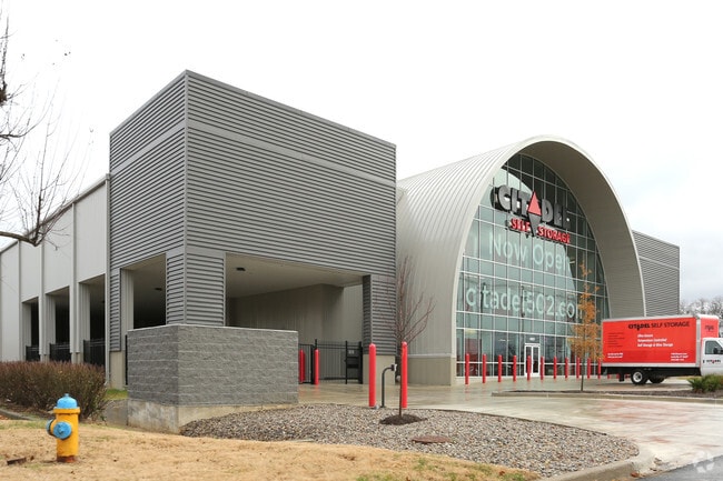
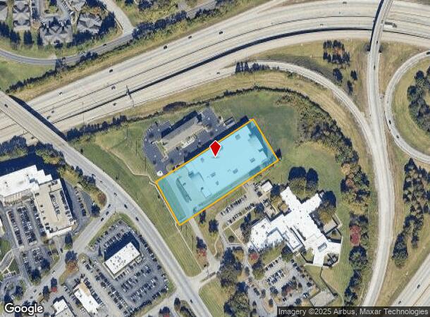
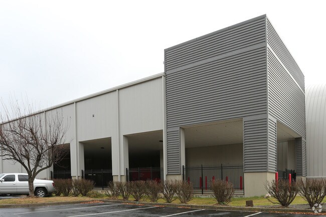
Property Record
1403 Browns Ln, Louisville, KY 40207
NEARBY LISTINGS FOR SALE OR LEASE
-
-
View all Louisville listings for sale on LoopNet.com
Property Detail
1403 Browns Ln
Louisville-Jefferson County, KY-IN
Minor Subdivision Plat
002900920000
2.491 AC +/-, ES BROWNS LN
Realpropertynec
Jefferson
X
Kentucky
21111C0045F
2.49 AC
2024
St Matthews
2024
Louisville
010602
DEMOGRAPHICS near 1403 Browns Ln
1 Mile
3 Mile
5 Mile
2024 Total Population
10,239
95,977
229,864
2029 Population
10,235
94,645
226,321
Pop Growth 2024-2029
(0.04%)
(1.39%)
(1.54%)
Average Age
39
42
42
2024 Total Households
5,160
44,080
102,752
HH Growth 2024-2029
+ 0.31%
(1.35%)
(1.54%)
Median Household Inc
$74,259
$73,706
$74,074
Avg Household Size
1.90
2.10
2.20
2024 Avg HH Vehicles
2.00
2.00
2.00
Median Home Value
$270,463
$266,902
$275,456
Median Year Built
1974
1970
1970
Nearby Places
Map Layers
Map Styles
 Street
 Aerial
- Restaurants
- Banks
- Shops
- Fitness
- Groceries
PUBLIC TRANSPORTATION
AIRPORT
Louisville Muhammad Ali International
DRIVE
WALK
Distance
Louisville Muhammad Ali International
21 min
11.2 mi
Freight Ports
Port of Toledo
DRIVE
WALK
Distance
Port of Toledo
353 min
302.9 mi
Nearby Properties
Address
Land Use
TOTAL SIZE
Lot Size
Zoning
Address
Land Use
TOTAL SIZE
Lot Size
Zoning
806,417 SF
43.50 AC
C2-COMMERC
Address
Land Use
TOTAL SIZE
Lot Size
Zoning
106,338 SF
17.28 AC
C2-COMMERC
Address
Land Use
TOTAL SIZE
Lot Size
Zoning
Address
Land Use
TOTAL SIZE
Lot Size
Zoning
499,626 SF
33.47 AC
C1-COMMERC
Address
Land Use
TOTAL SIZE
Lot Size
Zoning
16.41 AC
C1-COMMERC
Address
Land Use
TOTAL SIZE
Lot Size
Zoning
8,632 SF
20.91 AC
OR3-OFFICE
Address
Land Use
TOTAL SIZE
Lot Size
Zoning
Address
Land Use
TOTAL SIZE
Lot Size
Zoning
8,677 SF
26.10 AC
R7-RESIDEN
Address
Land Use
TOTAL SIZE
Lot Size
Zoning
6,754 SF
21.80 AC
C2-COMMERC
Address
Land Use
TOTAL SIZE
Lot Size
Zoning
11,168 SF
13.69 AC
OR3-OFFICE
Address
Land Use
TOTAL SIZE
Lot Size
Zoning
11,480 SF
15.29 AC
OR3-OFFICE
Address
Land Use
TOTAL SIZE
Lot Size
Zoning
211,009 SF
19.71 AC
C2-COMMERC
Address
Land Use
TOTAL SIZE
Lot Size
Zoning
34.06 AC
Address
Land Use
TOTAL SIZE
Lot Size
Zoning
10,080 SF
28.04 AC
OR3-OFFICE
Address
Land Use
TOTAL SIZE
Lot Size
Zoning
2,140 SF
18.35 AC
R4-RESIDEN
Address
Land Use
TOTAL SIZE
Lot Size
Zoning
8,820 SF
22.62 AC
R7-RESIDEN
Address
Land Use
TOTAL SIZE
Lot Size
Zoning
11,520 SF
35.60 AC
R6-RESIDEN
Address
Land Use
TOTAL SIZE
Lot Size
Zoning
18,394 SF
22.09 AC
C1-COMMERC
Address
Land Use
TOTAL SIZE
Lot Size
Zoning
16,336 SF
17.31 AC
R6-RESIDEN
Address
Land Use
TOTAL SIZE
Lot Size
Zoning
Address
Land Use
TOTAL SIZE
Lot Size
Zoning
77,585 SF
3.50 AC
C2-COMMERC
Address
Land Use
TOTAL SIZE
Lot Size
Zoning
19,568 SF
24.23 AC
R7-RESIDEN
Address
Land Use
TOTAL SIZE
Lot Size
Zoning
10,026 SF
13.45 AC
R6-RESIDEN
Address
Land Use
TOTAL SIZE
Lot Size
Zoning
34,805 SF
13.43 AC
C1-COMMERC
Address
Land Use
TOTAL SIZE
Lot Size
Zoning
148,682 SF
0.74 AC
OR3-OFFICE
Address
Land Use
TOTAL SIZE
Lot Size
Zoning
10,800 SF
18.70 AC
R6-RESIDEN
Address
Land Use
TOTAL SIZE
Lot Size
Zoning
10,112 SF
18.16 AC
R7-RESIDEN
Address
Land Use
TOTAL SIZE
Lot Size
Zoning
910 SF
9.77 AC
R6-RESIDEN
Address
Land Use
TOTAL SIZE
Lot Size
Zoning
6,825 SF
21.55 AC
R6-RESIDEN
Address
Land Use
TOTAL SIZE
Lot Size
Zoning
147,397 SF
9.59 AC
The World's #1 Commercial Real Estate Marketplace
Connect with us
© 2025 CoStar Group
The information above has been obtained from sources believed reliable. While we do not doubt its accuracy we have not verified it and make no guarantee, warranty or representation about it. It is your responsibility to independently confirm its accuracy and completeness. Any projections, opinions, assumptions, or estimates used are for example only and do not represent the current or future performance of the property. The value of this transaction to you depends on tax and other factors which should be evaluated by your tax, financial, and legal advisors. You and your advisors should conduct a careful, independent investigation of the property to determine to your satisfaction the suitability of the property for your needs.