Property Record
1403 N Dupont Hwy, New Castle, DE 19720


NEARBY LISTINGS FOR SALE OR LEASE
Property Detail
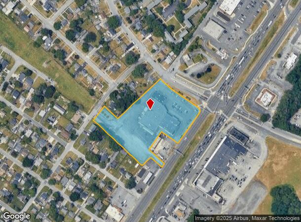
1403 N Dupont Hwy
10-014.30-437
Manor Park Shpg Ctr
Regionalshoppingcenterormallwithanchorstore
LEGAL-SITUATED ON DUPONT PKWY AT BACON AVE
X
New Castle
10003C0154L
Delaware
2024
3.57 AC
2024
South New Castle County
015200
Philadelphia
30,426 SF
Philadelphia-Camden-Wilmington, PA-NJ-DE-MD
DEMOGRAPHICS near 1403 N Dupont Hwy
1 Mile
3 Mile
5 Mile
2024 Total Population
9,095
50,441
181,989
2029 Population
9,129
51,067
185,387
Pop Growth 2024-2029
+ 0.37%
+ 1.24%
+ 1.87%
Average Age
40
40
40
2024 Total Households
3,313
19,254
73,659
HH Growth 2024-2029
+ 0.33%
+ 1.23%
+ 1.94%
Median Household Inc
$63,159
$60,529
$58,601
Avg Household Size
2.70
2.50
2.40
2024 Avg HH Vehicles
2.00
2.00
2.00
Median Home Value
$186,101
$199,796
$216,170
Median Year Built
1959
1957
1959
Nearby Places
Map Layers
Map Styles
 Street
 Aerial
- Restaurants
- Banks
- Shops
- Fitness
- Groceries
PUBLIC TRANSPORTATION
AIRPORT
Philadelphia International
DRIVE
WALK
Distance
Philadelphia International
32 min
24.7 mi
SALE & LEASE HISTORY
LISTING DATE
SALE/LEASE

Sep 25, 2016
For Lease
Nearby Properties
Address
Land Use
TOTAL SIZE
Lot Size
Zoning
Address
Land Use
TOTAL SIZE
Lot Size
Zoning
163,588 SF
1,229.95 AC
I
Address
Land Use
TOTAL SIZE
Lot Size
Zoning
624,255 SF
132.95 AC
SR
Address
Land Use
TOTAL SIZE
Lot Size
Zoning
324,073 SF
77.78 AC
S
Address
Land Use
TOTAL SIZE
Lot Size
Zoning
197,726 SF
25 AC
I
Address
Land Use
TOTAL SIZE
Lot Size
Zoning
116,042 SF
108.83 AC
SR
Address
Land Use
TOTAL SIZE
Lot Size
Zoning
25,801 SF
23.84 AC
S
Address
Land Use
TOTAL SIZE
Lot Size
Zoning
352,104 SF
16.35 AC
BP
Address
Land Use
TOTAL SIZE
Lot Size
Zoning
1,440 SF
0.72 AC
26W2
Address
Land Use
TOTAL SIZE
Lot Size
Zoning
248,554 SF
18.58 AC
CR
Address
Land Use
TOTAL SIZE
Lot Size
Zoning
56,352 SF
11.29 AC
I
Address
Land Use
TOTAL SIZE
Lot Size
Zoning
61,928 SF
128.88 AC
HI
Address
Land Use
TOTAL SIZE
Lot Size
Zoning
421,754 SF
47.58 AC
21I
Address
Land Use
TOTAL SIZE
Lot Size
Zoning
64,585 SF
14.61 AC
NC6.5
Address
Land Use
TOTAL SIZE
Lot Size
Zoning
213,565 SF
11.73 AC
21I
Address
Land Use
TOTAL SIZE
Lot Size
Zoning
166,492 SF
19.73 AC
S
Address
Land Use
TOTAL SIZE
Lot Size
Zoning
16,920 SF
12.50 AC
I
Address
Land Use
TOTAL SIZE
Lot Size
Zoning
358,315 SF
6.39 AC
BP
Address
Land Use
TOTAL SIZE
Lot Size
Zoning
115,880 SF
20.85 AC
21IOP
Address
Land Use
TOTAL SIZE
Lot Size
Zoning
79,778 SF
8.83 AC
NC6.5
Address
Land Use
TOTAL SIZE
Lot Size
Zoning
115,455 SF
20.58 AC
CR
Address
Land Use
TOTAL SIZE
Lot Size
Zoning
388,314 SF
22.06 AC
NCAP
Address
Land Use
TOTAL SIZE
Lot Size
Zoning
98,727 SF
9.38 AC
HI
Address
Land Use
TOTAL SIZE
Lot Size
Zoning
30,127 SF
6.53 AC
CR
Address
Land Use
TOTAL SIZE
Lot Size
Zoning
96,676 SF
6.17 AC
BP
Address
Land Use
TOTAL SIZE
Lot Size
Zoning
56,319 SF
I
Address
Land Use
TOTAL SIZE
Lot Size
Zoning
132,874 SF
13.51 AC
HI
Address
Land Use
TOTAL SIZE
Lot Size
Zoning
4,680 SF
12.41 AC
ST
Address
Land Use
TOTAL SIZE
Lot Size
Zoning
341,694 SF
13.66 AC
HI
Address
Land Use
TOTAL SIZE
Lot Size
Zoning
234,000 SF
15.52 AC
21I
Address
Land Use
TOTAL SIZE
Lot Size
Zoning
225,128 SF
9.47 AC
21I
The World's #1 Commercial Real Estate Marketplace
Connect with us
© 2025 CoStar Group
The information above has been obtained from sources believed reliable. While we do not doubt its accuracy we have not verified it and make no guarantee, warranty or representation about it. It is your responsibility to independently confirm its accuracy and completeness. Any projections, opinions, assumptions, or estimates used are for example only and do not represent the current or future performance of the property. The value of this transaction to you depends on tax and other factors which should be evaluated by your tax, financial, and legal advisors. You and your advisors should conduct a careful, independent investigation of the property to determine to your satisfaction the suitability of the property for your needs.