Property Record
1403 Uvalde Dr, Hutto, TX 78634

Save to a Folder
{{folder.Name}}
{{folder.ListingIds.length}} Properties
{{folder.ListingIds.length}} Property
Create a New Folder
Property Detail
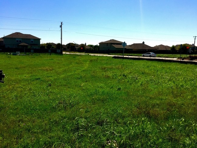
1403 Uvalde Dr
Austin-Round Rock-San Marcos, TX
S8420 - ENCLAVE AT BRUSHY CREEK SEC 1, BLOCK G, LOT C7, ACRES 0.944
R444128
WILLIAMSON
Commercialnec
Texas
B and X Area of moderate flood hazard, usually the area between the limits of the 100-year and 500-year floods.
c7
2024
0.94 AC
2025
Round Rock
020813
Austin
8,366 SF
NEARBY LISTINGS FOR SALE OR LEASE
-
-
-
-
-
-
-
-
-
-
-
-
-
-
-
-
No Photo
-
-
-
-
View all Hutto listings for sale on LoopNet.com
DEMOGRAPHICS near 1403 Uvalde Dr
1 mile
3 mile
5 mile
2025 Total Population
9,442
62,988
131,639
2030 Population
10,813
72,434
148,865
Pop Growth 2025-2030
+ 14.52%
+ 15.00%
+ 13.09%
Average Age
34
36
36
2025 Total Households
3,113
20,618
42,757
HH Growth 2025-2030
+ 15.07%
+ 15.41%
+ 13.65%
Median Household Inc
$118,877
$126,695
$134,909
Avg Household Size
3.00
3.00
3.00
2025 Avg HH Vehicles
2.00
2.00
2.00
Median Home Value
$411,629
$425,121
$455,904
Median Year Built
2009
2010
2010
Nearby Places
Map Layers
Map Styles
 Street
 Aerial
Layers
 Traffic
 Biking
Places
Listings with unknown addresses are not visible on the map
- Restaurants
- Banks
- Shops
- Fitness
- Groceries
PUBLIC TRANSPORTATION
AIRPORT
Austin-Bergstrom International
Drive
Walk
Distance
Austin-Bergstrom International
40 min
31.8 mi
Freight Ports
Calhoun Port
Drive
Walk
Distance
Calhoun Port
201 min
174.7 mi
SALE & LEASE HISTORY
LISTING DATE
SALE/LEASE

Sep 24, 2016
For Sale
Nearby Properties
Address
Land Use
TOTAL SIZE
Lot Size
Zoning
Address
Land Use
TOTAL SIZE
Lot Size
Zoning
533,782 SF
79.41 AC
Address
Land Use
TOTAL SIZE
Lot Size
Zoning
425,891 SF
20.85 AC
Address
Land Use
TOTAL SIZE
Lot Size
Zoning
409,416 SF
22.65 AC
Address
Land Use
TOTAL SIZE
Lot Size
Zoning
243,097 SF
15.73 AC
Address
Land Use
TOTAL SIZE
Lot Size
Zoning
336,672 SF
15.09 AC
Address
Land Use
TOTAL SIZE
Lot Size
Zoning
302,465 SF
15.79 AC
Address
Land Use
TOTAL SIZE
Lot Size
Zoning
315,884 SF
15.05 AC
Address
Land Use
TOTAL SIZE
Lot Size
Zoning
253,225 SF
12.25 AC
Address
Land Use
TOTAL SIZE
Lot Size
Zoning
301,721 SF
16.54 AC
Address
Land Use
TOTAL SIZE
Lot Size
Zoning
304,814 SF
17.04 AC
Address
Land Use
TOTAL SIZE
Lot Size
Zoning
308,759 SF
13.93 AC
Address
Land Use
TOTAL SIZE
Lot Size
Zoning
290,840 SF
20.08 AC
Address
Land Use
TOTAL SIZE
Lot Size
Zoning
165,534 SF
26.91 AC
Address
Land Use
TOTAL SIZE
Lot Size
Zoning
76.14 AC
Address
Land Use
TOTAL SIZE
Lot Size
Zoning
230,841 SF
17.51 AC
Address
Land Use
TOTAL SIZE
Lot Size
Zoning
183,310 SF
10.78 AC
Address
Land Use
TOTAL SIZE
Lot Size
Zoning
338,229 SF
15.38 AC
Address
Land Use
TOTAL SIZE
Lot Size
Zoning
195,520 SF
14.89 AC
Address
Land Use
TOTAL SIZE
Lot Size
Zoning
243,097 SF
12.53 AC
Address
Land Use
TOTAL SIZE
Lot Size
Zoning
154,528 SF
7.23 AC
Address
Land Use
TOTAL SIZE
Lot Size
Zoning
220,850 SF
12.06 AC
Address
Land Use
TOTAL SIZE
Lot Size
Zoning
161,190 SF
8.82 AC
Address
Land Use
TOTAL SIZE
Lot Size
Zoning
215,475 SF
21.31 AC
PUD
Address
Land Use
TOTAL SIZE
Lot Size
Zoning
49,505 SF
24.52 AC
Address
Land Use
TOTAL SIZE
Lot Size
Zoning
297,577 SF
28.22 AC
Address
Land Use
TOTAL SIZE
Lot Size
Zoning
141,718 SF
24.12 AC
Address
Land Use
TOTAL SIZE
Lot Size
Zoning
535,408 SF
30.16 AC
Address
Land Use
TOTAL SIZE
Lot Size
Zoning
147,230 SF
8.05 AC
Address
Land Use
TOTAL SIZE
Lot Size
Zoning
109,908 SF
7.94 AC
Address
Land Use
TOTAL SIZE
Lot Size
Zoning
16.70 AC
The World's #1 Commercial Real Estate Marketplace
Connect with us
© 2026 CoStar Group
The information above has been obtained from sources believed reliable. While we do not doubt its accuracy we have not verified it and make no guarantee, warranty or representation about it. It is your responsibility to independently confirm its accuracy and completeness. Any projections, opinions, assumptions, or estimates used are for example only and do not represent the current or future performance of the property. The value of this transaction to you depends on tax and other factors which should be evaluated by your tax, financial, and legal advisors. You and your advisors should conduct a careful, independent investigation of the property to determine to your satisfaction the suitability of the property for your needs.