Property Record
14048 Village Mill Dr, Maugansville, MD 21767

NEARBY LISTINGS FOR SALE OR LEASE
-
-
View all Maugansville listings for sale on LoopNet.com
Property Detail
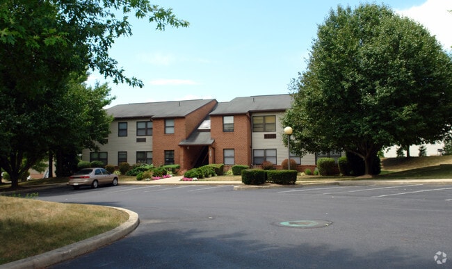
14048 Village Mill Dr
Hagerstown-Martinsburg, MD-WV
North St Ext
13-023166
4.491 ACRES 14020 VILLAGE MILL 14036
Multifamilydwelling
Washington
X
Maryland
24043C0128D
2.58 AC
2024
Outer Downtown/Maugansville
2025
Washington, DC
010401
DEMOGRAPHICS near 14048 Village Mill Dr
1 Mile
3 Mile
5 Mile
2024 Total Population
2,934
18,932
64,165
2029 Population
2,904
19,012
64,970
Pop Growth 2024-2029
(1.02%)
+ 0.42%
+ 1.25%
Average Age
40
40
40
2024 Total Households
1,161
7,261
25,371
HH Growth 2024-2029
(0.95%)
+ 0.45%
+ 1.29%
Median Household Inc
$56,749
$77,132
$55,360
Avg Household Size
2.50
2.60
2.40
2024 Avg HH Vehicles
2.00
2.00
2.00
Median Home Value
$248,360
$271,848
$221,914
Median Year Built
1988
1982
1969
Nearby Places
Map Layers
Map Styles
 Street
 Aerial
- Restaurants
- Banks
- Shops
- Fitness
- Groceries
Nearby Properties
Address
Land Use
TOTAL SIZE
Lot Size
Zoning
Address
Land Use
TOTAL SIZE
Lot Size
Zoning
1,190,700 SF
83.26 AC
HI
Address
Land Use
TOTAL SIZE
Lot Size
Zoning
23,941 SF
401.89 AC
U
Address
Land Use
TOTAL SIZE
Lot Size
Zoning
801,000 SF
86.86 AC
HI
Address
Land Use
TOTAL SIZE
Lot Size
Zoning
36,685 SF
281.72 AC
IG
Address
Land Use
TOTAL SIZE
Lot Size
Zoning
76,740 SF
16.01 AC
CG
Address
Land Use
TOTAL SIZE
Lot Size
Zoning
6,778 SF
8.24 AC
RH
Address
Land Use
TOTAL SIZE
Lot Size
Zoning
91,586 SF
28.49 AC
U
Address
Land Use
TOTAL SIZE
Lot Size
Zoning
65,433 SF
16.52 AC
PUD
Address
Land Use
TOTAL SIZE
Lot Size
Zoning
5,090 SF
25.27 AC
RMOD
Address
Land Use
TOTAL SIZE
Lot Size
Zoning
150,000 SF
22.73 AC
HI
Address
Land Use
TOTAL SIZE
Lot Size
Zoning
764,619 SF
31.10 AC
IG
Address
Land Use
TOTAL SIZE
Lot Size
Zoning
35,402 SF
10.18 AC
BG
Address
Land Use
TOTAL SIZE
Lot Size
Zoning
84,796 SF
8.81 AC
PB
Address
Land Use
TOTAL SIZE
Lot Size
Zoning
51,773 SF
11.96 AC
HI
Address
Land Use
TOTAL SIZE
Lot Size
Zoning
36,000 SF
12.07 AC
RM
Address
Land Use
TOTAL SIZE
Lot Size
Zoning
188,784 SF
79.06 AC
AP
Address
Land Use
TOTAL SIZE
Lot Size
Zoning
351,104 SF
55.68 AC
AP
Address
Land Use
TOTAL SIZE
Lot Size
Zoning
6,300 SF
35.92 AC
RT
Address
Land Use
TOTAL SIZE
Lot Size
Zoning
12,908 SF
12.94 AC
HI
Address
Land Use
TOTAL SIZE
Lot Size
Zoning
287,625 SF
19.69 AC
IG
Address
Land Use
TOTAL SIZE
Lot Size
Zoning
21,483 SF
3.51 AC
HI
Address
Land Use
TOTAL SIZE
Lot Size
Zoning
12.19 AC
RH
Address
Land Use
TOTAL SIZE
Lot Size
Zoning
34,110 SF
8.03 AC
HI
Address
Land Use
TOTAL SIZE
Lot Size
Zoning
135,184 SF
61.18 AC
HI
Address
Land Use
TOTAL SIZE
Lot Size
Zoning
43,600 SF
3.71 AC
HI
Address
Land Use
TOTAL SIZE
Lot Size
Zoning
6,077 SF
8.82 AC
U
Address
Land Use
TOTAL SIZE
Lot Size
Zoning
7.11 AC
PB
Address
Land Use
TOTAL SIZE
Lot Size
Zoning
3,880 SF
23 AC
RMOD
Address
Land Use
TOTAL SIZE
Lot Size
Zoning
53,406 SF
13.10 AC
RMOD
Address
Land Use
TOTAL SIZE
Lot Size
Zoning
34,527 SF
2.20 AC
U
The World's #1 Commercial Real Estate Marketplace
Connect with us
© 2026 CoStar Group
The information above has been obtained from sources believed reliable. While we do not doubt its accuracy we have not verified it and make no guarantee, warranty or representation about it. It is your responsibility to independently confirm its accuracy and completeness. Any projections, opinions, assumptions, or estimates used are for example only and do not represent the current or future performance of the property. The value of this transaction to you depends on tax and other factors which should be evaluated by your tax, financial, and legal advisors. You and your advisors should conduct a careful, independent investigation of the property to determine to your satisfaction the suitability of the property for your needs.