Property Record
1405 Columbus Pkwy, Opelika, AL 36804
NEARBY LISTINGS FOR SALE OR LEASE
Property Detail
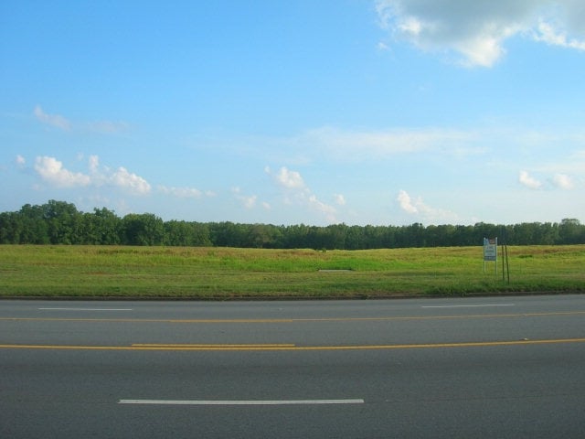
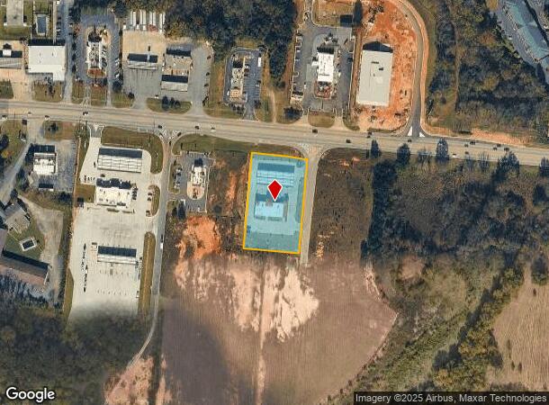
1405 Columbus Pkwy
Auburn-Opelika, AL
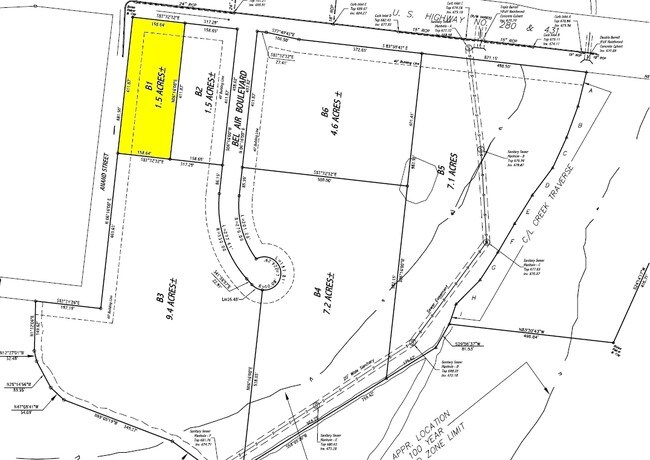
Eeb S/D
10-05-16-2-000-002.001
PARCEL B-2-A EEB S/D 3RD REDIVISION OF PARCEL B REDIVISION OF PARCEL B-2-A REDIVISION OF A PORTION OF PARCEL B PLAT 40-60
Conveniencestore
Lee
X
Alabama
01081C0088G
b-2-a
2025
1.65 AC
2025
Lee County
041703
Columbus GA
5,100 SF
DEMOGRAPHICS near 1405 Columbus Pkwy
1 Mile
3 Mile
5 Mile
2024 Total Population
940
20,666
34,729
2029 Population
1,043
22,671
38,114
Pop Growth 2024-2029
+ 10.96%
+ 9.70%
+ 9.75%
Average Age
39
40
41
2024 Total Households
371
8,281
13,822
HH Growth 2024-2029
+ 11.05%
+ 9.60%
+ 9.68%
Median Household Inc
$52,111
$46,756
$51,370
Avg Household Size
2.40
2.40
2.40
2024 Avg HH Vehicles
2.00
2.00
2.00
Median Home Value
$159,090
$158,490
$167,808
Median Year Built
1997
1986
1991
Nearby Places
Map Layers
Map Styles
 Street
 Aerial
- Restaurants
- Banks
- Shops
- Fitness
- Groceries
PUBLIC TRANSPORTATION
AIRPORT
Columbus
DRIVE
WALK
Distance
Columbus
39 min
29.5 mi
Freight Ports
Port of Panama City
DRIVE
WALK
Distance
Port of Panama City
258 min
196.1 mi
SALE & LEASE HISTORY
LISTING DATE
SALE/LEASE

Sep 24, 2016
For Sale
Nearby Properties
Address
Land Use
TOTAL SIZE
Lot Size
Zoning
Address
Land Use
TOTAL SIZE
Lot Size
Zoning
29,160 SF
107.43 AC
Address
Land Use
TOTAL SIZE
Lot Size
Zoning
177,673 SF
21.50 AC
Address
Land Use
TOTAL SIZE
Lot Size
Zoning
213,785 SF
Address
Land Use
TOTAL SIZE
Lot Size
Zoning
9,804 SF
10.78 AC
Address
Land Use
TOTAL SIZE
Lot Size
Zoning
13,800 SF
24.31 AC
Address
Land Use
TOTAL SIZE
Lot Size
Zoning
19,818 SF
11.95 AC
Address
Land Use
TOTAL SIZE
Lot Size
Zoning
180,290 SF
Address
Land Use
TOTAL SIZE
Lot Size
Zoning
7,690 SF
21.24 AC
Address
Land Use
TOTAL SIZE
Lot Size
Zoning
6,540 SF
Address
Land Use
TOTAL SIZE
Lot Size
Zoning
132,815 SF
6.10 AC
Address
Land Use
TOTAL SIZE
Lot Size
Zoning
199,325 SF
14.48 AC
Address
Land Use
TOTAL SIZE
Lot Size
Zoning
72,178 SF
12.40 AC
Address
Land Use
TOTAL SIZE
Lot Size
Zoning
68,030 SF
Address
Land Use
TOTAL SIZE
Lot Size
Zoning
720 SF
14 AC
Address
Land Use
TOTAL SIZE
Lot Size
Zoning
7,854 SF
3.86 AC
Address
Land Use
TOTAL SIZE
Lot Size
Zoning
80,882 SF
Address
Land Use
TOTAL SIZE
Lot Size
Zoning
64,712 SF
6.30 AC
Address
Land Use
TOTAL SIZE
Lot Size
Zoning
10,662 SF
1.31 AC
Address
Land Use
TOTAL SIZE
Lot Size
Zoning
8,520 SF
10 AC
Address
Land Use
TOTAL SIZE
Lot Size
Zoning
28,797 SF
1.38 AC
Address
Land Use
TOTAL SIZE
Lot Size
Zoning
50,749 SF
4.53 AC
Address
Land Use
TOTAL SIZE
Lot Size
Zoning
2,009 SF
4.60 AC
Address
Land Use
TOTAL SIZE
Lot Size
Zoning
14,064 SF
1.15 AC
Address
Land Use
TOTAL SIZE
Lot Size
Zoning
527,074 SF
39.40 AC
Address
Land Use
TOTAL SIZE
Lot Size
Zoning
6,480 SF
9.22 AC
Address
Land Use
TOTAL SIZE
Lot Size
Zoning
3,968 SF
1.30 AC
Address
Land Use
TOTAL SIZE
Lot Size
Zoning
2,956 SF
0.42 AC
Address
Land Use
TOTAL SIZE
Lot Size
Zoning
1,708 SF
54.71 AC
Address
Land Use
TOTAL SIZE
Lot Size
Zoning
24,054 SF
0.70 AC
Address
Land Use
TOTAL SIZE
Lot Size
Zoning
30,618 SF
2.72 AC
The World's #1 Commercial Real Estate Marketplace
Connect with us
© 2026 CoStar Group
The information above has been obtained from sources believed reliable. While we do not doubt its accuracy we have not verified it and make no guarantee, warranty or representation about it. It is your responsibility to independently confirm its accuracy and completeness. Any projections, opinions, assumptions, or estimates used are for example only and do not represent the current or future performance of the property. The value of this transaction to you depends on tax and other factors which should be evaluated by your tax, financial, and legal advisors. You and your advisors should conduct a careful, independent investigation of the property to determine to your satisfaction the suitability of the property for your needs.