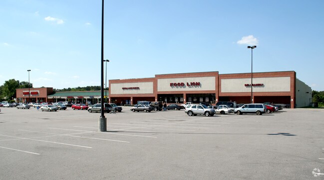
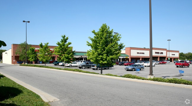
Property Record
1405 E Andrews Ave, Henderson, NC 27536

Property Detail
1405 E Andrews Ave
0214-03017
1401 CARDINAL DR PARCEL #2 8.688
Stripcommercialcenter
VANCE
HB4
North Carolina
B and X Area of moderate flood hazard, usually the area between the limits of the 100-year and 500-year floods.
2
2025
8.69 AC
2025
North Carolina Northeast Area
960500
Other Market Areas
56,315 SF
Henderson, NC
NEARBY LISTINGS FOR SALE OR LEASE
DEMOGRAPHICS near 1405 E Andrews Ave
1 mile
3 mile
5 mile
2025 Total Population
4,257
19,477
27,352
2030 Population
4,325
19,609
27,457
Pop Growth 2025-2030
+ 1.60%
+ 0.68%
+ 0.38%
Average Age
38
40
41
2025 Total Households
1,666
7,745
10,916
HH Growth 2025-2030
+ 1.62%
+ 0.68%
+ 0.37%
Median Household Inc
$35,332
$39,606
$44,133
Avg Household Size
2.50
2.40
2.40
2025 Avg HH Vehicles
2.00
2.00
2.00
Median Home Value
$77,594
$120,719
$142,281
Median Year Built
1967
1971
1975
Nearby Places
Map Layers
Map Styles
 Street
 Aerial
Layers
 Traffic
 Biking
Places
Listings with unknown addresses are not visible on the map
- Restaurants
- Banks
- Shops
- Fitness
- Groceries
SALE & LEASE HISTORY
LISTING DATE
SALE/LEASE

Dec 15, 2016
For Lease
Nearby Properties
Address
Land Use
TOTAL SIZE
Lot Size
Zoning
Address
Land Use
TOTAL SIZE
Lot Size
Zoning
125,900 SF
38.64 AC
HI2
Address
Land Use
TOTAL SIZE
Lot Size
Zoning
149,688 SF
131.64 AC
HI2
Address
Land Use
TOTAL SIZE
Lot Size
Zoning
96,081 SF
1.33 AC
HB1
Address
Land Use
TOTAL SIZE
Lot Size
Zoning
603,204 SF
45.50 AC
HI2
Address
Land Use
TOTAL SIZE
Lot Size
Zoning
51,768 SF
40.75 AC
HR8M
Address
Land Use
TOTAL SIZE
Lot Size
Zoning
104,496 SF
14.95 AC
HR6
Address
Land Use
TOTAL SIZE
Lot Size
Zoning
64,208 SF
1.90 AC
HB1
Address
Land Use
TOTAL SIZE
Lot Size
Zoning
58,025 SF
12.06 AC
HB4
Address
Land Use
TOTAL SIZE
Lot Size
Zoning
167,900 SF
70.82 AC
HR15
Address
Land Use
TOTAL SIZE
Lot Size
Zoning
230,400 SF
69.68 AC
HI2
Address
Land Use
TOTAL SIZE
Lot Size
Zoning
22,572 SF
88.80 AC
HR15M
Address
Land Use
TOTAL SIZE
Lot Size
Zoning
157,874 SF
40 AC
OI
Address
Land Use
TOTAL SIZE
Lot Size
Zoning
214,900 SF
25.24 AC
HI2
Address
Land Use
TOTAL SIZE
Lot Size
Zoning
24,888 SF
33.39 AC
HR20
Address
Land Use
TOTAL SIZE
Lot Size
Zoning
54,090 SF
7.61 AC
HB3
Address
Land Use
TOTAL SIZE
Lot Size
Zoning
150,320 SF
9.51 AC
HB3
Address
Land Use
TOTAL SIZE
Lot Size
Zoning
54,793 SF
47.70 AC
HR15
Address
Land Use
TOTAL SIZE
Lot Size
Zoning
85,355 SF
13.80 AC
HB4
Address
Land Use
TOTAL SIZE
Lot Size
Zoning
257,656 SF
31.28 AC
HI2
Address
Land Use
TOTAL SIZE
Lot Size
Zoning
27,784 SF
2.04 AC
HB1
Address
Land Use
TOTAL SIZE
Lot Size
Zoning
78,661 SF
4.84 AC
HOI
Address
Land Use
TOTAL SIZE
Lot Size
Zoning
49,414 SF
8.46 AC
HB4
Address
Land Use
TOTAL SIZE
Lot Size
Zoning
1,824 SF
13 AC
HR8
Address
Land Use
TOTAL SIZE
Lot Size
Zoning
48,490 SF
6.14 AC
HB2A
Address
Land Use
TOTAL SIZE
Lot Size
Zoning
40,456 SF
2 AC
HB3
Address
Land Use
TOTAL SIZE
Lot Size
Zoning
29,400 SF
8.24 AC
HB2
Address
Land Use
TOTAL SIZE
Lot Size
Zoning
67,977 SF
17.65 AC
HOI
Address
Land Use
TOTAL SIZE
Lot Size
Zoning
12,000 SF
1.50 AC
HI2
Address
Land Use
TOTAL SIZE
Lot Size
Zoning
65,156 SF
46.85 AC
HI2
The World's #1 Commercial Real Estate Marketplace
Connect with us
© 2026 CoStar Group
The information above has been obtained from sources believed reliable. While we do not doubt its accuracy we have not verified it and make no guarantee, warranty or representation about it. It is your responsibility to independently confirm its accuracy and completeness. Any projections, opinions, assumptions, or estimates used are for example only and do not represent the current or future performance of the property. The value of this transaction to you depends on tax and other factors which should be evaluated by your tax, financial, and legal advisors. You and your advisors should conduct a careful, independent investigation of the property to determine to your satisfaction the suitability of the property for your needs.