Property Record
1405 Hamburg Tpke, Wayne, NJ 07470

Property Detail
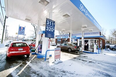
1405 Hamburg Tpke
14-02605-0000-00028
Passaic
Autorepair
New Jersey
B and X Area of moderate flood hazard, usually the area between the limits of the 100-year and 500-year floods.
28
2024
0.51 AC
2025
Passaic Rt 46/23
246201
Northern New Jersey
1,710 SF
New York-Jersey City-White Plains, NY-NJ
NEARBY LISTINGS FOR SALE OR LEASE
DEMOGRAPHICS near 1405 Hamburg Tpke
1 mile
3 mile
5 mile
2025 Total Population
9,273
69,764
218,441
2030 Population
9,594
72,274
224,229
Pop Growth 2025-2030
+ 3.46%
+ 3.60%
+ 2.65%
Average Age
42
43
42
2025 Total Households
3,136
24,506
75,583
HH Growth 2025-2030
+ 3.22%
+ 3.42%
+ 2.68%
Median Household Inc
$145,605
$145,361
$113,239
Avg Household Size
2.80
2.80
2.80
2025 Avg HH Vehicles
2.00
2.00
2.00
Median Home Value
$685,299
$660,551
$588,659
Median Year Built
1974
1965
1963
Nearby Places
Map Layers
Map Styles
 Street
 Aerial
Layers
 Traffic
 Biking
Places
Listings with unknown addresses are not visible on the map
- Restaurants
- Banks
- Shops
- Fitness
- Groceries
PUBLIC TRANSPORTATION
COMMUTER RAIL
Mountain View (Montclair-Boonton Line - NJ Transit Commuter Rail (NJ Transit))
Drive
Walk
Distance
Mountain View (Montclair-Boonton Line - NJ Transit Commuter Rail (NJ Transit))
10 min
4.6 mi
Wayne/Route 23 Transit Center (Montclair-Boonton Line - NJ Transit Commuter Rail (NJ Transit))
Drive
Walk
Distance
Wayne/Route 23 Transit Center (Montclair-Boonton Line - NJ Transit Commuter Rail (NJ Transit))
11 min
5.1 mi
AIRPORT
Newark Liberty International
Drive
Walk
Distance
Newark Liberty International
34 min
25.5 mi
LaGuardia
Drive
Walk
Distance
LaGuardia
47 min
30.0 mi
Westchester County
Drive
Walk
Distance
Westchester County
64 min
46.1 mi
Freight Ports
Maher Terminal
Drive
Walk
Distance
Maher Terminal
41 min
25.4 mi
Nearby Properties
Address
Land Use
TOTAL SIZE
Lot Size
Zoning
Address
Land Use
TOTAL SIZE
Lot Size
Zoning
21.99 AC
H
Address
Land Use
TOTAL SIZE
Lot Size
Zoning
10.88 AC
Address
Land Use
TOTAL SIZE
Lot Size
Zoning
18.76 AC
C-3
Address
Land Use
TOTAL SIZE
Lot Size
Zoning
32.21 AC
R-15
Address
Land Use
TOTAL SIZE
Lot Size
Zoning
334,755 SF
107.89 AC
Address
Land Use
TOTAL SIZE
Lot Size
Zoning
220,994 SF
16.48 AC
Address
Land Use
TOTAL SIZE
Lot Size
Zoning
186,299 SF
2.16 AC
R-A
Address
Land Use
TOTAL SIZE
Lot Size
Zoning
41.71 AC
C-4
Address
Land Use
TOTAL SIZE
Lot Size
Zoning
79,562 SF
10.33 AC
AHO3
Address
Land Use
TOTAL SIZE
Lot Size
Zoning
145,949 SF
50 AC
Address
Land Use
TOTAL SIZE
Lot Size
Zoning
277,661 SF
50.20 AC
Address
Land Use
TOTAL SIZE
Lot Size
Zoning
63,460 SF
10.72 AC
Address
Land Use
TOTAL SIZE
Lot Size
Zoning
259,919 SF
48.14 AC
Address
Land Use
TOTAL SIZE
Lot Size
Zoning
9.08 AC
H-C
Address
Land Use
TOTAL SIZE
Lot Size
Zoning
25.80 AC
Address
Land Use
TOTAL SIZE
Lot Size
Zoning
9.28 AC
R-11
Address
Land Use
TOTAL SIZE
Lot Size
Zoning
10.07 AC
R-15
Address
Land Use
TOTAL SIZE
Lot Size
Zoning
12.24 AC
H-C
Address
Land Use
TOTAL SIZE
Lot Size
Zoning
8.87 AC
RA1
Address
Land Use
TOTAL SIZE
Lot Size
Zoning
2,372 SF
5 AC
IP
Address
Land Use
TOTAL SIZE
Lot Size
Zoning
7,398 SF
13.96 AC
Address
Land Use
TOTAL SIZE
Lot Size
Zoning
1,600 SF
11.60 AC
OB
Address
Land Use
TOTAL SIZE
Lot Size
Zoning
1,197.68 AC
Address
Land Use
TOTAL SIZE
Lot Size
Zoning
634 SF
14.76 AC
H
Address
Land Use
TOTAL SIZE
Lot Size
Zoning
145,904 SF
14.20 AC
IP
Address
Land Use
TOTAL SIZE
Lot Size
Zoning
2,511 SF
17.63 AC
Address
Land Use
TOTAL SIZE
Lot Size
Zoning
89,728 SF
5.83 AC
R-A
Address
Land Use
TOTAL SIZE
Lot Size
Zoning
5.89 AC
R-9
Address
Land Use
TOTAL SIZE
Lot Size
Zoning
145,639 SF
27.40 AC
Address
Land Use
TOTAL SIZE
Lot Size
Zoning
2,688 SF
18.85 AC
The World's #1 Commercial Real Estate Marketplace
Connect with us
© 2026 CoStar Group
The information above has been obtained from sources believed reliable. While we do not doubt its accuracy we have not verified it and make no guarantee, warranty or representation about it. It is your responsibility to independently confirm its accuracy and completeness. Any projections, opinions, assumptions, or estimates used are for example only and do not represent the current or future performance of the property. The value of this transaction to you depends on tax and other factors which should be evaluated by your tax, financial, and legal advisors. You and your advisors should conduct a careful, independent investigation of the property to determine to your satisfaction the suitability of the property for your needs.