Property Record
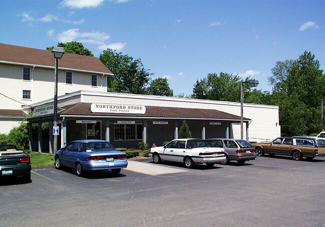
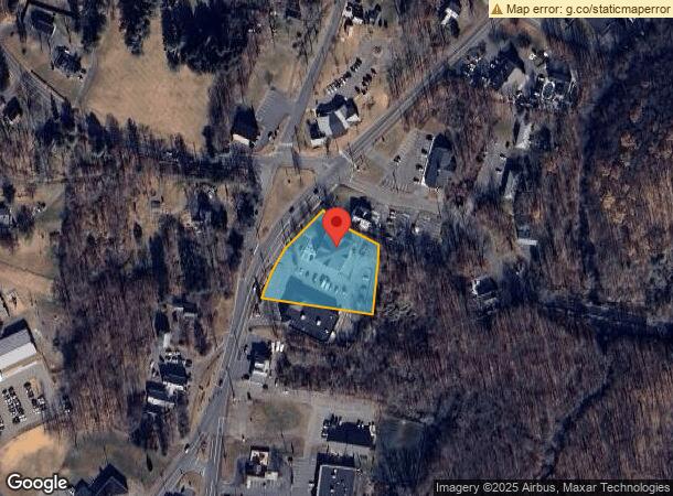
1405 Middletown Ave, Northford, CT 06472
NEARBY LISTINGS FOR SALE OR LEASE
Property Detail
1405 Middletown Ave
Commercialbuilding
New Haven
X
Connecticut
09009C0318J
0.98 AC
2025
Branford
2025
Westchester/So Connecticut
186200
New Haven-Milford, CT
11,286 SF
NBRA-000062B-000000-000032
DEMOGRAPHICS near 1405 Middletown Ave
1 Mile
3 Mile
5 Mile
2024 Total Population
1,944
16,403
59,246
2029 Population
1,929
16,365
59,023
Pop Growth 2024-2029
(0.77%)
(0.23%)
(0.38%)
Average Age
44
45
44
2024 Total Households
733
6,363
23,442
HH Growth 2024-2029
(0.95%)
(0.33%)
(0.49%)
Median Household Inc
$117,368
$99,417
$99,337
Avg Household Size
2.60
2.50
2.50
2024 Avg HH Vehicles
2.00
2.00
2.00
Median Home Value
$345,899
$332,309
$315,787
Median Year Built
1971
1972
1968
Nearby Places
Map Layers
Map Styles
 Street
 Aerial
- Restaurants
- Banks
- Shops
- Fitness
- Groceries
PUBLIC TRANSPORTATION
COMMUTER RAIL
Wallingford Amtrak (Amtrak Hartford Line - Amtrak, Hartford Line - Amtrak, Northeast Regional - Amtrak, Valley Flyer - Amtrak)
DRIVE
WALK
Distance
Wallingford Amtrak (Amtrak Hartford Line - Amtrak, Hartford Line - Amtrak, Northeast Regional - Amtrak, Valley Flyer - Amtrak)
10 min
5.6 mi
Wallingford (Hartford Line - CONN DOT)
DRIVE
WALK
Distance
Wallingford (Hartford Line - CONN DOT)
12 min
6.0 mi
AIRPORT
Tweed/New Haven
DRIVE
WALK
Distance
Tweed/New Haven
22 min
11.9 mi
Freight Ports
Port of New Haven
DRIVE
WALK
Distance
Port of New Haven
20 min
9.8 mi
Nearby Properties
Address
Land Use
TOTAL SIZE
Lot Size
Zoning
Address
Land Use
TOTAL SIZE
Lot Size
Zoning
100 AC
LO15
Address
Land Use
TOTAL SIZE
Lot Size
Zoning
36,520 SF
4.64 AC
IL30
Address
Land Use
TOTAL SIZE
Lot Size
Zoning
97,898 SF
11.40 AC
R20
Address
Land Use
TOTAL SIZE
Lot Size
Zoning
3.84 AC
CB40
Address
Land Use
TOTAL SIZE
Lot Size
Zoning
15,432 SF
5.67 AC
CB40
Address
Land Use
TOTAL SIZE
Lot Size
Zoning
20.01 AC
R20
Address
Land Use
TOTAL SIZE
Lot Size
Zoning
91,455 SF
14.20 AC
RU-2
Address
Land Use
TOTAL SIZE
Lot Size
Zoning
64,827 SF
24.94 AC
R40
Address
Land Use
TOTAL SIZE
Lot Size
Zoning
60,678 SF
21.50 AC
R40
Address
Land Use
TOTAL SIZE
Lot Size
Zoning
51.31 AC
R40
Address
Land Use
TOTAL SIZE
Lot Size
Zoning
53,901 SF
5.76 AC
R12
Address
Land Use
TOTAL SIZE
Lot Size
Zoning
5,440 SF
19.17 AC
R40P
Address
Land Use
TOTAL SIZE
Lot Size
Zoning
78,394 SF
4 AC
D
Address
Land Use
TOTAL SIZE
Lot Size
Zoning
243,672 SF
18.85 AC
I3
Address
Land Use
TOTAL SIZE
Lot Size
Zoning
65,827 SF
25.16 AC
R80
Address
Land Use
TOTAL SIZE
Lot Size
Zoning
2.77 AC
IL30
Address
Land Use
TOTAL SIZE
Lot Size
Zoning
100,271 SF
8.79 AC
I3
Address
Land Use
TOTAL SIZE
Lot Size
Zoning
45,951 SF
9.40 AC
RU40
Address
Land Use
TOTAL SIZE
Lot Size
Zoning
17.69 AC
R-5
Address
Land Use
TOTAL SIZE
Lot Size
Zoning
70,623 SF
7.59 AC
R40
Address
Land Use
TOTAL SIZE
Lot Size
Zoning
33,577 SF
21.86 AC
R40
Address
Land Use
TOTAL SIZE
Lot Size
Zoning
3.43 AC
R20
Address
Land Use
TOTAL SIZE
Lot Size
Zoning
10,223 SF
13.74 AC
R40
Address
Land Use
TOTAL SIZE
Lot Size
Zoning
24,046 SF
3.31 AC
R20
Address
Land Use
TOTAL SIZE
Lot Size
Zoning
13,856 SF
2.10 AC
CB40
Address
Land Use
TOTAL SIZE
Lot Size
Zoning
5,796 SF
3.66 AC
CB40
Address
Land Use
TOTAL SIZE
Lot Size
Zoning
48,374 SF
7.66 AC
EH
Address
Land Use
TOTAL SIZE
Lot Size
Zoning
1.50 AC
R40
Address
Land Use
TOTAL SIZE
Lot Size
Zoning
28,048 SF
5.12 AC
R40
Address
Land Use
TOTAL SIZE
Lot Size
Zoning
2,640 SF
20 AC
CB40
The World's #1 Commercial Real Estate Marketplace
Connect with us
© 2026 CoStar Group
The information above has been obtained from sources believed reliable. While we do not doubt its accuracy we have not verified it and make no guarantee, warranty or representation about it. It is your responsibility to independently confirm its accuracy and completeness. Any projections, opinions, assumptions, or estimates used are for example only and do not represent the current or future performance of the property. The value of this transaction to you depends on tax and other factors which should be evaluated by your tax, financial, and legal advisors. You and your advisors should conduct a careful, independent investigation of the property to determine to your satisfaction the suitability of the property for your needs.