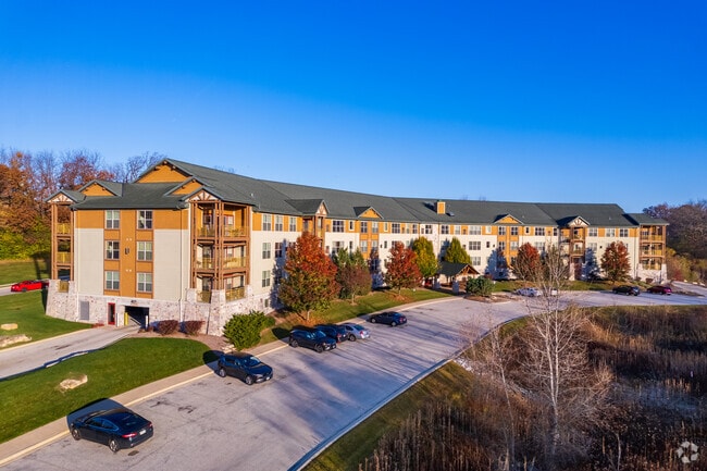
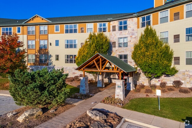
Property Record
1405 Rockridge Rd, Waukesha, WI 53188
NEARBY LISTINGS FOR SALE OR LEASE
-
-
View all Waukesha listings for sale on LoopNet.com
Property Detail
1405 Rockridge Rd
Milwaukee-Waukesha-West Allis, WI
Rolling Ridge South Add
WAKC-0990-126
LOT 2 CSM NO 10541 (V101 DEEDS P14) REDIV LOTS 429 & 430 & OUTLOT 26 ROLLING RIDGE SOUTH ADD NO 8 PT NW1/4 SEC 32 T7N R19E 6.96 AC R1256/260 & DOC NO 3556501
Commercialnec
Waukesha
X
Wisconsin
55133C0193H
2
2024
6.96 AC
2024
Eastern Waukesha
203107
Milwaukee/Madison
77,514 SF
DEMOGRAPHICS near 1405 Rockridge Rd
1 Mile
3 Mile
5 Mile
2024 Total Population
7,151
43,212
103,220
2029 Population
7,374
44,675
106,375
Pop Growth 2024-2029
+ 3.12%
+ 3.39%
+ 3.06%
Average Age
43
41
41
2024 Total Households
2,844
18,585
43,918
HH Growth 2024-2029
+ 3.20%
+ 3.49%
+ 3.14%
Median Household Inc
$109,185
$77,496
$79,945
Avg Household Size
2.50
2.20
2.30
2024 Avg HH Vehicles
2.00
2.00
2.00
Median Home Value
$351,644
$279,147
$281,676
Median Year Built
1995
1982
1980
Nearby Places
Map Layers
Map Styles
 Street
 Aerial
- Restaurants
- Banks
- Shops
- Fitness
- Groceries
PUBLIC TRANSPORTATION
AIRPORT
General Mitchell International
DRIVE
WALK
Distance
General Mitchell International
41 min
27.1 mi
Freight Ports
Port Milwaukee
DRIVE
WALK
Distance
Port Milwaukee
34 min
23.7 mi
Nearby Properties
Address
Land Use
TOTAL SIZE
Lot Size
Zoning
Address
Land Use
TOTAL SIZE
Lot Size
Zoning
172.13 AC
M-2
Address
Land Use
TOTAL SIZE
Lot Size
Zoning
21.73 AC
M-1
Address
Land Use
TOTAL SIZE
Lot Size
Zoning
71.18 AC
M-2
Address
Land Use
TOTAL SIZE
Lot Size
Zoning
68,591 SF
2.97 AC
RM-3(PUD)
Address
Land Use
TOTAL SIZE
Lot Size
Zoning
63,482 SF
39.53 AC
I-1
Address
Land Use
TOTAL SIZE
Lot Size
Zoning
51,676 SF
7.41 AC
RM-3(PUD)
Address
Land Use
TOTAL SIZE
Lot Size
Zoning
129,059 SF
19.19 AC
RM-2(PUD)
Address
Land Use
TOTAL SIZE
Lot Size
Zoning
91,322 SF
8.48 AC
B-4
Address
Land Use
TOTAL SIZE
Lot Size
Zoning
110,992 SF
12.15 AC
RM-1(PUD)
Address
Land Use
TOTAL SIZE
Lot Size
Zoning
20.65 AC
Address
Land Use
TOTAL SIZE
Lot Size
Zoning
61,299 SF
6.59 AC
RM-2(PUD)
Address
Land Use
TOTAL SIZE
Lot Size
Zoning
79,529 SF
23.85 AC
I-1
Address
Land Use
TOTAL SIZE
Lot Size
Zoning
4.21 AC
B-5(PUD)
Address
Land Use
TOTAL SIZE
Lot Size
Zoning
203,208 SF
41.18 AC
B-5,C-1
Address
Land Use
TOTAL SIZE
Lot Size
Zoning
11.54 AC
M-1
Address
Land Use
TOTAL SIZE
Lot Size
Zoning
65,803 SF
15.22 AC
RM-2(PUD),
Address
Land Use
TOTAL SIZE
Lot Size
Zoning
136.33 AC
M-2
Address
Land Use
TOTAL SIZE
Lot Size
Zoning
102,333 SF
11.99 AC
B-5(PUD)
Address
Land Use
TOTAL SIZE
Lot Size
Zoning
11.11 AC
B-5
Address
Land Use
TOTAL SIZE
Lot Size
Zoning
0.81 AC
B-2
Address
Land Use
TOTAL SIZE
Lot Size
Zoning
47,353 SF
5.41 AC
RM-2(PUD)
Address
Land Use
TOTAL SIZE
Lot Size
Zoning
180,616 SF
10.46 AC
B-5(PUD)
Address
Land Use
TOTAL SIZE
Lot Size
Zoning
10.31 AC
B-5
Address
Land Use
TOTAL SIZE
Lot Size
Zoning
36,054 SF
10.62 AC
I-1
Address
Land Use
TOTAL SIZE
Lot Size
Zoning
1.74 AC
RM-3(PUD)
Address
Land Use
TOTAL SIZE
Lot Size
Zoning
81,796 SF
5.96 AC
B-5
Address
Land Use
TOTAL SIZE
Lot Size
Zoning
4.50 AC
B-5(PUD)
Address
Land Use
TOTAL SIZE
Lot Size
Zoning
24,684 SF
1.56 AC
RM-3(PUD)
Address
Land Use
TOTAL SIZE
Lot Size
Zoning
132,634 SF
9.25 AC
B-5(PUD)
The World's #1 Commercial Real Estate Marketplace
Connect with us
© 2025 CoStar Group
The information above has been obtained from sources believed reliable. While we do not doubt its accuracy we have not verified it and make no guarantee, warranty or representation about it. It is your responsibility to independently confirm its accuracy and completeness. Any projections, opinions, assumptions, or estimates used are for example only and do not represent the current or future performance of the property. The value of this transaction to you depends on tax and other factors which should be evaluated by your tax, financial, and legal advisors. You and your advisors should conduct a careful, independent investigation of the property to determine to your satisfaction the suitability of the property for your needs.