Property Record
1405 Spruce St, Riverside, CA 92507
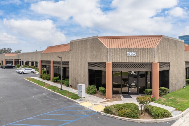

This Property Is For Sale
Property Detail
1405 Spruce St
Riverside-San Bernardino-Ontario, CA
UNIT 8 CM 148/134 INT IN COMM IN LOT 1-P IF TR 32252 MB 378/077
249-111-039
Riverside
Lightindustrial
California
B and X Area of moderate flood hazard, usually the area between the limits of the 100-year and 500-year floods.
1-p
2024
0.08 AC
2025
Riverside
042209
Inland Empire (California)
3,374 SF
NEARBY LISTINGS FOR SALE OR LEASE
DEMOGRAPHICS near 1405 Spruce St
1 mile
3 mile
5 mile
2025 Total Population
15,921
96,775
209,718
2030 Population
16,237
99,363
214,554
Pop Growth 2025-2030
+ 1.98%
+ 2.67%
+ 2.31%
Average Age
31
34
36
2025 Total Households
5,236
29,468
65,195
HH Growth 2025-2030
+ 1.34%
+ 2.29%
+ 1.98%
Median Household Inc
$60,213
$80,123
$87,462
Avg Household Size
2.60
2.90
3.00
2025 Avg HH Vehicles
2.00
2.00
2.00
Median Home Value
$413,793
$609,893
$616,159
Median Year Built
1981
1975
1976
Nearby Places
Map Layers
Map Styles
 Street
 Aerial
Layers
 Traffic
 Biking
Places
Listings with unknown addresses are not visible on the map
- Restaurants
- Banks
- Shops
- Fitness
- Groceries
PUBLIC TRANSPORTATION
COMMUTER RAIL
Drive
Walk
Distance
2 min
18 min
0.9 mi
Riverside-Downtown (91 Line - Southern California Regional Rail Authority (Metrolink), Inland Empire-Orange County Line - Southern California Regional Rail Authority (Metrolink), Riverside Line - Southern California Regional Rail Authority (Metrolink))
Drive
Walk
Distance
Riverside-Downtown (91 Line - Southern California Regional Rail Authority (Metrolink), Inland Empire-Orange County Line - Southern California Regional Rail Authority (Metrolink), Riverside Line - Southern California Regional Rail Authority (Metrolink))
7 min
2.6 mi
AIRPORT
Ontario International
Drive
Walk
Distance
Ontario International
25 min
19.0 mi
John Wayne/Orange County
Drive
Walk
Distance
John Wayne/Orange County
54 min
44.4 mi
Freight Ports
Port of Long Beach
Drive
Walk
Distance
Port of Long Beach
75 min
58.3 mi
Nearby Properties
Address
Land Use
TOTAL SIZE
Lot Size
Zoning
Address
Land Use
TOTAL SIZE
Lot Size
Zoning
798,304 SF
42.64 AC
AMSP
Address
Land Use
TOTAL SIZE
Lot Size
Zoning
247,416 SF
10.17 AC
Address
Land Use
TOTAL SIZE
Lot Size
Zoning
1,009,120 SF
35.22 AC
Address
Land Use
TOTAL SIZE
Lot Size
Zoning
494,575 SF
25.33 AC
MP
Address
Land Use
TOTAL SIZE
Lot Size
Zoning
599,735 SF
33.25 AC
AMSP
Address
Land Use
TOTAL SIZE
Lot Size
Zoning
369,842 SF
16.35 AC
Address
Land Use
TOTAL SIZE
Lot Size
Zoning
411,707 SF
19.34 AC
Address
Land Use
TOTAL SIZE
Lot Size
Zoning
350,278 SF
1.21 AC
Address
Land Use
TOTAL SIZE
Lot Size
Zoning
126,036 SF
30.90 AC
Address
Land Use
TOTAL SIZE
Lot Size
Zoning
26,879 SF
16.27 AC
R3
Address
Land Use
TOTAL SIZE
Lot Size
Zoning
217,036 SF
1.66 AC
C2
Address
Land Use
TOTAL SIZE
Lot Size
Zoning
156,241 SF
2.55 AC
Address
Land Use
TOTAL SIZE
Lot Size
Zoning
55.22 AC
AMSP
Address
Land Use
TOTAL SIZE
Lot Size
Zoning
209,734 SF
10.87 AC
R3
Address
Land Use
TOTAL SIZE
Lot Size
Zoning
139,454 SF
0.97 AC
DSP
Address
Land Use
TOTAL SIZE
Lot Size
Zoning
36,010 SF
11.76 AC
R3
Address
Land Use
TOTAL SIZE
Lot Size
Zoning
87,600 SF
0.39 AC
Address
Land Use
TOTAL SIZE
Lot Size
Zoning
182,446 SF
9.01 AC
Address
Land Use
TOTAL SIZE
Lot Size
Zoning
244,495 SF
17.53 AC
MH
Address
Land Use
TOTAL SIZE
Lot Size
Zoning
134,944 SF
2.52 AC
Address
Land Use
TOTAL SIZE
Lot Size
Zoning
415,990 SF
5.16 AC
Address
Land Use
TOTAL SIZE
Lot Size
Zoning
307,163 SF
16.65 AC
Address
Land Use
TOTAL SIZE
Lot Size
Zoning
230,063 SF
11.06 AC
Address
Land Use
TOTAL SIZE
Lot Size
Zoning
85,616 SF
18.64 AC
Address
Land Use
TOTAL SIZE
Lot Size
Zoning
26.48 AC
R3
Address
Land Use
TOTAL SIZE
Lot Size
Zoning
272,472 SF
24.49 AC
N2
The World's #1 Commercial Real Estate Marketplace
Connect with us
© 2026 CoStar Group
The information above has been obtained from sources believed reliable. While we do not doubt its accuracy we have not verified it and make no guarantee, warranty or representation about it. It is your responsibility to independently confirm its accuracy and completeness. Any projections, opinions, assumptions, or estimates used are for example only and do not represent the current or future performance of the property. The value of this transaction to you depends on tax and other factors which should be evaluated by your tax, financial, and legal advisors. You and your advisors should conduct a careful, independent investigation of the property to determine to your satisfaction the suitability of the property for your needs.