Property Record
14060 Van Nuys Blvd, Arleta, CA 91331
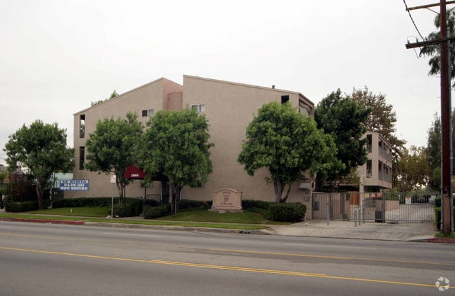


Property Detail
14060 Van Nuys Blvd
2645-014-047
*TR=THE MACLAY RANCHO*SW 100 FT OF NE 315 FT OF NW 320.5 FT OF LOT 330
Multifamilydwelling
Los Angeles
LAR3
California
B and X Area of moderate flood hazard, usually the area between the limits of the 100-year and 500-year floods.
330
2024
0.74 AC
2025
Arleta
119003
Los Angeles
22,810 SF
Los Angeles-Long Beach-Glendale, CA
NEARBY LISTINGS FOR SALE OR LEASE
DEMOGRAPHICS near 14060 Van Nuys Blvd
1 mile
3 mile
5 mile
2025 Total Population
32,794
289,547
640,836
2030 Population
31,989
286,675
636,259
Pop Growth 2025-2030
(2.45%)
(0.99%)
(0.71%)
Average Age
39
38
39
2025 Total Households
7,683
75,314
183,688
HH Growth 2025-2030
(2.68%)
(1.14%)
(0.86%)
Median Household Inc
$89,391
$73,594
$74,686
Avg Household Size
4.00
3.60
3.30
2025 Avg HH Vehicles
3.00
2.00
2.00
Median Home Value
$695,524
$706,375
$741,011
Median Year Built
1957
1965
1967
Nearby Places
Map Layers
Map Styles
 Street
 Aerial
Layers
 Traffic
 Biking
Places
Listings with unknown addresses are not visible on the map
- Restaurants
- Banks
- Shops
- Fitness
- Groceries
PUBLIC TRANSPORTATION
COMMUTER RAIL
Van Nuys (Ventura County Line - Southern California Regional Rail Authority (Metrolink))
Drive
Walk
Distance
Van Nuys (Ventura County Line - Southern California Regional Rail Authority (Metrolink))
7 min
3.2 mi
Sylmar/San Fernando (Antelope Valley Line - Southern California Regional Rail Authority (Metrolink))
Drive
Walk
Distance
Sylmar/San Fernando (Antelope Valley Line - Southern California Regional Rail Authority (Metrolink))
8 min
3.9 mi
AIRPORT
Bob Hope
Drive
Walk
Distance
Bob Hope
12 min
6.9 mi
Los Angeles International
Drive
Walk
Distance
Los Angeles International
37 min
25.8 mi
Long Beach (Daugherty Field)
Drive
Walk
Distance
Long Beach (Daugherty Field)
55 min
42.2 mi
Freight Ports
Port of Long Beach
Drive
Walk
Distance
Port of Long Beach
57 min
44.1 mi
Nearby Properties
Address
Land Use
TOTAL SIZE
Lot Size
Zoning
Address
Land Use
TOTAL SIZE
Lot Size
Zoning
838,226 SF
11.23 AC
LARA
Address
Land Use
TOTAL SIZE
Lot Size
Zoning
237,451 SF
13.93 AC
LAA2
Address
Land Use
TOTAL SIZE
Lot Size
Zoning
72,420 SF
17.08 AC
LAP
Address
Land Use
TOTAL SIZE
Lot Size
Zoning
204,387 SF
8.46 AC
LAM2
Address
Land Use
TOTAL SIZE
Lot Size
Zoning
124,418 SF
6.80 AC
LAC1
Address
Land Use
TOTAL SIZE
Lot Size
Zoning
154,631 SF
11.62 AC
LAC2
Address
Land Use
TOTAL SIZE
Lot Size
Zoning
768,483 SF
6.87 AC
LAC1
Address
Land Use
TOTAL SIZE
Lot Size
Zoning
281,288 SF
34.03 AC
LAM2
Address
Land Use
TOTAL SIZE
Lot Size
Zoning
196,404 SF
10.06 AC
LARD1.5
Address
Land Use
TOTAL SIZE
Lot Size
Zoning
185,568 SF
9.06 AC
LARD1.5
Address
Land Use
TOTAL SIZE
Lot Size
Zoning
370,138 SF
9.84 AC
LAM2
Address
Land Use
TOTAL SIZE
Lot Size
Zoning
408,735 SF
LAC2
Address
Land Use
TOTAL SIZE
Lot Size
Zoning
160,858 SF
2.40 AC
LAR3
Address
Land Use
TOTAL SIZE
Lot Size
Zoning
169,259 SF
2.56 AC
LAC1
Address
Land Use
TOTAL SIZE
Lot Size
Zoning
61,315 SF
0.84 AC
LARAS4
Address
Land Use
TOTAL SIZE
Lot Size
Zoning
257,802 SF
4.52 AC
LARA
Address
Land Use
TOTAL SIZE
Lot Size
Zoning
180,277 SF
4.13 AC
LAM1, LAC2
Address
Land Use
TOTAL SIZE
Lot Size
Zoning
776,594 SF
16.18 AC
LAC2
Address
Land Use
TOTAL SIZE
Lot Size
Zoning
150,041 SF
10.46 AC
LAA2
Address
Land Use
TOTAL SIZE
Lot Size
Zoning
143,203 SF
1.52 AC
LAR4
Address
Land Use
TOTAL SIZE
Lot Size
Zoning
155,788 SF
4.58 AC
LAR1
Address
Land Use
TOTAL SIZE
Lot Size
Zoning
56,396 SF
0.74 AC
LARAS4
Address
Land Use
TOTAL SIZE
Lot Size
Zoning
75,050 SF
2.09 AC
LAC2
Address
Land Use
TOTAL SIZE
Lot Size
Zoning
146,718 SF
7.36 AC
Address
Land Use
TOTAL SIZE
Lot Size
Zoning
146,718 SF
7.11 AC
SFM
Address
Land Use
TOTAL SIZE
Lot Size
Zoning
74,764 SF
2.81 AC
LAR3
Address
Land Use
TOTAL SIZE
Lot Size
Zoning
11,067 SF
3.21 AC
LAM2
Address
Land Use
TOTAL SIZE
Lot Size
Zoning
154,575 SF
12.20 AC
LAM3
Address
Land Use
TOTAL SIZE
Lot Size
Zoning
179,394 SF
6.44 AC
LAC1
The World's #1 Commercial Real Estate Marketplace
Connect with us
© 2026 CoStar Group
The information above has been obtained from sources believed reliable. While we do not doubt its accuracy we have not verified it and make no guarantee, warranty or representation about it. It is your responsibility to independently confirm its accuracy and completeness. Any projections, opinions, assumptions, or estimates used are for example only and do not represent the current or future performance of the property. The value of this transaction to you depends on tax and other factors which should be evaluated by your tax, financial, and legal advisors. You and your advisors should conduct a careful, independent investigation of the property to determine to your satisfaction the suitability of the property for your needs.