Property Record
14065 Se 48Th Ave, Starke, FL 32091
NEARBY LISTINGS FOR SALE OR LEASE
Property Detail
14065 Se 48Th Ave
04703-B-01800
Deerwood S/D
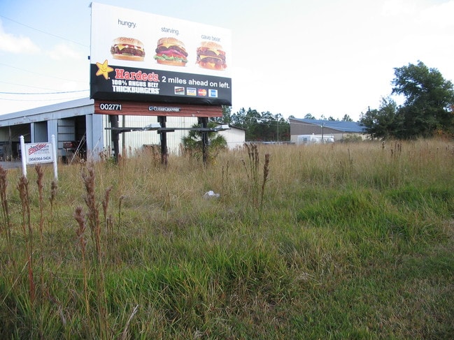
Restaurantdrivein
5 7S 22 LOT 17 & 18 OF DEERWOOD S/D DESC AS:COM AT ELY R/W US 301 & NLY R/W SE 48TH AVE FOR POB. N33*4325E 230.05, S57*2214E 200.04, S33*4252W 234.04, N56*1340W 200.04 TO POB. BEING 1.07 AC COMBINE PER OWNER
X
Bradford
12007C0192F
Florida
2025
17&18
2025
0.57 AC
000100
Florida Central North Area
1,539 SF
Other Market Areas
DEMOGRAPHICS near 14065 Se 48Th Ave
1 Mile
3 Mile
5 Mile
2024 Total Population
427
7,822
13,373
2029 Population
441
8,163
13,955
Pop Growth 2024-2029
+ 3.28%
+ 4.36%
+ 4.35%
Average Age
41
41
41
2024 Total Households
161
2,992
5,094
HH Growth 2024-2029
+ 3.11%
+ 3.58%
+ 3.55%
Median Household Inc
$42,291
$44,537
$45,021
Avg Household Size
2.50
2.50
2.50
2024 Avg HH Vehicles
1.00
2.00
2.00
Median Home Value
$101,724
$121,981
$125,814
Median Year Built
1982
1981
1983
Nearby Places
Map Layers
Map Styles
 Street
 Aerial
- Restaurants
- Banks
- Shops
- Fitness
- Groceries
PUBLIC TRANSPORTATION
AIRPORT
Gainesville Regional
DRIVE
WALK
Distance
Gainesville Regional
32 min
21.7 mi
Freight Ports
Jacksonville Port
DRIVE
WALK
Distance
Jacksonville Port
67 min
52.3 mi
SALE & LEASE HISTORY
LISTING DATE
SALE/LEASE

Sep 24, 2016
For Sale
Aug 23, 2017
For Sale
Nearby Properties
Address
Land Use
TOTAL SIZE
Lot Size
Zoning
Address
Land Use
TOTAL SIZE
Lot Size
Zoning
168,336 SF
23.97 AC
Address
Land Use
TOTAL SIZE
Lot Size
Zoning
96,617 SF
11 AC
Address
Land Use
TOTAL SIZE
Lot Size
Zoning
63,568 SF
8.54 AC
Address
Land Use
TOTAL SIZE
Lot Size
Zoning
117,119 SF
30.15 AC
Address
Land Use
TOTAL SIZE
Lot Size
Zoning
24,370 SF
1.27 AC
Address
Land Use
TOTAL SIZE
Lot Size
Zoning
64,054 SF
4.07 AC
Address
Land Use
TOTAL SIZE
Lot Size
Zoning
74,461 SF
7.92 AC
Address
Land Use
TOTAL SIZE
Lot Size
Zoning
119,949 SF
5.50 AC
Address
Land Use
TOTAL SIZE
Lot Size
Zoning
51,918 SF
7.97 AC
Address
Land Use
TOTAL SIZE
Lot Size
Zoning
69,258 SF
10 AC
Address
Land Use
TOTAL SIZE
Lot Size
Zoning
14,776 SF
73.70 AC
Address
Land Use
TOTAL SIZE
Lot Size
Zoning
35,032 SF
8.75 AC
Address
Land Use
TOTAL SIZE
Lot Size
Zoning
30,963 SF
7.47 AC
Address
Land Use
TOTAL SIZE
Lot Size
Zoning
111,635 SF
44.63 AC
Address
Land Use
TOTAL SIZE
Lot Size
Zoning
84,782 SF
5.89 AC
Address
Land Use
TOTAL SIZE
Lot Size
Zoning
42,534 SF
1.86 AC
Address
Land Use
TOTAL SIZE
Lot Size
Zoning
47,283 SF
5.70 AC
Address
Land Use
TOTAL SIZE
Lot Size
Zoning
38,431 SF
13.76 AC
Address
Land Use
TOTAL SIZE
Lot Size
Zoning
104,030 SF
24.65 AC
Address
Land Use
TOTAL SIZE
Lot Size
Zoning
65,461 SF
8 AC
Address
Land Use
TOTAL SIZE
Lot Size
Zoning
23,225 SF
4.81 AC
Address
Land Use
TOTAL SIZE
Lot Size
Zoning
7,572 SF
1.32 AC
Address
Land Use
TOTAL SIZE
Lot Size
Zoning
29,120 SF
3.26 AC
Address
Land Use
TOTAL SIZE
Lot Size
Zoning
56,944 SF
6.55 AC
Address
Land Use
TOTAL SIZE
Lot Size
Zoning
15,287 SF
1.54 AC
Address
Land Use
TOTAL SIZE
Lot Size
Zoning
63.28 AC
Address
Land Use
TOTAL SIZE
Lot Size
Zoning
16,274 SF
1.51 AC
Address
Land Use
TOTAL SIZE
Lot Size
Zoning
35,950 SF
2.76 AC
Address
Land Use
TOTAL SIZE
Lot Size
Zoning
22,052 SF
2.67 AC
Address
Land Use
TOTAL SIZE
Lot Size
Zoning
7,490 SF
18.84 AC
The World's #1 Commercial Real Estate Marketplace
Connect with us
© 2026 CoStar Group
The information above has been obtained from sources believed reliable. While we do not doubt its accuracy we have not verified it and make no guarantee, warranty or representation about it. It is your responsibility to independently confirm its accuracy and completeness. Any projections, opinions, assumptions, or estimates used are for example only and do not represent the current or future performance of the property. The value of this transaction to you depends on tax and other factors which should be evaluated by your tax, financial, and legal advisors. You and your advisors should conduct a careful, independent investigation of the property to determine to your satisfaction the suitability of the property for your needs.