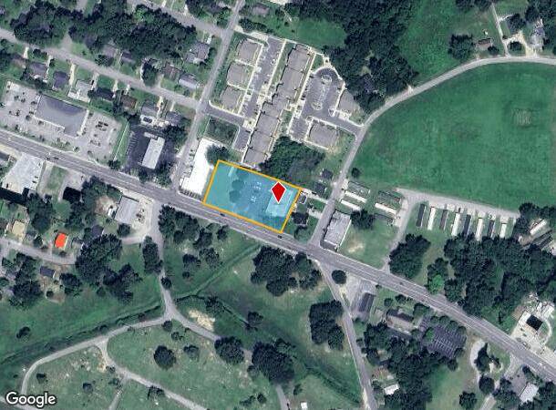
Property Record
1407 E 5Th St, Lumberton, NC 28358
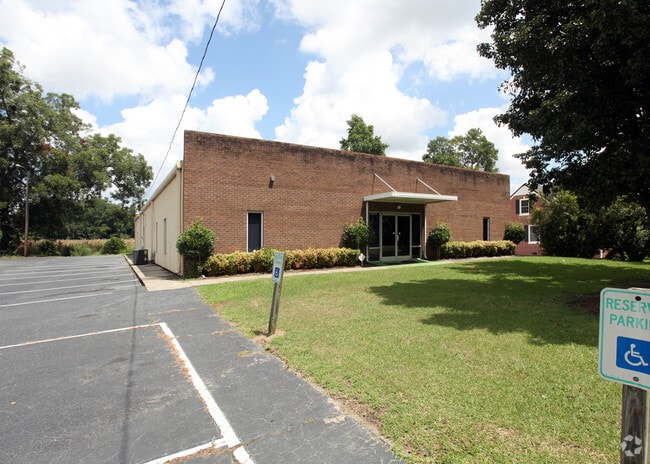
This Property Is For Sale
NEARBY LISTINGS FOR SALE OR LEASE
Property Detail
1407 E 5Th St
3240-01-017
Part Of R E Thompson Est
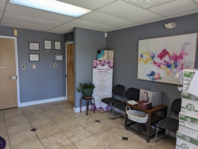
Officebuilding
NORTH SIDE HWY 74 PART OF R E THOMPSON EST
X
Robeson
3720030100K
North Carolina
2025
1.04 AC
2025
North Carolina Southeast Area
961200
Other Market Areas
6,000 SF
Lumberton, NC
DEMOGRAPHICS near 1407 E 5Th St
1 Mile
3 Mile
5 Mile
2024 Total Population
6,161
22,325
33,612
2029 Population
6,289
22,745
34,170
Pop Growth 2024-2029
+ 2.08%
+ 1.88%
+ 1.66%
Average Age
38
38
39
2024 Total Households
2,418
8,606
12,840
HH Growth 2024-2029
+ 1.94%
+ 1.89%
+ 1.67%
Median Household Inc
$33,197
$36,124
$40,917
Avg Household Size
2.40
2.40
2.40
2024 Avg HH Vehicles
1.00
2.00
2.00
Median Home Value
$78,711
$104,981
$109,353
Median Year Built
1970
1976
1981
Nearby Places
Map Layers
Map Styles
 Street
 Aerial
- Restaurants
- Banks
- Shops
- Fitness
- Groceries
PUBLIC TRANSPORTATION
AIRPORT
Fayetteville Regional/Grannis Field
DRIVE
WALK
Distance
Fayetteville Regional/Grannis Field
39 min
30.1 mi
Nearby Properties
Address
Land Use
TOTAL SIZE
Lot Size
Zoning
Address
Land Use
TOTAL SIZE
Lot Size
Zoning
59,810 SF
7.69 AC
R7
Address
Land Use
TOTAL SIZE
Lot Size
Zoning
116,616 SF
10.18 AC
B6
Address
Land Use
TOTAL SIZE
Lot Size
Zoning
82,115 SF
39.22 AC
R15
Address
Land Use
TOTAL SIZE
Lot Size
Zoning
24,173 SF
44.32 AC
B3
Address
Land Use
TOTAL SIZE
Lot Size
Zoning
134,160 SF
0.26 AC
B6
Address
Land Use
TOTAL SIZE
Lot Size
Zoning
128,531 SF
22.20 AC
B4
Address
Land Use
TOTAL SIZE
Lot Size
Zoning
120,000 SF
17.10 AC
M2
Address
Land Use
TOTAL SIZE
Lot Size
Zoning
36,329 SF
16.87 AC
R6
Address
Land Use
TOTAL SIZE
Lot Size
Zoning
24,984 SF
41.13 AC
R11
Address
Land Use
TOTAL SIZE
Lot Size
Zoning
90,800 SF
36.65 AC
R20
Address
Land Use
TOTAL SIZE
Lot Size
Zoning
67,728 SF
1.50 AC
B1
Address
Land Use
TOTAL SIZE
Lot Size
Zoning
69,765 SF
9.51 AC
B4
Address
Land Use
TOTAL SIZE
Lot Size
Zoning
2,187 SF
18.75 AC
R3
Address
Land Use
TOTAL SIZE
Lot Size
Zoning
23,442 SF
7.22 AC
R6
Address
Land Use
TOTAL SIZE
Lot Size
Zoning
4,048 SF
12.73 AC
R3
Address
Land Use
TOTAL SIZE
Lot Size
Zoning
88,710 SF
1.11 AC
B1
Address
Land Use
TOTAL SIZE
Lot Size
Zoning
95,143 SF
7.55 AC
B4
Address
Land Use
TOTAL SIZE
Lot Size
Zoning
51,003 SF
8.49 AC
B3
Address
Land Use
TOTAL SIZE
Lot Size
Zoning
62,404 SF
12.88 AC
Address
Land Use
TOTAL SIZE
Lot Size
Zoning
59,635 SF
10.24 AC
R11
Address
Land Use
TOTAL SIZE
Lot Size
Zoning
75,704 SF
7.60 AC
R3
Address
Land Use
TOTAL SIZE
Lot Size
Zoning
5,784 SF
903.32 AC
RA
Address
Land Use
TOTAL SIZE
Lot Size
Zoning
24,880 SF
19.30 AC
R20
Address
Land Use
TOTAL SIZE
Lot Size
Zoning
149,800 SF
66.53 AC
M2
Address
Land Use
TOTAL SIZE
Lot Size
Zoning
1,232 SF
10.68 AC
R7
Address
Land Use
TOTAL SIZE
Lot Size
Zoning
7,700 SF
10.66 AC
M1
Address
Land Use
TOTAL SIZE
Lot Size
Zoning
39,439 SF
1.10 AC
B5
Address
Land Use
TOTAL SIZE
Lot Size
Zoning
35,650 SF
9.25 AC
Address
Land Use
TOTAL SIZE
Lot Size
Zoning
13,367 SF
6.09 AC
R7
Address
Land Use
TOTAL SIZE
Lot Size
Zoning
373,485 SF
102.67 AC
RA
The World's #1 Commercial Real Estate Marketplace
Connect with us
© 2026 CoStar Group
The information above has been obtained from sources believed reliable. While we do not doubt its accuracy we have not verified it and make no guarantee, warranty or representation about it. It is your responsibility to independently confirm its accuracy and completeness. Any projections, opinions, assumptions, or estimates used are for example only and do not represent the current or future performance of the property. The value of this transaction to you depends on tax and other factors which should be evaluated by your tax, financial, and legal advisors. You and your advisors should conduct a careful, independent investigation of the property to determine to your satisfaction the suitability of the property for your needs.