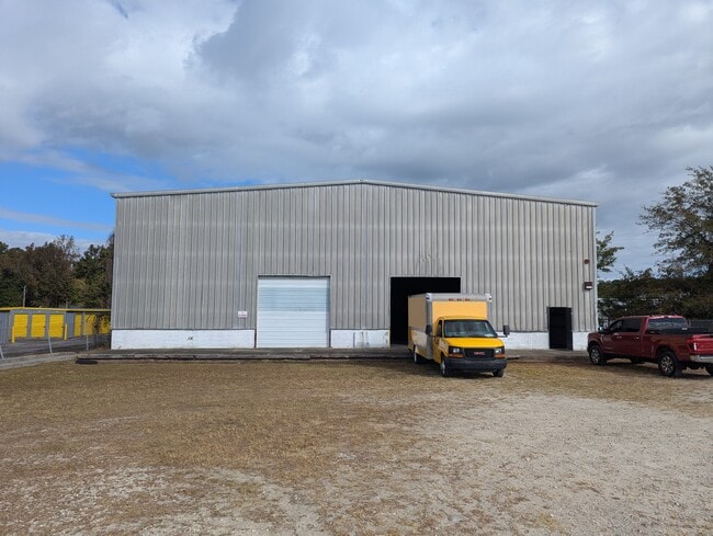
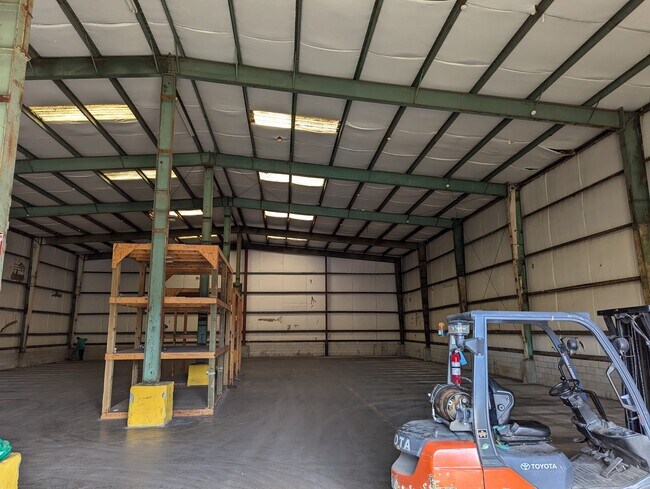
Property Record
1405 Lejeune Blvd, Jacksonville, NC 28540

NEARBY LISTINGS FOR SALE OR LEASE
Property Detail
1405 Lejeune Blvd
009913
Jeffrey Melendy + Angela Damiano
Officebuilding
NC 24
X
Onslow
3720438600J
North Carolina
2025
1.42 AC
2025
North Carolina Southeast Area
002600
Other Market Areas
872 SF
Jacksonville, NC
DEMOGRAPHICS near 1405 Lejeune Blvd
1 Mile
3 Mile
5 Mile
2024 Total Population
2,966
36,076
78,705
2029 Population
3,139
37,739
82,317
Pop Growth 2024-2029
+ 5.83%
+ 4.61%
+ 4.59%
Average Age
29
32
31
2024 Total Households
835
13,750
27,821
HH Growth 2024-2029
+ 7.31%
+ 4.96%
+ 4.90%
Median Household Inc
$40,808
$44,966
$50,252
Avg Household Size
2.60
2.40
2.50
2024 Avg HH Vehicles
2.00
2.00
2.00
Median Home Value
$120,270
$151,007
$163,210
Median Year Built
1977
1983
1991
Nearby Places
Map Layers
Map Styles
 Street
 Aerial
- Restaurants
- Banks
- Shops
- Fitness
- Groceries
PUBLIC TRANSPORTATION
AIRPORT
Albert J Ellis
DRIVE
WALK
Distance
Albert J Ellis
32 min
16.2 mi
Coastal Carolina Regional
DRIVE
WALK
Distance
Coastal Carolina Regional
61 min
43.5 mi
SALE & LEASE HISTORY
LISTING DATE
SALE/LEASE

Oct 30, 2024
For Lease
Nearby Properties
Address
Land Use
TOTAL SIZE
Lot Size
Zoning
Address
Land Use
TOTAL SIZE
Lot Size
Zoning
244,010 SF
52.70 AC
CC
Address
Land Use
TOTAL SIZE
Lot Size
Zoning
11,192 SF
64.76 AC
OI
Address
Land Use
TOTAL SIZE
Lot Size
Zoning
164,207 SF
43.55 AC
OI
Address
Land Use
TOTAL SIZE
Lot Size
Zoning
189,717 SF
1.93 AC
DTB
Address
Land Use
TOTAL SIZE
Lot Size
Zoning
25,860 SF
13.10 AC
RMF-HD
Address
Land Use
TOTAL SIZE
Lot Size
Zoning
50,600 SF
17 AC
CC
Address
Land Use
TOTAL SIZE
Lot Size
Zoning
38,147 SF
3.14 AC
DTB
Address
Land Use
TOTAL SIZE
Lot Size
Zoning
94,547 SF
6.37 AC
DTB
Address
Land Use
TOTAL SIZE
Lot Size
Zoning
2,951 SF
16.39 AC
RMF-HD
Address
Land Use
TOTAL SIZE
Lot Size
Zoning
24,882 SF
7.30 AC
RMF-HD
Address
Land Use
TOTAL SIZE
Lot Size
Zoning
204,711 SF
9.70 AC
CC
Address
Land Use
TOTAL SIZE
Lot Size
Zoning
16,248 SF
21.09 AC
RMF-HD
Address
Land Use
TOTAL SIZE
Lot Size
Zoning
94,263 SF
5.88 AC
DTB
Address
Land Use
TOTAL SIZE
Lot Size
Zoning
124,749 SF
16.31 AC
CC
Address
Land Use
TOTAL SIZE
Lot Size
Zoning
2,289 SF
7.22 AC
RMF-HD
Address
Land Use
TOTAL SIZE
Lot Size
Zoning
139,938 SF
13.87 AC
CC
Address
Land Use
TOTAL SIZE
Lot Size
Zoning
3,369 SF
79.40 AC
RMF-LD
Address
Land Use
TOTAL SIZE
Lot Size
Zoning
7,740 SF
16.50 AC
RMF-LD
Address
Land Use
TOTAL SIZE
Lot Size
Zoning
10,368 SF
23.17 AC
CC
Address
Land Use
TOTAL SIZE
Lot Size
Zoning
828 SF
8.56 AC
RMF-HD
Address
Land Use
TOTAL SIZE
Lot Size
Zoning
130,374 SF
15.72 AC
CC
Address
Land Use
TOTAL SIZE
Lot Size
Zoning
7,008 SF
9.72 AC
RMF-HD
Address
Land Use
TOTAL SIZE
Lot Size
Zoning
18,312 SF
16.25 AC
IND
Address
Land Use
TOTAL SIZE
Lot Size
Zoning
1,584 SF
61.32 AC
PDR
Address
Land Use
TOTAL SIZE
Lot Size
Zoning
103,789 SF
9.31 AC
CC
Address
Land Use
TOTAL SIZE
Lot Size
Zoning
102,423 SF
10.04 AC
CC
Address
Land Use
TOTAL SIZE
Lot Size
Zoning
58,570 SF
8.95 AC
DTB
Address
Land Use
TOTAL SIZE
Lot Size
Zoning
25,625 SF
10.46 AC
CC
Address
Land Use
TOTAL SIZE
Lot Size
Zoning
46,502 SF
11.03 AC
CC
Address
Land Use
TOTAL SIZE
Lot Size
Zoning
26,040 SF
2.20 AC
CC
The World's #1 Commercial Real Estate Marketplace
Connect with us
© 2025 CoStar Group
The information above has been obtained from sources believed reliable. While we do not doubt its accuracy we have not verified it and make no guarantee, warranty or representation about it. It is your responsibility to independently confirm its accuracy and completeness. Any projections, opinions, assumptions, or estimates used are for example only and do not represent the current or future performance of the property. The value of this transaction to you depends on tax and other factors which should be evaluated by your tax, financial, and legal advisors. You and your advisors should conduct a careful, independent investigation of the property to determine to your satisfaction the suitability of the property for your needs.