Property Record
2047 N Highway 183, Lampasas, TX 76550

NEARBY LISTINGS FOR SALE OR LEASE
-
-
View all Lampasas listings for sale on LoopNet.com
Property Detail
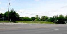
2047 N Highway 183
Killeen-Temple, TX
ACR: 4 ABST: 0684 SURV: THOMAS TOBY LOCCD:108
13357
Lampasas
Farms
Texas
2024
4 AC
2025
Lampasas County
950302
Killeen/Temple/Fort Hood
DEMOGRAPHICS near 2047 N Highway 183
1 Mile
3 Mile
5 Mile
2024 Total Population
46
5,209
9,956
2029 Population
51
5,919
11,299
Pop Growth 2024-2029
+ 10.87%
+ 13.63%
+ 13.49%
Average Age
45
42
42
2024 Total Households
18
2,078
4,030
HH Growth 2024-2029
+ 11.11%
+ 13.23%
+ 13.10%
Median Household Inc
$87,500
$60,250
$60,450
Avg Household Size
2.60
2.40
2.40
2024 Avg HH Vehicles
3.00
2.00
2.00
Median Home Value
$299,999
$175,768
$164,628
Median Year Built
1995
1976
1976
Nearby Places
Map Layers
Map Styles
 Street
 Aerial
- Restaurants
- Banks
- Shops
- Fitness
- Groceries
PUBLIC TRANSPORTATION
AIRPORT
Robert Gray AAF
DRIVE
WALK
Distance
Robert Gray AAF
41 min
28.4 mi
Freight Ports
Calhoun Port
DRIVE
WALK
Distance
Calhoun Port
265 min
225.5 mi
SALE & LEASE HISTORY
LISTING DATE
SALE/LEASE

Jun 01, 2020
For Sale
Nearby Properties
Address
Land Use
TOTAL SIZE
Lot Size
Zoning
Address
Land Use
TOTAL SIZE
Lot Size
Zoning
361,650 SF
182.01 AC
Address
Land Use
TOTAL SIZE
Lot Size
Zoning
9,585 SF
334.77 AC
Address
Land Use
TOTAL SIZE
Lot Size
Zoning
23,135 SF
1.72 AC
Address
Land Use
TOTAL SIZE
Lot Size
Zoning
34,264 SF
2 AC
Address
Land Use
TOTAL SIZE
Lot Size
Zoning
19,244 SF
1.01 AC
Address
Land Use
TOTAL SIZE
Lot Size
Zoning
86,584 SF
15.07 AC
Address
Land Use
TOTAL SIZE
Lot Size
Zoning
3,190 SF
283.17 AC
Address
Land Use
TOTAL SIZE
Lot Size
Zoning
150,207 SF
6.97 AC
Address
Land Use
TOTAL SIZE
Lot Size
Zoning
32,049 SF
2.13 AC
Address
Land Use
TOTAL SIZE
Lot Size
Zoning
268 AC
Address
Land Use
TOTAL SIZE
Lot Size
Zoning
47,882 SF
4.50 AC
Address
Land Use
TOTAL SIZE
Lot Size
Zoning
250.11 AC
Address
Land Use
TOTAL SIZE
Lot Size
Zoning
4,057 SF
247.14 AC
Address
Land Use
TOTAL SIZE
Lot Size
Zoning
233.48 AC
Address
Land Use
TOTAL SIZE
Lot Size
Zoning
214.75 AC
Address
Land Use
TOTAL SIZE
Lot Size
Zoning
13,392 SF
0.41 AC
Address
Land Use
TOTAL SIZE
Lot Size
Zoning
200.47 AC
Address
Land Use
TOTAL SIZE
Lot Size
Zoning
193.57 AC
Address
Land Use
TOTAL SIZE
Lot Size
Zoning
185.97 AC
Address
Land Use
TOTAL SIZE
Lot Size
Zoning
15,937 SF
21.41 AC
Address
Land Use
TOTAL SIZE
Lot Size
Zoning
240 SF
201.40 AC
Address
Land Use
TOTAL SIZE
Lot Size
Zoning
31,780 SF
1.52 AC
Address
Land Use
TOTAL SIZE
Lot Size
Zoning
17,995 SF
3.46 AC
Address
Land Use
TOTAL SIZE
Lot Size
Zoning
3,760 SF
148.13 AC
Address
Land Use
TOTAL SIZE
Lot Size
Zoning
25,910 SF
0.82 AC
Address
Land Use
TOTAL SIZE
Lot Size
Zoning
12,416 SF
1.70 AC
Address
Land Use
TOTAL SIZE
Lot Size
Zoning
7,656 SF
0.41 AC
Address
Land Use
TOTAL SIZE
Lot Size
Zoning
10,080 SF
0.40 AC
Address
Land Use
TOTAL SIZE
Lot Size
Zoning
5,338 SF
44.83 AC
The World's #1 Commercial Real Estate Marketplace
Connect with us
© 2025 CoStar Group
The information above has been obtained from sources believed reliable. While we do not doubt its accuracy we have not verified it and make no guarantee, warranty or representation about it. It is your responsibility to independently confirm its accuracy and completeness. Any projections, opinions, assumptions, or estimates used are for example only and do not represent the current or future performance of the property. The value of this transaction to you depends on tax and other factors which should be evaluated by your tax, financial, and legal advisors. You and your advisors should conduct a careful, independent investigation of the property to determine to your satisfaction the suitability of the property for your needs.