Property Record
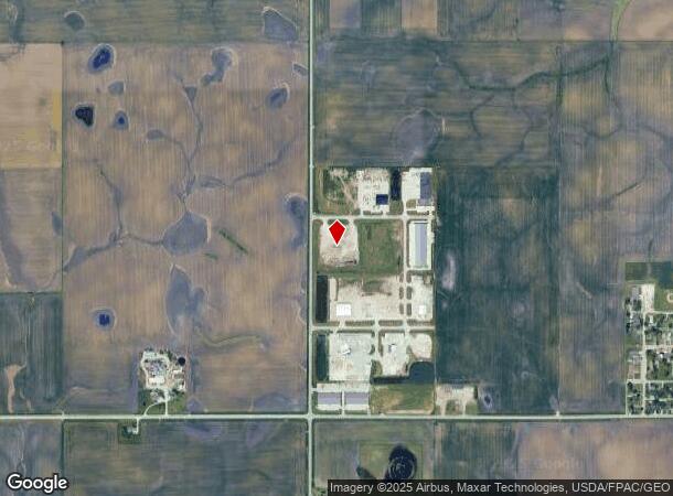
1409 Nw Laurel St, Elkhart, IA 50073


NEARBY LISTINGS FOR SALE OR LEASE
Property Detail
1409 Nw Laurel St
Des Moines-West Des Moines, IA
Elkhart Industrial Park Plat 3
211/00175-200-006
PARCEL 2024-119 BK 19896 PG 486 LOT 6 ELKHART INDUSTRIAL PARK PLAT 3
Warehouse
Polk
X
Iowa
19169C0425F
6
2024
3.31 AC
2025
Outlying Polk County
010101
Des Moines
23,400 SF
DEMOGRAPHICS near 1409 Nw Laurel St
1 Mile
3 Mile
5 Mile
2024 Total Population
297
5,162
26,516
2029 Population
329
5,677
28,903
Pop Growth 2024-2029
+ 10.77%
+ 9.98%
+ 9.00%
Average Age
39
38
37
2024 Total Households
113
1,921
10,395
HH Growth 2024-2029
+ 10.62%
+ 10.26%
+ 9.24%
Median Household Inc
$101,923
$115,949
$112,089
Avg Household Size
2.60
2.70
2.50
2024 Avg HH Vehicles
2.00
2.00
2.00
Median Home Value
$410,000
$421,894
$383,483
Median Year Built
2000
2009
2007
Nearby Places
Map Layers
Map Styles
 Street
 Aerial
- Restaurants
- Banks
- Shops
- Fitness
- Groceries
PUBLIC TRANSPORTATION
AIRPORT
Des Moines International
DRIVE
WALK
Distance
Des Moines International
36 min
23.1 mi
Freight Ports
Port Milwaukee
DRIVE
WALK
Distance
Port Milwaukee
422 min
375.5 mi
Nearby Properties
Address
Land Use
TOTAL SIZE
Lot Size
Zoning
Address
Land Use
TOTAL SIZE
Lot Size
Zoning
210,696 SF
6.57 AC
Address
Land Use
TOTAL SIZE
Lot Size
Zoning
192,668 SF
20.73 AC
Address
Land Use
TOTAL SIZE
Lot Size
Zoning
48,839 SF
16.05 AC
Address
Land Use
TOTAL SIZE
Lot Size
Zoning
63,448 SF
3.39 AC
Address
Land Use
TOTAL SIZE
Lot Size
Zoning
36,178 SF
4.98 AC
Address
Land Use
TOTAL SIZE
Lot Size
Zoning
9,180 SF
8.02 AC
Address
Land Use
TOTAL SIZE
Lot Size
Zoning
19,396 SF
7.67 AC
Address
Land Use
TOTAL SIZE
Lot Size
Zoning
9,070 SF
1.29 AC
Address
Land Use
TOTAL SIZE
Lot Size
Zoning
12,649 SF
1.79 AC
Address
Land Use
TOTAL SIZE
Lot Size
Zoning
5,060 SF
1.77 AC
C-2
Address
Land Use
TOTAL SIZE
Lot Size
Zoning
9,020 SF
0.97 AC
Address
Land Use
TOTAL SIZE
Lot Size
Zoning
12,500 SF
5 AC
Address
Land Use
TOTAL SIZE
Lot Size
Zoning
11,040 SF
2.37 AC
Address
Land Use
TOTAL SIZE
Lot Size
Zoning
5,390 SF
7.97 AC
Address
Land Use
TOTAL SIZE
Lot Size
Zoning
1.76 AC
Address
Land Use
TOTAL SIZE
Lot Size
Zoning
5,744 SF
1.03 AC
C-2
Address
Land Use
TOTAL SIZE
Lot Size
Zoning
14,260 SF
1.79 AC
R-3
Address
Land Use
TOTAL SIZE
Lot Size
Zoning
18,496 SF
1.38 AC
I-1
Address
Land Use
TOTAL SIZE
Lot Size
Zoning
26,496 SF
3.24 AC
I-1
Address
Land Use
TOTAL SIZE
Lot Size
Zoning
36 SF
10 AC
R-4
Address
Land Use
TOTAL SIZE
Lot Size
Zoning
1,960 SF
4.31 AC
Address
Land Use
TOTAL SIZE
Lot Size
Zoning
Address
Land Use
TOTAL SIZE
Lot Size
Zoning
8,670 SF
0.48 AC
C-1
Address
Land Use
TOTAL SIZE
Lot Size
Zoning
3,852 SF
38.96 AC
Address
Land Use
TOTAL SIZE
Lot Size
Zoning
8,200 SF
4.78 AC
AG
Address
Land Use
TOTAL SIZE
Lot Size
Zoning
Address
Land Use
TOTAL SIZE
Lot Size
Zoning
3.56 AC
Address
Land Use
TOTAL SIZE
Lot Size
Zoning
4,480 SF
0.17 AC
Address
Land Use
TOTAL SIZE
Lot Size
Zoning
4,200 SF
0.17 AC
I1
The World's #1 Commercial Real Estate Marketplace
Connect with us
© 2026 CoStar Group
The information above has been obtained from sources believed reliable. While we do not doubt its accuracy we have not verified it and make no guarantee, warranty or representation about it. It is your responsibility to independently confirm its accuracy and completeness. Any projections, opinions, assumptions, or estimates used are for example only and do not represent the current or future performance of the property. The value of this transaction to you depends on tax and other factors which should be evaluated by your tax, financial, and legal advisors. You and your advisors should conduct a careful, independent investigation of the property to determine to your satisfaction the suitability of the property for your needs.