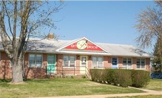
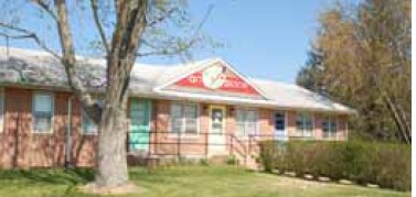
Property Record
141 Dump Rd, Clayton, DE 19938

Property Detail
141 Dump Rd
1-04-00900-01-0400-000
82 CATTLE DRIVE
Vacantlandexempt
KENT
OS
Delaware
AE The base floodplain where base flood elevations are provided. AE Zones are now used on new format FIRMs instead of A1-A30 Zones.
15.40 AC
0
Kent County
2025
Philadelphia
040100
Dover, DE
NEARBY LISTINGS FOR SALE OR LEASE
DEMOGRAPHICS near 141 Dump Rd
1 mile
3 mile
5 mile
2025 Total Population
2,624
27,330
39,773
2030 Population
2,764
28,653
41,734
Pop Growth 2025-2030
+ 5.34%
+ 4.84%
+ 4.93%
Average Age
39
40
41
2025 Total Households
930
9,733
13,965
HH Growth 2025-2030
+ 5.38%
+ 4.92%
+ 5.03%
Median Household Inc
$103,559
$87,565
$90,637
Avg Household Size
2.80
2.70
2.70
2025 Avg HH Vehicles
2.00
2.00
2.00
Median Home Value
$350,158
$347,848
$358,844
Median Year Built
2000
2002
2002
Nearby Places
Map Layers
Map Styles
 Street
 Aerial
Layers
 Traffic
 Biking
Places
Listings with unknown addresses are not visible on the map
- Restaurants
- Banks
- Shops
- Fitness
- Groceries
Nearby Properties
Address
Land Use
TOTAL SIZE
Lot Size
Zoning
Address
Land Use
TOTAL SIZE
Lot Size
Zoning
388,647 SF
119.70 AC
I&R
Address
Land Use
TOTAL SIZE
Lot Size
Zoning
189 AC
IORP
Address
Land Use
TOTAL SIZE
Lot Size
Zoning
1,590 SF
188.40 AC
A
Address
Land Use
TOTAL SIZE
Lot Size
Zoning
Address
Land Use
TOTAL SIZE
Lot Size
Zoning
6,760 SF
80.30 AC
MHP
Address
Land Use
TOTAL SIZE
Lot Size
Zoning
13.66 AC
28IORP
Address
Land Use
TOTAL SIZE
Lot Size
Zoning
86,973 SF
24.80 AC
R
Address
Land Use
TOTAL SIZE
Lot Size
Zoning
113,094 SF
3.44 AC
C-C
Address
Land Use
TOTAL SIZE
Lot Size
Zoning
74,160 SF
7.20 AC
R3
Address
Land Use
TOTAL SIZE
Lot Size
Zoning
40,043 SF
43.70 AC
NA
Address
Land Use
TOTAL SIZE
Lot Size
Zoning
378,374 SF
41.02 AC
I
Address
Land Use
TOTAL SIZE
Lot Size
Zoning
12,615 SF
60.63 AC
28I&R
Address
Land Use
TOTAL SIZE
Lot Size
Zoning
30,200 SF
22.42 AC
H-C
Address
Land Use
TOTAL SIZE
Lot Size
Zoning
1,440 SF
51.10 AC
RMH
Address
Land Use
TOTAL SIZE
Lot Size
Zoning
Address
Land Use
TOTAL SIZE
Lot Size
Zoning
Address
Land Use
TOTAL SIZE
Lot Size
Zoning
57,200 SF
7.50 AC
R3
Address
Land Use
TOTAL SIZE
Lot Size
Zoning
113,479 SF
8.20 AC
R1
Address
Land Use
TOTAL SIZE
Lot Size
Zoning
Address
Land Use
TOTAL SIZE
Lot Size
Zoning
30,954 SF
23.93 AC
OR
Address
Land Use
TOTAL SIZE
Lot Size
Zoning
52,000 SF
10 AC
R3
Address
Land Use
TOTAL SIZE
Lot Size
Zoning
55,732 SF
16.30 AC
R-2A
Address
Land Use
TOTAL SIZE
Lot Size
Zoning
80,172 SF
9.50 AC
R3
Address
Land Use
TOTAL SIZE
Lot Size
Zoning
57.10 AC
I&R
Address
Land Use
TOTAL SIZE
Lot Size
Zoning
59,375 SF
13 AC
IORP
Address
Land Use
TOTAL SIZE
Lot Size
Zoning
65,280 SF
11.40 AC
H-C
Address
Land Use
TOTAL SIZE
Lot Size
Zoning
33,561 SF
35.40 AC
RS
Address
Land Use
TOTAL SIZE
Lot Size
Zoning
Address
Land Use
TOTAL SIZE
Lot Size
Zoning
58,179 SF
16 AC
I&R
Address
Land Use
TOTAL SIZE
Lot Size
Zoning
53,376 SF
11.50 AC
R
The World's #1 Commercial Real Estate Marketplace
Connect with us
© 2026 CoStar Group
The information above has been obtained from sources believed reliable. While we do not doubt its accuracy we have not verified it and make no guarantee, warranty or representation about it. It is your responsibility to independently confirm its accuracy and completeness. Any projections, opinions, assumptions, or estimates used are for example only and do not represent the current or future performance of the property. The value of this transaction to you depends on tax and other factors which should be evaluated by your tax, financial, and legal advisors. You and your advisors should conduct a careful, independent investigation of the property to determine to your satisfaction the suitability of the property for your needs.