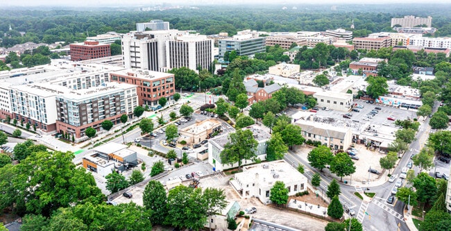
Property Record
141 E Trinity Pl, Decatur, GA 30030


Property Detail
141 E Trinity Pl
15-246-03-029
BEG INTERSECTION SWLY R/W EAST TRINITY PLACE WLY R/W CHURCH ST TO POB
Storebuilding
DeKalb
C1: LOCAL
Georgia
B and X Area of moderate flood hazard, usually the area between the limits of the 100-year and 500-year floods.
6
2025
0.60 AC
2025
Decatur
022601
Atlanta
12,403 SF
Atlanta-Sandy Springs-Roswell, GA
NEARBY LISTINGS FOR SALE OR LEASE
DEMOGRAPHICS near 141 E Trinity Pl
1 mile
3 mile
5 mile
2025 Total Population
19,867
118,986
349,979
2030 Population
20,374
121,971
358,070
Pop Growth 2025-2030
+ 2.55%
+ 2.51%
+ 2.31%
Average Age
40
39
38
2025 Total Households
8,536
51,241
154,824
HH Growth 2025-2030
+ 2.74%
+ 2.52%
+ 2.40%
Median Household Inc
$135,555
$108,778
$97,368
Avg Household Size
2.30
2.20
2.10
2025 Avg HH Vehicles
2.00
2.00
2.00
Median Home Value
$675,570
$536,476
$487,181
Median Year Built
1978
1974
1977
Nearby Places
Map Layers
Map Styles
 Street
 Aerial
Layers
 Traffic
 Biking
Places
Listings with unknown addresses are not visible on the map
- Restaurants
- Banks
- Shops
- Fitness
- Groceries
PUBLIC TRANSPORTATION
TRANSIT/SUBWAY
Decatur (Blue Line - Metropolitan Atlanta Rapid Transit Authority (MARTA))
Drive
Walk
Distance
Decatur (Blue Line - Metropolitan Atlanta Rapid Transit Authority (MARTA))
2 min
4 min
0.2 mi
Avondale (Blue Line - Metropolitan Atlanta Rapid Transit Authority (MARTA))
Drive
Walk
Distance
Avondale (Blue Line - Metropolitan Atlanta Rapid Transit Authority (MARTA))
3 min
18 min
0.9 mi
COMMUTER RAIL
Drive
Walk
Distance
18 min
8.1 mi
AIRPORT
Hartsfield - Jackson Atlanta International
Drive
Walk
Distance
Hartsfield - Jackson Atlanta International
27 min
15.2 mi
SALE & LEASE HISTORY
LISTING DATE
SALE/LEASE

May 31, 2022
For Sale
Nearby Properties
Address
Land Use
TOTAL SIZE
Lot Size
Zoning
Address
Land Use
TOTAL SIZE
Lot Size
Zoning
2,612 SF
137.60 AC
X
Address
Land Use
TOTAL SIZE
Lot Size
Zoning
345,125 SF
7.73 AC
C1
Address
Land Use
TOTAL SIZE
Lot Size
Zoning
123,089 SF
5.07 AC
MU-4
Address
Land Use
TOTAL SIZE
Lot Size
Zoning
78,008 SF
11.16 AC
HR-3
Address
Land Use
TOTAL SIZE
Lot Size
Zoning
188,469 SF
4.06 AC
C-1
Address
Land Use
TOTAL SIZE
Lot Size
Zoning
230,911 SF
6.29 AC
X
Address
Land Use
TOTAL SIZE
Lot Size
Zoning
123,732 SF
0.51 AC
RM75
Address
Land Use
TOTAL SIZE
Lot Size
Zoning
327,098 SF
4.92 AC
X
Address
Land Use
TOTAL SIZE
Lot Size
Zoning
393,333 SF
5.37 AC
X
Address
Land Use
TOTAL SIZE
Lot Size
Zoning
99,770 SF
2.14 AC
Address
Land Use
TOTAL SIZE
Lot Size
Zoning
158,294 SF
9.41 AC
OI
Address
Land Use
TOTAL SIZE
Lot Size
Zoning
174,052 SF
4.15 AC
MU-5
Address
Land Use
TOTAL SIZE
Lot Size
Zoning
290,130 SF
6.13 AC
R100
Address
Land Use
TOTAL SIZE
Lot Size
Zoning
225,500 SF
9.74 AC
RM75
Address
Land Use
TOTAL SIZE
Lot Size
Zoning
67,882 SF
4.77 AC
X
Address
Land Use
TOTAL SIZE
Lot Size
Zoning
357,531 SF
11.51 AC
RM75
Address
Land Use
TOTAL SIZE
Lot Size
Zoning
202,577 SF
2.97 AC
OI
Address
Land Use
TOTAL SIZE
Lot Size
Zoning
249,774 SF
15.57 AC
RM-HD
Address
Land Use
TOTAL SIZE
Lot Size
Zoning
350,556 SF
46.09 AC
X
Address
Land Use
TOTAL SIZE
Lot Size
Zoning
455,599 SF
43.15 AC
HR-3
Address
Land Use
TOTAL SIZE
Lot Size
Zoning
334,127 SF
0.01 AC
X
Address
Land Use
TOTAL SIZE
Lot Size
Zoning
166,663 SF
8.65 AC
X
Address
Land Use
TOTAL SIZE
Lot Size
Zoning
259,834 SF
3.56 AC
OI
Address
Land Use
TOTAL SIZE
Lot Size
Zoning
296,175 SF
18.95 AC
RM100
Address
Land Use
TOTAL SIZE
Lot Size
Zoning
198,241 SF
13.33 AC
RM75
Address
Land Use
TOTAL SIZE
Lot Size
Zoning
244,293 SF
2.09 AC
C-2
Address
Land Use
TOTAL SIZE
Lot Size
Zoning
298,763 SF
3.27 AC
M
Address
Land Use
TOTAL SIZE
Lot Size
Zoning
185,074 SF
10.49 AC
RM-HD
Address
Land Use
TOTAL SIZE
Lot Size
Zoning
214,505 SF
11.65 AC
C-1
Address
Land Use
TOTAL SIZE
Lot Size
Zoning
103,567 SF
2.80 AC
X
The World's #1 Commercial Real Estate Marketplace
Connect with us
© 2026 CoStar Group
The information above has been obtained from sources believed reliable. While we do not doubt its accuracy we have not verified it and make no guarantee, warranty or representation about it. It is your responsibility to independently confirm its accuracy and completeness. Any projections, opinions, assumptions, or estimates used are for example only and do not represent the current or future performance of the property. The value of this transaction to you depends on tax and other factors which should be evaluated by your tax, financial, and legal advisors. You and your advisors should conduct a careful, independent investigation of the property to determine to your satisfaction the suitability of the property for your needs.