Property Record
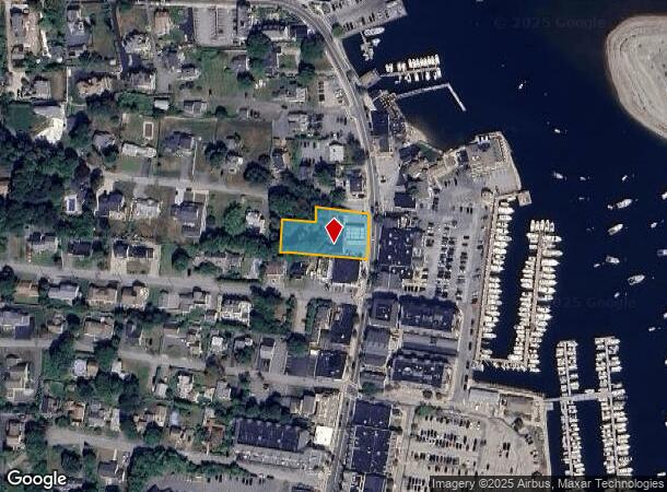
141 Front St, Scituate, MA 02066

NEARBY LISTINGS FOR SALE OR LEASE
-
-
View all Scituate listings for sale on LoopNet.com
Property Detail
141 Front St
SCIT-000050-000003-000023
Lafayette Ave
Servicestation
Plymouth
AE
Massachusetts
25023C0128L
23
2025
0.58 AC
2025
Route 3 Corridor
505202
Boston
1,910 SF
Boston-Cambridge-Newton, MA-NH
DEMOGRAPHICS near 141 Front St
1 Mile
3 Mile
5 Mile
2024 Total Population
5,120
17,192
33,004
2029 Population
5,254
17,494
33,339
Pop Growth 2024-2029
+ 2.62%
+ 1.76%
+ 1.02%
Average Age
45
44
43
2024 Total Households
2,051
6,456
12,135
HH Growth 2024-2029
+ 2.54%
+ 1.78%
+ 1.02%
Median Household Inc
$134,555
$138,879
$151,579
Avg Household Size
2.50
2.60
2.70
2024 Avg HH Vehicles
2.00
2.00
2.00
Median Home Value
$718,781
$730,394
$755,017
Median Year Built
1964
1962
1964
Nearby Places
Map Layers
Map Styles
 Street
 Aerial
- Restaurants
- Banks
- Shops
- Fitness
- Groceries
PUBLIC TRANSPORTATION
COMMUTER RAIL
Greenbush (Greenbush Line - Massachusetts Bay Transportation Authority Commuter Rail (Purple Line))
DRIVE
WALK
Distance
Greenbush (Greenbush Line - Massachusetts Bay Transportation Authority Commuter Rail (Purple Line))
4 min
2.0 mi
North Scituate Station (Greenbush Line - Massachusetts Bay Transportation Authority Commuter Rail (Purple Line))
DRIVE
WALK
Distance
North Scituate Station (Greenbush Line - Massachusetts Bay Transportation Authority Commuter Rail (Purple Line))
10 min
4.6 mi
AIRPORT
General Edward Lawrence Logan International
DRIVE
WALK
Distance
General Edward Lawrence Logan International
50 min
27.5 mi
Freight Ports
Port of Boston
DRIVE
WALK
Distance
Port of Boston
47 min
25.3 mi
Nearby Properties
Address
Land Use
TOTAL SIZE
Lot Size
Zoning
Address
Land Use
TOTAL SIZE
Lot Size
Zoning
4.47 AC
Address
Land Use
TOTAL SIZE
Lot Size
Zoning
75,792 SF
1.22 AC
Address
Land Use
TOTAL SIZE
Lot Size
Zoning
76,562 SF
4.45 AC
Address
Land Use
TOTAL SIZE
Lot Size
Zoning
91,692 SF
11.50 AC
Address
Land Use
TOTAL SIZE
Lot Size
Zoning
264 SF
12.40 AC
Address
Land Use
TOTAL SIZE
Lot Size
Zoning
1,797 SF
9.75 AC
Address
Land Use
TOTAL SIZE
Lot Size
Zoning
12,663 SF
1.41 AC
Address
Land Use
TOTAL SIZE
Lot Size
Zoning
43,690 SF
18.75 AC
Address
Land Use
TOTAL SIZE
Lot Size
Zoning
55,184 SF
11.09 AC
Address
Land Use
TOTAL SIZE
Lot Size
Zoning
3,280 SF
120.42 AC
Address
Land Use
TOTAL SIZE
Lot Size
Zoning
Address
Land Use
TOTAL SIZE
Lot Size
Zoning
8,135 SF
11.03 AC
Address
Land Use
TOTAL SIZE
Lot Size
Zoning
30,884 SF
4.86 AC
Address
Land Use
TOTAL SIZE
Lot Size
Zoning
59,580 SF
1.80 AC
Address
Land Use
TOTAL SIZE
Lot Size
Zoning
27,434 SF
6.02 AC
Address
Land Use
TOTAL SIZE
Lot Size
Zoning
34,476 SF
3.48 AC
Address
Land Use
TOTAL SIZE
Lot Size
Zoning
Address
Land Use
TOTAL SIZE
Lot Size
Zoning
20,230 SF
3.77 AC
Address
Land Use
TOTAL SIZE
Lot Size
Zoning
1.02 AC
Address
Land Use
TOTAL SIZE
Lot Size
Zoning
45,745 SF
4.96 AC
Address
Land Use
TOTAL SIZE
Lot Size
Zoning
31,959 SF
5 AC
Address
Land Use
TOTAL SIZE
Lot Size
Zoning
15.40 AC
Address
Land Use
TOTAL SIZE
Lot Size
Zoning
25,392 SF
1.74 AC
Address
Land Use
TOTAL SIZE
Lot Size
Zoning
5,542 SF
2.34 AC
Address
Land Use
TOTAL SIZE
Lot Size
Zoning
26,613 SF
2.68 AC
Address
Land Use
TOTAL SIZE
Lot Size
Zoning
4,294 SF
4.67 AC
Address
Land Use
TOTAL SIZE
Lot Size
Zoning
1,622 SF
2.65 AC
Address
Land Use
TOTAL SIZE
Lot Size
Zoning
3,000 SF
1.67 AC
Address
Land Use
TOTAL SIZE
Lot Size
Zoning
5,747 SF
0.43 AC
Address
Land Use
TOTAL SIZE
Lot Size
Zoning
39,848 SF
4.38 AC
The World's #1 Commercial Real Estate Marketplace
Connect with us
© 2026 CoStar Group
The information above has been obtained from sources believed reliable. While we do not doubt its accuracy we have not verified it and make no guarantee, warranty or representation about it. It is your responsibility to independently confirm its accuracy and completeness. Any projections, opinions, assumptions, or estimates used are for example only and do not represent the current or future performance of the property. The value of this transaction to you depends on tax and other factors which should be evaluated by your tax, financial, and legal advisors. You and your advisors should conduct a careful, independent investigation of the property to determine to your satisfaction the suitability of the property for your needs.