Property Record
141 Iron Point Rd, Folsom, CA 95630
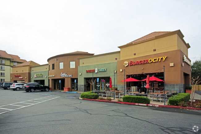

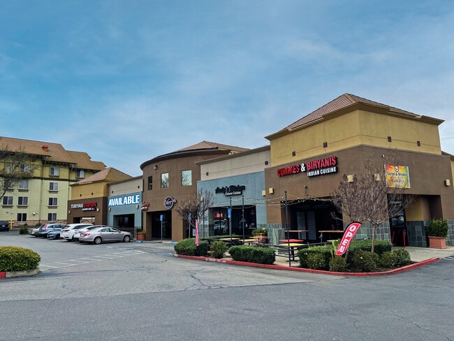


Current Lease Availabilities
Property Detail
141 Iron Point Rd
072-1220-004
PARCEL MAP, LOT 4
Storesoffices
Sacramento
C-3 (PD)
California
B and X Area of moderate flood hazard, usually the area between the limits of the 100-year and 500-year floods.
4
2024
1.11 AC
2025
Folsom
008504
Sacramento
12,045 SF
Sacramento-Roseville-Folsom, CA
NEARBY LISTINGS FOR SALE OR LEASE
DEMOGRAPHICS near 141 Iron Point Rd
1 mile
3 mile
5 mile
2025 Total Population
2,545
56,432
160,564
2030 Population
2,595
57,103
163,585
Pop Growth 2025-2030
+ 1.96%
+ 1.19%
+ 1.88%
Average Age
39
42
43
2025 Total Households
1,023
22,500
61,364
HH Growth 2025-2030
+ 1.96%
+ 1.24%
+ 1.83%
Median Household Inc
$120,925
$113,596
$115,140
Avg Household Size
2.50
2.50
2.50
2025 Avg HH Vehicles
2.00
2.00
2.00
Median Home Value
$724,713
$711,044
$706,344
Median Year Built
1997
1987
1986
Nearby Places
Map Layers
Map Styles
 Street
 Aerial
Layers
 Traffic
 Biking
Places
Listings with unknown addresses are not visible on the map
- Restaurants
- Banks
- Shops
- Fitness
- Groceries
PUBLIC TRANSPORTATION
TRANSIT/SUBWAY
Iron Point (Gold Line - Sacramento Regional Transit District Light Rail (The RT))
Drive
Walk
Distance
Iron Point (Gold Line - Sacramento Regional Transit District Light Rail (The RT))
2 min
6 min
0.3 mi
AIRPORT
Sacramento International
Drive
Walk
Distance
Sacramento International
42 min
31.6 mi
Freight Ports
Port of Stockton
Drive
Walk
Distance
Port of Stockton
77 min
65.2 mi
Nearby Properties
Address
Land Use
TOTAL SIZE
Lot Size
Zoning
Address
Land Use
TOTAL SIZE
Lot Size
Zoning
1,686,420 SF
161.78 AC
M-1 (PD)
Address
Land Use
TOTAL SIZE
Lot Size
Zoning
278,000 SF
28.48 AC
SP-LI/BP (
Address
Land Use
TOTAL SIZE
Lot Size
Zoning
311,043 SF
10.10 AC
R-4 (PD)
Address
Land Use
TOTAL SIZE
Lot Size
Zoning
302,124 SF
13.30 AC
R-M (PD)
Address
Land Use
TOTAL SIZE
Lot Size
Zoning
SPA (ASPA)
Address
Land Use
TOTAL SIZE
Lot Size
Zoning
304,607 SF
14.70 AC
LC
Address
Land Use
TOTAL SIZE
Lot Size
Zoning
115,076 SF
22.09 AC
SP-INDUSTR
Address
Land Use
TOTAL SIZE
Lot Size
Zoning
6.02 AC
C-3 (PD)
Address
Land Use
TOTAL SIZE
Lot Size
Zoning
287,131 SF
32.53 AC
C-3 (PD)
Address
Land Use
TOTAL SIZE
Lot Size
Zoning
202,776 SF
12.17 AC
RD-25 (PC)
Address
Land Use
TOTAL SIZE
Lot Size
Zoning
415,320 SF
32.51 AC
R-M (PD) O
Address
Land Use
TOTAL SIZE
Lot Size
Zoning
140,000 SF
4.12 AC
BP (PD)
Address
Land Use
TOTAL SIZE
Lot Size
Zoning
269,928 SF
246.95 AC
SPA
Address
Land Use
TOTAL SIZE
Lot Size
Zoning
2,146.73 AC
SPA
Address
Land Use
TOTAL SIZE
Lot Size
Zoning
40,447 SF
8.89 AC
M-1
Address
Land Use
TOTAL SIZE
Lot Size
Zoning
241,672 SF
18.54 AC
SC
Address
Land Use
TOTAL SIZE
Lot Size
Zoning
5.73 AC
R-4 (PD)
Address
Land Use
TOTAL SIZE
Lot Size
Zoning
14.54 AC
SPA (ASPA)
Address
Land Use
TOTAL SIZE
Lot Size
Zoning
163,800 SF
9.13 AC
SP-IND/OP
Address
Land Use
TOTAL SIZE
Lot Size
Zoning
55,579 SF
44.38 AC
M-2
Address
Land Use
TOTAL SIZE
Lot Size
Zoning
52,992 SF
4.07 AC
M-1 (PD)
Address
Land Use
TOTAL SIZE
Lot Size
Zoning
153,983 SF
4.16 AC
MU
Address
Land Use
TOTAL SIZE
Lot Size
Zoning
104,750 SF
5.66 AC
RD-20
Address
Land Use
TOTAL SIZE
Lot Size
Zoning
121,416 SF
8.22 AC
SP-IND/OP
Address
Land Use
TOTAL SIZE
Lot Size
Zoning
120,556 SF
14.77 AC
C-2 (PD)
Address
Land Use
TOTAL SIZE
Lot Size
Zoning
939,277 SF
58.75 AC
SPA
Address
Land Use
TOTAL SIZE
Lot Size
Zoning
2,646.76 AC
SPA
Address
Land Use
TOTAL SIZE
Lot Size
Zoning
134,216 SF
7.79 AC
SPA
Address
Land Use
TOTAL SIZE
Lot Size
Zoning
119,310 SF
6.98 AC
BP (PD)
Address
Land Use
TOTAL SIZE
Lot Size
Zoning
99,766 SF
105.69 AC
C-3 (PD)
The World's #1 Commercial Real Estate Marketplace
Connect with us
© 2026 CoStar Group
The information above has been obtained from sources believed reliable. While we do not doubt its accuracy we have not verified it and make no guarantee, warranty or representation about it. It is your responsibility to independently confirm its accuracy and completeness. Any projections, opinions, assumptions, or estimates used are for example only and do not represent the current or future performance of the property. The value of this transaction to you depends on tax and other factors which should be evaluated by your tax, financial, and legal advisors. You and your advisors should conduct a careful, independent investigation of the property to determine to your satisfaction the suitability of the property for your needs.