Property Record
141 Skyway Dr, Edgewater, FL 32132


NEARBY LISTINGS FOR SALE OR LEASE
-
-
View all Edgewater listings for sale on LoopNet.com
Property Detail
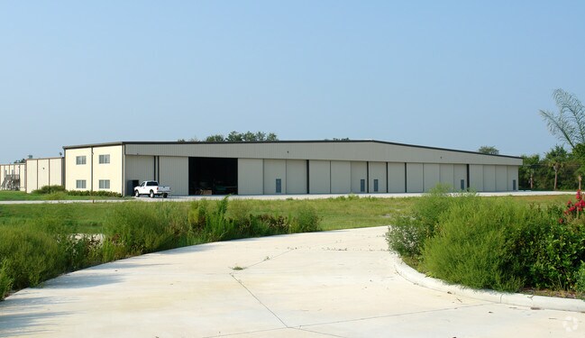
141 Skyway Dr
Deltona-Daytona Beach-Ormond Beach, FL
Air Park
7431-00-00-0112
31-17-34 IRREG PARCEL IN GOVT LOTS 3 & 4 S OF PARK AVE & E OF AIR PARK RD MEAS 713.47 FT ON S/L PARK AVE & MEAS 361.12 FT ON E/L & INC THAT PART OF PARK AVE VACATED IN COUNTY RES 2018-76 PER OR 4534 PG 3474 PER OR 4625 PG 4660
Aircraft
Volusia
X
Florida
12127C0685J
3,4
2025
4.99 AC
2026
South Beach Cities
083009
Deltona/Daytona Beach
16,200 SF
DEMOGRAPHICS near 141 Skyway Dr
1 Mile
3 Mile
5 Mile
2024 Total Population
2,121
27,462
60,444
2029 Population
2,356
30,499
68,456
Pop Growth 2024-2029
+ 11.08%
+ 11.06%
+ 13.26%
Average Age
46
46
50
2024 Total Households
900
11,772
27,916
HH Growth 2024-2029
+ 11.22%
+ 11.26%
+ 13.71%
Median Household Inc
$52,348
$51,729
$59,796
Avg Household Size
2.30
2.20
2.10
2024 Avg HH Vehicles
2.00
2.00
2.00
Median Home Value
$246,019
$229,130
$268,331
Median Year Built
1985
1983
1985
Nearby Places
Map Layers
Map Styles
 Street
 Aerial
- Restaurants
- Banks
- Shops
- Fitness
- Groceries
PUBLIC TRANSPORTATION
AIRPORT
Daytona Beach International
DRIVE
WALK
Distance
Daytona Beach International
34 min
20.4 mi
Orlando Sanford International
DRIVE
WALK
Distance
Orlando Sanford International
54 min
34.2 mi
Freight Ports
Port Canaveral
DRIVE
WALK
Distance
Port Canaveral
69 min
55.9 mi
Nearby Properties
Address
Land Use
TOTAL SIZE
Lot Size
Zoning
Address
Land Use
TOTAL SIZE
Lot Size
Zoning
360,394 SF
65.63 AC
01R4
Address
Land Use
TOTAL SIZE
Lot Size
Zoning
177,619 SF
6.91 AC
10R2
Address
Land Use
TOTAL SIZE
Lot Size
Zoning
260,126 SF
2 AC
10R3
Address
Land Use
TOTAL SIZE
Lot Size
Zoning
209,027 SF
29.13 AC
10R2A
Address
Land Use
TOTAL SIZE
Lot Size
Zoning
150,044 SF
19.80 AC
R4
Address
Land Use
TOTAL SIZE
Lot Size
Zoning
23,142 SF
7.98 AC
R
Address
Land Use
TOTAL SIZE
Lot Size
Zoning
91,509 SF
4.06 AC
I1
Address
Land Use
TOTAL SIZE
Lot Size
Zoning
91,759 SF
10.15 AC
10B2
Address
Land Use
TOTAL SIZE
Lot Size
Zoning
5,249 SF
0.42 AC
01MH5
Address
Land Use
TOTAL SIZE
Lot Size
Zoning
94,251 SF
18.51 AC
Address
Land Use
TOTAL SIZE
Lot Size
Zoning
51,507 SF
10.61 AC
B3C
Address
Land Use
TOTAL SIZE
Lot Size
Zoning
111,686 SF
10.03 AC
10B5
Address
Land Use
TOTAL SIZE
Lot Size
Zoning
119,537 SF
12.06 AC
PUD
Address
Land Use
TOTAL SIZE
Lot Size
Zoning
55,587 SF
85.39 AC
R4
Address
Land Use
TOTAL SIZE
Lot Size
Zoning
229,941 SF
0.57 AC
10R2A
Address
Land Use
TOTAL SIZE
Lot Size
Zoning
44,239 SF
2.31 AC
10B1
Address
Land Use
TOTAL SIZE
Lot Size
Zoning
2,628 SF
3.04 AC
Address
Land Use
TOTAL SIZE
Lot Size
Zoning
98,105 SF
8.03 AC
07B3
Address
Land Use
TOTAL SIZE
Lot Size
Zoning
64,123 SF
6.94 AC
07B5
Address
Land Use
TOTAL SIZE
Lot Size
Zoning
108,762 SF
11.60 AC
RA
Address
Land Use
TOTAL SIZE
Lot Size
Zoning
70,088 SF
0.30 AC
10R5
Address
Land Use
TOTAL SIZE
Lot Size
Zoning
41,310 SF
1.57 AC
10B1
Address
Land Use
TOTAL SIZE
Lot Size
Zoning
73,711 SF
7.06 AC
R2
Address
Land Use
TOTAL SIZE
Lot Size
Zoning
89,757 SF
12.19 AC
07B5
Address
Land Use
TOTAL SIZE
Lot Size
Zoning
91.24 AC
RC
Address
Land Use
TOTAL SIZE
Lot Size
Zoning
79,518 SF
8.69 AC
B3
Address
Land Use
TOTAL SIZE
Lot Size
Zoning
56,841 SF
8.81 AC
B4C
Address
Land Use
TOTAL SIZE
Lot Size
Zoning
71,824 SF
2.01 AC
10R5
Address
Land Use
TOTAL SIZE
Lot Size
Zoning
99,241 SF
8.11 AC
B4
Address
Land Use
TOTAL SIZE
Lot Size
Zoning
31,765 SF
27.25 AC
The World's #1 Commercial Real Estate Marketplace
Connect with us
© 2025 CoStar Group
The information above has been obtained from sources believed reliable. While we do not doubt its accuracy we have not verified it and make no guarantee, warranty or representation about it. It is your responsibility to independently confirm its accuracy and completeness. Any projections, opinions, assumptions, or estimates used are for example only and do not represent the current or future performance of the property. The value of this transaction to you depends on tax and other factors which should be evaluated by your tax, financial, and legal advisors. You and your advisors should conduct a careful, independent investigation of the property to determine to your satisfaction the suitability of the property for your needs.