Property Record
1410 Washington St, Hanover, MA 02339


NEARBY LISTINGS FOR SALE OR LEASE
Property Detail
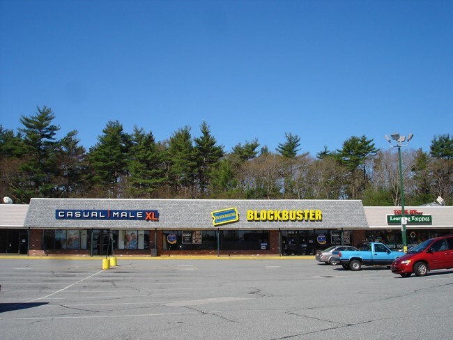
1410 Washington St
HANO-000017-000000-000155
Plymouth
Departmentstore
Massachusetts
X
155
25023C0113K
4.67 AC
2025
Route 3 Corridor
2025
Boston
503101
Boston-Cambridge-Newton, MA-NH
23,600 SF
DEMOGRAPHICS near 1410 Washington St
1 Mile
3 Mile
5 Mile
2024 Total Population
2,598
22,821
65,451
2029 Population
2,653
22,926
65,565
Pop Growth 2024-2029
+ 2.12%
+ 0.46%
+ 0.17%
Average Age
41
41
42
2024 Total Households
922
7,778
23,536
HH Growth 2024-2029
+ 2.17%
+ 0.45%
+ 0.11%
Median Household Inc
$134,762
$157,524
$137,193
Avg Household Size
2.80
2.90
2.70
2024 Avg HH Vehicles
2.00
2.00
2.00
Median Home Value
$689,493
$659,977
$614,648
Median Year Built
1968
1970
1969
Nearby Places
Map Layers
Map Styles
 Street
 Aerial
- Restaurants
- Banks
- Shops
- Fitness
- Groceries
SALE & LEASE HISTORY
LISTING DATE
SALE/LEASE

Nov 04, 2024
For Lease
Jun 02, 2017
For Lease
Jan 26, 2021
For Lease
Jan 25, 2021
For Sale
Nearby Properties
Address
Land Use
TOTAL SIZE
Lot Size
Zoning
Address
Land Use
TOTAL SIZE
Lot Size
Zoning
67.07 AC
Address
Land Use
TOTAL SIZE
Lot Size
Zoning
23.41 AC
R
Address
Land Use
TOTAL SIZE
Lot Size
Zoning
13.15 AC
Address
Land Use
TOTAL SIZE
Lot Size
Zoning
276,753 SF
25.44 AC
Address
Land Use
TOTAL SIZE
Lot Size
Zoning
78.50 AC
R
Address
Land Use
TOTAL SIZE
Lot Size
Zoning
94.53 AC
Address
Land Use
TOTAL SIZE
Lot Size
Zoning
141,514 SF
46.60 AC
R
Address
Land Use
TOTAL SIZE
Lot Size
Zoning
141,687 SF
17.27 AC
Address
Land Use
TOTAL SIZE
Lot Size
Zoning
91,586 SF
13.70 AC
R
Address
Land Use
TOTAL SIZE
Lot Size
Zoning
121,800 SF
0.97 AC
C
Address
Land Use
TOTAL SIZE
Lot Size
Zoning
54,756 SF
15.40 AC
Address
Land Use
TOTAL SIZE
Lot Size
Zoning
108,958 SF
7.37 AC
LI
Address
Land Use
TOTAL SIZE
Lot Size
Zoning
85,616 SF
5.48 AC
INDUST
Address
Land Use
TOTAL SIZE
Lot Size
Zoning
93,933 SF
13 AC
Address
Land Use
TOTAL SIZE
Lot Size
Zoning
107,123 SF
15.92 AC
Address
Land Use
TOTAL SIZE
Lot Size
Zoning
13.10 AC
Address
Land Use
TOTAL SIZE
Lot Size
Zoning
137,617 SF
24.54 AC
C
Address
Land Use
TOTAL SIZE
Lot Size
Zoning
12.04 AC
C
Address
Land Use
TOTAL SIZE
Lot Size
Zoning
101,935 SF
10.61 AC
INDUST
Address
Land Use
TOTAL SIZE
Lot Size
Zoning
66,834 SF
13.03 AC
Address
Land Use
TOTAL SIZE
Lot Size
Zoning
62,569 SF
3.52 AC
C
Address
Land Use
TOTAL SIZE
Lot Size
Zoning
89,369 SF
15.40 AC
Address
Land Use
TOTAL SIZE
Lot Size
Zoning
24.07 AC
BD
Address
Land Use
TOTAL SIZE
Lot Size
Zoning
3.88 AC
BD
Address
Land Use
TOTAL SIZE
Lot Size
Zoning
48,300 SF
7.81 AC
PSC
Address
Land Use
TOTAL SIZE
Lot Size
Zoning
11.48 AC
C
Address
Land Use
TOTAL SIZE
Lot Size
Zoning
54,216 SF
5.69 AC
Address
Land Use
TOTAL SIZE
Lot Size
Zoning
63,495 SF
6.93 AC
INDUST
Address
Land Use
TOTAL SIZE
Lot Size
Zoning
71,327 SF
6.58 AC
Address
Land Use
TOTAL SIZE
Lot Size
Zoning
60,274 SF
15.10 AC
B
The World's #1 Commercial Real Estate Marketplace
Connect with us
© 2025 CoStar Group
The information above has been obtained from sources believed reliable. While we do not doubt its accuracy we have not verified it and make no guarantee, warranty or representation about it. It is your responsibility to independently confirm its accuracy and completeness. Any projections, opinions, assumptions, or estimates used are for example only and do not represent the current or future performance of the property. The value of this transaction to you depends on tax and other factors which should be evaluated by your tax, financial, and legal advisors. You and your advisors should conduct a careful, independent investigation of the property to determine to your satisfaction the suitability of the property for your needs.