Property Record
14107 E Bandera Rd, Helotes, TX 78023
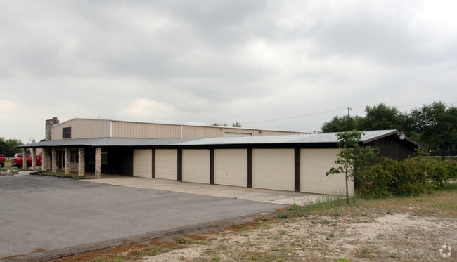

Property Detail
14107 E Bandera Rd
San Antonio-New Braunfels, TX
CB 4524D BLK 1 LOT S IRR 586.45 FT OF 1 2009 MAP CORR
04524-401-0010
BEXAR
Warehouse
Texas
B and X Area of moderate flood hazard, usually the area between the limits of the 100-year and 500-year floods.
1
2024
4.14 AC
2025
Far Northwest
182106
San Antonio
26,826 SF
NEARBY LISTINGS FOR SALE OR LEASE
-
-
View all Helotes listings for sale on LoopNet.com
DEMOGRAPHICS near 14107 E Bandera Rd
1 mile
3 mile
5 mile
2025 Total Population
3,461
45,209
169,975
2030 Population
3,637
47,369
178,158
Pop Growth 2025-2030
+ 5.09%
+ 4.78%
+ 4.81%
Average Age
42
38
36
2025 Total Households
1,296
15,296
58,972
HH Growth 2025-2030
+ 5.02%
+ 4.73%
+ 4.95%
Median Household Inc
$110,937
$117,067
$97,989
Avg Household Size
2.60
2.90
2.80
2025 Avg HH Vehicles
2.00
2.00
2.00
Median Home Value
$473,920
$363,480
$318,036
Median Year Built
2002
2004
2000
Nearby Places
Map Layers
Map Styles
 Street
 Aerial
Transit
 Traffic
 Biking
Places
Listings with unknown addresses are not visible on the map
- Restaurants
- Banks
- Shops
- Fitness
- Groceries
PUBLIC TRANSPORTATION
AIRPORT
San Antonio International
Drive
Walk
Distance
San Antonio International
27 min
17.4 mi
Nearby Properties
Address
Land Use
TOTAL SIZE
Lot Size
Zoning
Address
Land Use
TOTAL SIZE
Lot Size
Zoning
413,362 SF
33.77 AC
Address
Land Use
TOTAL SIZE
Lot Size
Zoning
305,600 SF
30.64 AC
Address
Land Use
TOTAL SIZE
Lot Size
Zoning
268,854 SF
15.88 AC
Address
Land Use
TOTAL SIZE
Lot Size
Zoning
237,499 SF
37.26 AC
Address
Land Use
TOTAL SIZE
Lot Size
Zoning
220,719 SF
25.86 AC
Address
Land Use
TOTAL SIZE
Lot Size
Zoning
217,267 SF
17.63 AC
Address
Land Use
TOTAL SIZE
Lot Size
Zoning
255,890 SF
14.23 AC
Address
Land Use
TOTAL SIZE
Lot Size
Zoning
232,610 SF
13.16 AC
Address
Land Use
TOTAL SIZE
Lot Size
Zoning
185,896 SF
26.12 AC
Address
Land Use
TOTAL SIZE
Lot Size
Zoning
1,080 SF
92.05 AC
Address
Land Use
TOTAL SIZE
Lot Size
Zoning
193,004 SF
16.43 AC
Address
Land Use
TOTAL SIZE
Lot Size
Zoning
228,364 SF
16.14 AC
Address
Land Use
TOTAL SIZE
Lot Size
Zoning
248,352 SF
14.72 AC
Address
Land Use
TOTAL SIZE
Lot Size
Zoning
74,514 SF
15.57 AC
Address
Land Use
TOTAL SIZE
Lot Size
Zoning
157,714 SF
16.22 AC
Address
Land Use
TOTAL SIZE
Lot Size
Zoning
52,631 SF
5.54 AC
Address
Land Use
TOTAL SIZE
Lot Size
Zoning
62,157 SF
7.64 AC
Address
Land Use
TOTAL SIZE
Lot Size
Zoning
122,275 SF
3.51 AC
Address
Land Use
TOTAL SIZE
Lot Size
Zoning
67.52 AC
Address
Land Use
TOTAL SIZE
Lot Size
Zoning
27,712 SF
11.48 AC
Address
Land Use
TOTAL SIZE
Lot Size
Zoning
103,616 SF
5.94 AC
Address
Land Use
TOTAL SIZE
Lot Size
Zoning
114,677 SF
2.43 AC
Address
Land Use
TOTAL SIZE
Lot Size
Zoning
36,384 SF
2.79 AC
Address
Land Use
TOTAL SIZE
Lot Size
Zoning
38,082 SF
5.11 AC
Address
Land Use
TOTAL SIZE
Lot Size
Zoning
172,517 SF
13.95 AC
Address
Land Use
TOTAL SIZE
Lot Size
Zoning
2,068 SF
49.60 AC
Address
Land Use
TOTAL SIZE
Lot Size
Zoning
111,198 SF
5 AC
Address
Land Use
TOTAL SIZE
Lot Size
Zoning
2,736 SF
49.40 AC
Address
Land Use
TOTAL SIZE
Lot Size
Zoning
62,165 SF
5.07 AC
Address
Land Use
TOTAL SIZE
Lot Size
Zoning
137,982 SF
14.25 AC
The World's #1 Commercial Real Estate Marketplace
Connect with us
© 2026 CoStar Group
The information above has been obtained from sources believed reliable. While we do not doubt its accuracy we have not verified it and make no guarantee, warranty or representation about it. It is your responsibility to independently confirm its accuracy and completeness. Any projections, opinions, assumptions, or estimates used are for example only and do not represent the current or future performance of the property. The value of this transaction to you depends on tax and other factors which should be evaluated by your tax, financial, and legal advisors. You and your advisors should conduct a careful, independent investigation of the property to determine to your satisfaction the suitability of the property for your needs.