Property Record
1411 Lemay Dr, Carrollton, TX 75007
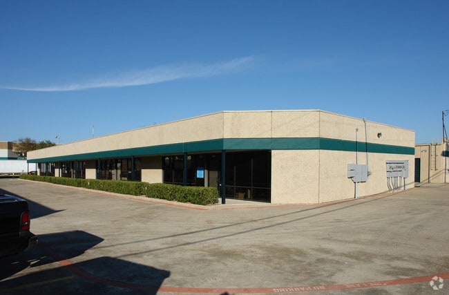

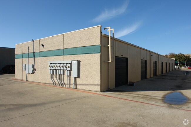

Property Detail
1411 Lemay Dr
Dallas-Fort Worth-Arlington, TX
TRINITY MILLS IH35 BUSINESS PARK BLK D LOT 5B
R100878
Denton
Commercialnec
Texas
AE The base floodplain where base flood elevations are provided. AE Zones are now used on new format FIRMs instead of A1-A30 Zones.
5b
2024
2.16 AC
2025
N Stemmons/Valwood
021621
Dallas/Ft Worth
32,437 SF
NEARBY LISTINGS FOR SALE OR LEASE
DEMOGRAPHICS near 1411 Lemay Dr
1 mile
3 mile
5 mile
2024 Total Population
8,213
101,879
312,259
2029 Population
9,025
110,028
336,546
Pop Growth 2024-2029
+ 9.89%
+ 8.00%
+ 7.78%
Average Age
43
39
38
2024 Total Households
3,148
37,866
124,864
HH Growth 2024-2029
+ 9.72%
+ 8.32%
+ 8.07%
Median Household Inc
$129,412
$104,367
$95,374
Avg Household Size
2.60
2.60
2.50
2024 Avg HH Vehicles
2.00
2.00
2.00
Median Home Value
$456,040
$400,818
$429,521
Median Year Built
1991
1989
1991
Nearby Places
Map Layers
Map Styles
 Street
 Aerial
Transit
 Traffic
 Biking
Places
Listings with unknown addresses are not visible on the map
- Restaurants
- Banks
- Shops
- Fitness
- Groceries
PUBLIC TRANSPORTATION
COMMUTER RAIL
Trinity Mills Station (Green Line - Dallas Area Rapid Transit (DART))
Drive
Walk
Distance
Trinity Mills Station (Green Line - Dallas Area Rapid Transit (DART))
3 min
18 min
0.9 mi
Hebron Station (A-train - Denton County Transportation Authority)
Drive
Walk
Distance
Hebron Station (A-train - Denton County Transportation Authority)
9 min
4.0 mi
AIRPORT
Dallas-Fort Worth International
Drive
Walk
Distance
Dallas-Fort Worth International
19 min
13.9 mi
Dallas Love Field
Drive
Walk
Distance
Dallas Love Field
25 min
15.6 mi
Freight Ports
Port of Shreveport
Drive
Walk
Distance
Port of Shreveport
231 min
213.1 mi
SALE & LEASE HISTORY
LISTING DATE
SALE/LEASE

Aug 01, 2017
For Lease
Nearby Properties
Address
Land Use
TOTAL SIZE
Lot Size
Zoning
Address
Land Use
TOTAL SIZE
Lot Size
Zoning
660,180 SF
29.95 AC
Address
Land Use
TOTAL SIZE
Lot Size
Zoning
462,692 SF
30.77 AC
2G
Address
Land Use
TOTAL SIZE
Lot Size
Zoning
452,167 SF
5.80 AC
Address
Land Use
TOTAL SIZE
Lot Size
Zoning
513,871 SF
3.63 AC
Z235
Address
Land Use
TOTAL SIZE
Lot Size
Zoning
242,707 SF
27.63 AC
Z343
Address
Land Use
TOTAL SIZE
Lot Size
Zoning
321,732 SF
4.05 AC
Z235
Address
Land Use
TOTAL SIZE
Lot Size
Zoning
343,234 SF
32.41 AC
Address
Land Use
TOTAL SIZE
Lot Size
Zoning
354,546 SF
19.38 AC
3B
Address
Land Use
TOTAL SIZE
Lot Size
Zoning
345,320 SF
20.50 AC
Z172
Address
Land Use
TOTAL SIZE
Lot Size
Zoning
266,871 SF
87 SF
Address
Land Use
TOTAL SIZE
Lot Size
Zoning
725,972 SF
4 AC
Address
Land Use
TOTAL SIZE
Lot Size
Zoning
189,500 SF
53.90 AC
Address
Land Use
TOTAL SIZE
Lot Size
Zoning
297,932 SF
14.05 AC
Address
Land Use
TOTAL SIZE
Lot Size
Zoning
397,889 SF
23.14 AC
2A
Address
Land Use
TOTAL SIZE
Lot Size
Zoning
251,650 SF
14.22 AC
Address
Land Use
TOTAL SIZE
Lot Size
Zoning
318,477 SF
18.79 AC
Address
Land Use
TOTAL SIZE
Lot Size
Zoning
270,915 SF
3.91 AC
Z84
Address
Land Use
TOTAL SIZE
Lot Size
Zoning
300,958 SF
16.61 AC
Address
Land Use
TOTAL SIZE
Lot Size
Zoning
711,360 SF
32.62 AC
Address
Land Use
TOTAL SIZE
Lot Size
Zoning
350,002 SF
21.01 AC
Z172
Address
Land Use
TOTAL SIZE
Lot Size
Zoning
228,674 SF
11.81 AC
Z235
Address
Land Use
TOTAL SIZE
Lot Size
Zoning
294,764 SF
18 AC
Address
Land Use
TOTAL SIZE
Lot Size
Zoning
276,509 SF
16.67 AC
2G
Address
Land Use
TOTAL SIZE
Lot Size
Zoning
385,026 SF
7.46 AC
Address
Land Use
TOTAL SIZE
Lot Size
Zoning
284,869 SF
12.49 AC
3B
Address
Land Use
TOTAL SIZE
Lot Size
Zoning
217,200 SF
10.50 AC
Address
Land Use
TOTAL SIZE
Lot Size
Zoning
310,696 SF
13.35 AC
2B
Address
Land Use
TOTAL SIZE
Lot Size
Zoning
288,278 SF
16.16 AC
2G
Address
Land Use
TOTAL SIZE
Lot Size
Zoning
219,057 SF
12.63 AC
2B
Address
Land Use
TOTAL SIZE
Lot Size
Zoning
232,109 SF
4.38 AC
The World's #1 Commercial Real Estate Marketplace
Connect with us
© 2026 CoStar Group
The information above has been obtained from sources believed reliable. While we do not doubt its accuracy we have not verified it and make no guarantee, warranty or representation about it. It is your responsibility to independently confirm its accuracy and completeness. Any projections, opinions, assumptions, or estimates used are for example only and do not represent the current or future performance of the property. The value of this transaction to you depends on tax and other factors which should be evaluated by your tax, financial, and legal advisors. You and your advisors should conduct a careful, independent investigation of the property to determine to your satisfaction the suitability of the property for your needs.