Property Record
1411 N Custer Rd, Mckinney, TX 75071
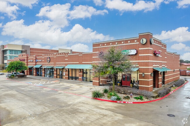

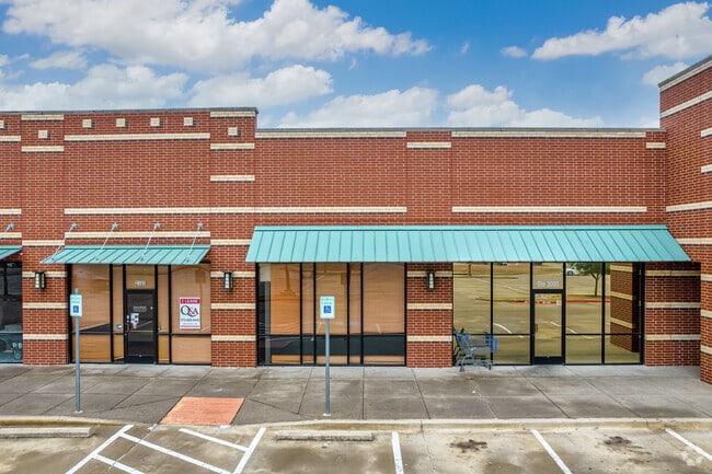
Property Detail
1411 N Custer Rd
Dallas-Fort Worth-Arlington, TX
SHOPS AT EAGLE POINT, BLK A, LOT 6; (REPLAT)
R-9401-00A-0060-1
COLLIN
Commercialnec
Texas
B and X Area of moderate flood hazard, usually the area between the limits of the 100-year and 500-year floods.
6
2025
5.38 AC
2025
Frisco
030524
Dallas/Ft Worth
37,725 SF
NEARBY LISTINGS FOR SALE OR LEASE
DEMOGRAPHICS near 1411 N Custer Rd
1 mile
3 mile
5 mile
2024 Total Population
9,460
95,146
236,299
2029 Population
10,739
108,296
271,082
Pop Growth 2024-2029
+ 13.52%
+ 13.82%
+ 14.72%
Average Age
37
37
37
2024 Total Households
3,154
30,746
76,170
HH Growth 2024-2029
+ 13.67%
+ 14.03%
+ 14.92%
Median Household Inc
$153,038
$163,775
$159,034
Avg Household Size
3.00
3.00
3.10
2024 Avg HH Vehicles
2.00
2.00
2.00
Median Home Value
$515,359
$638,866
$638,690
Median Year Built
2008
2010
2010
Nearby Places
Map Layers
Map Styles
 Street
 Aerial
Transit
 Traffic
 Biking
Places
Listings with unknown addresses are not visible on the map
- Restaurants
- Banks
- Shops
- Fitness
- Groceries
PUBLIC TRANSPORTATION
AIRPORT
Dallas-Fort Worth International
Drive
Walk
Distance
Dallas-Fort Worth International
40 min
33.4 mi
Dallas Love Field
Drive
Walk
Distance
Dallas Love Field
45 min
36.3 mi
SALE & LEASE HISTORY
LISTING DATE
SALE/LEASE

Sep 25, 2016
For Lease
Nearby Properties
Address
Land Use
TOTAL SIZE
Lot Size
Zoning
Address
Land Use
TOTAL SIZE
Lot Size
Zoning
882,734 SF
98.26 AC
Address
Land Use
TOTAL SIZE
Lot Size
Zoning
621,249 SF
80.03 AC
Address
Land Use
TOTAL SIZE
Lot Size
Zoning
681,949 SF
71.30 AC
Address
Land Use
TOTAL SIZE
Lot Size
Zoning
641,090 SF
60.44 AC
Address
Land Use
TOTAL SIZE
Lot Size
Zoning
490,246 SF
24.39 AC
MF-M
Address
Land Use
TOTAL SIZE
Lot Size
Zoning
466,467 SF
46.81 AC
Address
Land Use
TOTAL SIZE
Lot Size
Zoning
398,732 SF
25.88 AC
MF-M
Address
Land Use
TOTAL SIZE
Lot Size
Zoning
505,541 SF
19.78 AC
SFR
Address
Land Use
TOTAL SIZE
Lot Size
Zoning
218,013 SF
32.85 AC
AG
Address
Land Use
TOTAL SIZE
Lot Size
Zoning
274,184 SF
20.34 AC
COMM
Address
Land Use
TOTAL SIZE
Lot Size
Zoning
348,136 SF
23.07 AC
MF-L
Address
Land Use
TOTAL SIZE
Lot Size
Zoning
300,789 SF
43.28 AC
Address
Land Use
TOTAL SIZE
Lot Size
Zoning
275,288 SF
19.40 AC
MF-M
Address
Land Use
TOTAL SIZE
Lot Size
Zoning
251,455 SF
35.62 AC
Address
Land Use
TOTAL SIZE
Lot Size
Zoning
282,528 SF
5.14 AC
MF-R
Address
Land Use
TOTAL SIZE
Lot Size
Zoning
264,070 SF
15.74 AC
MF-M
Address
Land Use
TOTAL SIZE
Lot Size
Zoning
197,115 SF
10.37 AC
MF-M
Address
Land Use
TOTAL SIZE
Lot Size
Zoning
243,827 SF
13.23 AC
MF
Address
Land Use
TOTAL SIZE
Lot Size
Zoning
201,902 SF
11.22 AC
MF-M
Address
Land Use
TOTAL SIZE
Lot Size
Zoning
118,608 SF
5.24 AC
Address
Land Use
TOTAL SIZE
Lot Size
Zoning
98,872 SF
10.77 AC
Address
Land Use
TOTAL SIZE
Lot Size
Zoning
91,545 SF
9.08 AC
Address
Land Use
TOTAL SIZE
Lot Size
Zoning
105,321 SF
12.29 AC
Address
Land Use
TOTAL SIZE
Lot Size
Zoning
126,334 SF
26.04 AC
Address
Land Use
TOTAL SIZE
Lot Size
Zoning
113,730 SF
Address
Land Use
TOTAL SIZE
Lot Size
Zoning
100,900 SF
10.08 AC
Address
Land Use
TOTAL SIZE
Lot Size
Zoning
202,093 SF
23.07 AC
Address
Land Use
TOTAL SIZE
Lot Size
Zoning
81,464 SF
19.93 AC
Address
Land Use
TOTAL SIZE
Lot Size
Zoning
127,539 SF
26.28 AC
PD
Address
Land Use
TOTAL SIZE
Lot Size
Zoning
73,256 SF
4.97 AC
The World's #1 Commercial Real Estate Marketplace
Connect with us
© 2026 CoStar Group
The information above has been obtained from sources believed reliable. While we do not doubt its accuracy we have not verified it and make no guarantee, warranty or representation about it. It is your responsibility to independently confirm its accuracy and completeness. Any projections, opinions, assumptions, or estimates used are for example only and do not represent the current or future performance of the property. The value of this transaction to you depends on tax and other factors which should be evaluated by your tax, financial, and legal advisors. You and your advisors should conduct a careful, independent investigation of the property to determine to your satisfaction the suitability of the property for your needs.