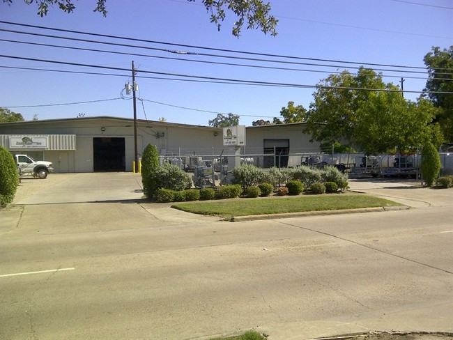
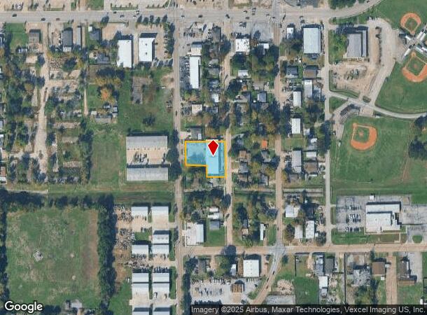
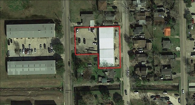
Property Record
1411 Preston Ave, Pasadena, TX 77503
NEARBY LISTINGS FOR SALE OR LEASE
Property Detail
1411 Preston Ave
Houston-The Woodlands-Sugar Land, TX
Satsuma Heights
0752350000021
LTS 21 22 34 35 & 36 SATSUMA HEIGHTS
Warehouse
Harris
X
Texas
48201C0910M
21
2024
0.62 AC
2025
East-Southeast Far
323100
Houston
8,965 SF
DEMOGRAPHICS near 1411 Preston Ave
1 Mile
3 Mile
5 Mile
2024 Total Population
22,666
117,406
233,300
2029 Population
23,032
119,820
238,145
Pop Growth 2024-2029
+ 1.61%
+ 2.06%
+ 2.08%
Average Age
35
35
36
2024 Total Households
7,422
38,466
76,020
HH Growth 2024-2029
+ 1.59%
+ 2.02%
+ 2.06%
Median Household Inc
$55,188
$53,793
$59,044
Avg Household Size
3.00
3.00
3.00
2024 Avg HH Vehicles
2.00
2.00
2.00
Median Home Value
$128,012
$147,648
$166,653
Median Year Built
1967
1971
1974
Nearby Places
Map Layers
Map Styles
 Street
 Aerial
- Restaurants
- Banks
- Shops
- Fitness
- Groceries
PUBLIC TRANSPORTATION
AIRPORT
William P Hobby
DRIVE
WALK
Distance
William P Hobby
23 min
10.6 mi
George Bush Intcntl/Houston
DRIVE
WALK
Distance
George Bush Intcntl/Houston
39 min
30.3 mi
Freight Ports
Port of Houston
DRIVE
WALK
Distance
Port of Houston
18 min
9.9 mi
SALE & LEASE HISTORY
LISTING DATE
SALE/LEASE

Jul 07, 2017
For Lease
Nearby Properties
Address
Land Use
TOTAL SIZE
Lot Size
Zoning
Address
Land Use
TOTAL SIZE
Lot Size
Zoning
Address
Land Use
TOTAL SIZE
Lot Size
Zoning
188.11 AC
Address
Land Use
TOTAL SIZE
Lot Size
Zoning
5,379,424 SF
145.51 AC
Address
Land Use
TOTAL SIZE
Lot Size
Zoning
1,456,582 SF
93.83 AC
Address
Land Use
TOTAL SIZE
Lot Size
Zoning
2,822,672 SF
33.97 AC
Address
Land Use
TOTAL SIZE
Lot Size
Zoning
19.38 AC
Address
Land Use
TOTAL SIZE
Lot Size
Zoning
153.75 AC
Address
Land Use
TOTAL SIZE
Lot Size
Zoning
155.61 AC
Address
Land Use
TOTAL SIZE
Lot Size
Zoning
72.68 AC
Address
Land Use
TOTAL SIZE
Lot Size
Zoning
606,550 SF
31.17 AC
Address
Land Use
TOTAL SIZE
Lot Size
Zoning
552,961 SF
25.01 AC
Address
Land Use
TOTAL SIZE
Lot Size
Zoning
188.11 AC
Address
Land Use
TOTAL SIZE
Lot Size
Zoning
3,568,104 SF
61.61 AC
Address
Land Use
TOTAL SIZE
Lot Size
Zoning
345,420 SF
4.02 AC
Address
Land Use
TOTAL SIZE
Lot Size
Zoning
7.19 AC
Address
Land Use
TOTAL SIZE
Lot Size
Zoning
371,097 SF
10.32 AC
Address
Land Use
TOTAL SIZE
Lot Size
Zoning
411,046 SF
46.92 AC
Address
Land Use
TOTAL SIZE
Lot Size
Zoning
1,978,100 SF
50.02 AC
Address
Land Use
TOTAL SIZE
Lot Size
Zoning
265,567 SF
14.86 AC
Address
Land Use
TOTAL SIZE
Lot Size
Zoning
488,281 SF
26.48 AC
Address
Land Use
TOTAL SIZE
Lot Size
Zoning
4,580,000 SF
42.82 AC
Address
Land Use
TOTAL SIZE
Lot Size
Zoning
2,367,893 SF
39.85 AC
Address
Land Use
TOTAL SIZE
Lot Size
Zoning
403,776 SF
21.06 AC
Address
Land Use
TOTAL SIZE
Lot Size
Zoning
2,131,181 SF
118.10 AC
Address
Land Use
TOTAL SIZE
Lot Size
Zoning
359,223 SF
17.24 AC
Address
Land Use
TOTAL SIZE
Lot Size
Zoning
222.82 AC
Address
Land Use
TOTAL SIZE
Lot Size
Zoning
281,470 SF
11.24 AC
Address
Land Use
TOTAL SIZE
Lot Size
Zoning
Address
Land Use
TOTAL SIZE
Lot Size
Zoning
148.36 AC
Address
Land Use
TOTAL SIZE
Lot Size
Zoning
297,900 SF
17.72 AC
The World's #1 Commercial Real Estate Marketplace
Connect with us
© 2025 CoStar Group
The information above has been obtained from sources believed reliable. While we do not doubt its accuracy we have not verified it and make no guarantee, warranty or representation about it. It is your responsibility to independently confirm its accuracy and completeness. Any projections, opinions, assumptions, or estimates used are for example only and do not represent the current or future performance of the property. The value of this transaction to you depends on tax and other factors which should be evaluated by your tax, financial, and legal advisors. You and your advisors should conduct a careful, independent investigation of the property to determine to your satisfaction the suitability of the property for your needs.