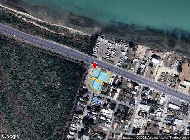
Property Record
1411 State Highway 100, Laguna Heights, TX 78578
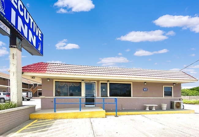
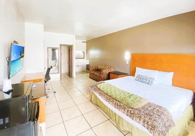
This Property Is For Sale
NEARBY LISTINGS FOR SALE OR LEASE
-
-
View all Laguna Heights listings for sale on LoopNet.com
Property Detail
1411 State Highway 100
Brownsville-Harlingen, TX
Rutherford- Harding Addition
727500-0800-001000
LOT 1,2,3,4,20,21,22 & 16 ALLEY BLK 8 RUTHERFORD- HARDING ADDITION
Commercialnec
Cameron
X
Texas
48061C0500F
1,2
2024
0.37 AC
2025
Brownsville
014202
Brownsville/Harlingen
23,936 SF
DEMOGRAPHICS near 1411 State Highway 100
1 Mile
3 Mile
5 Mile
2024 Total Population
620
5,902
10,754
2029 Population
612
5,971
11,016
Pop Growth 2024-2029
(1.29%)
+ 1.17%
+ 2.44%
Average Age
32
41
44
2024 Total Households
167
2,188
4,251
HH Growth 2024-2029
(1.80%)
+ 1.55%
+ 3.03%
Median Household Inc
$27,777
$46,402
$53,520
Avg Household Size
3.40
2.60
2.50
2024 Avg HH Vehicles
1.00
2.00
2.00
Median Home Value
$55,101
$172,663
$205,693
Median Year Built
1985
1987
1987
Nearby Places
- Restaurants
- Banks
- Shops
- Fitness
- Groceries
PUBLIC TRANSPORTATION
AIRPORT
Brownsville/South Padre Island International
DRIVE
WALK
Distance
Brownsville/South Padre Island International
28 min
21.6 mi
Valley International
DRIVE
WALK
Distance
Valley International
49 min
34.5 mi
Freight Ports
Port of Brownsville
DRIVE
WALK
Distance
Port of Brownsville
20 min
17.8 mi
Nearby Properties
Address
Land Use
TOTAL SIZE
Lot Size
Zoning
Address
Land Use
TOTAL SIZE
Lot Size
Zoning
194,092 SF
40 AC
C
Address
Land Use
TOTAL SIZE
Lot Size
Zoning
90,794 SF
22.76 AC
C
Address
Land Use
TOTAL SIZE
Lot Size
Zoning
159,538 SF
22.34 AC
Address
Land Use
TOTAL SIZE
Lot Size
Zoning
78,345 SF
7.05 AC
A-C
Address
Land Use
TOTAL SIZE
Lot Size
Zoning
62,486 SF
9.83 AC
C
Address
Land Use
TOTAL SIZE
Lot Size
Zoning
92,749 SF
8.58 AC
Address
Land Use
TOTAL SIZE
Lot Size
Zoning
48,150 SF
3.14 AC
C
Address
Land Use
TOTAL SIZE
Lot Size
Zoning
78,361 SF
9.60 AC
B
Address
Land Use
TOTAL SIZE
Lot Size
Zoning
45,591 SF
3.36 AC
Address
Land Use
TOTAL SIZE
Lot Size
Zoning
48,596 SF
4.73 AC
C
Address
Land Use
TOTAL SIZE
Lot Size
Zoning
17,616 SF
1.13 AC
C
Address
Land Use
TOTAL SIZE
Lot Size
Zoning
14,991 SF
1.37 AC
Address
Land Use
TOTAL SIZE
Lot Size
Zoning
48,152 SF
2.27 AC
Address
Land Use
TOTAL SIZE
Lot Size
Zoning
21,756 SF
2.48 AC
Address
Land Use
TOTAL SIZE
Lot Size
Zoning
6,329 SF
1.35 AC
Address
Land Use
TOTAL SIZE
Lot Size
Zoning
25,257 SF
2.72 AC
C
Address
Land Use
TOTAL SIZE
Lot Size
Zoning
11,100 SF
0.94 AC
Address
Land Use
TOTAL SIZE
Lot Size
Zoning
53,100 SF
2.27 AC
C
Address
Land Use
TOTAL SIZE
Lot Size
Zoning
16,700 SF
2.12 AC
Address
Land Use
TOTAL SIZE
Lot Size
Zoning
37,566 SF
2.46 AC
Address
Land Use
TOTAL SIZE
Lot Size
Zoning
10,306 SF
0.85 AC
C
Address
Land Use
TOTAL SIZE
Lot Size
Zoning
2,356 SF
1.82 AC
Address
Land Use
TOTAL SIZE
Lot Size
Zoning
6,430 SF
1.54 AC
Address
Land Use
TOTAL SIZE
Lot Size
Zoning
23,802 SF
3.24 AC
Address
Land Use
TOTAL SIZE
Lot Size
Zoning
15,270 SF
0.66 AC
Address
Land Use
TOTAL SIZE
Lot Size
Zoning
19,421 SF
1.88 AC
C
Address
Land Use
TOTAL SIZE
Lot Size
Zoning
46,577 SF
5.38 AC
Address
Land Use
TOTAL SIZE
Lot Size
Zoning
4,420 SF
1.02 AC
Address
Land Use
TOTAL SIZE
Lot Size
Zoning
19,162 SF
1.23 AC
C
Address
Land Use
TOTAL SIZE
Lot Size
Zoning
8,181 SF
0.90 AC
C
The World's #1 Commercial Real Estate Marketplace
Connect with us
© 2025 CoStar Group
The information above has been obtained from sources believed reliable. While we do not doubt its accuracy we have not verified it and make no guarantee, warranty or representation about it. It is your responsibility to independently confirm its accuracy and completeness. Any projections, opinions, assumptions, or estimates used are for example only and do not represent the current or future performance of the property. The value of this transaction to you depends on tax and other factors which should be evaluated by your tax, financial, and legal advisors. You and your advisors should conduct a careful, independent investigation of the property to determine to your satisfaction the suitability of the property for your needs.