Property Record
14110 Grand Pre Rd, Silver Spring, MD 20906


Property Detail
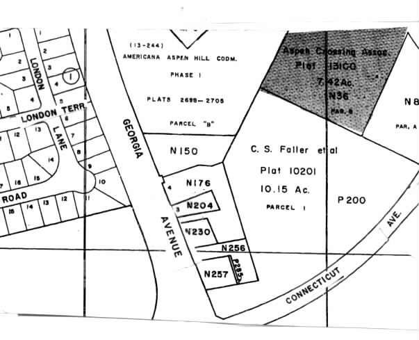
14110 Grand Pre Rd
13-02010168
PAR 6 GATE OF HEAVEN
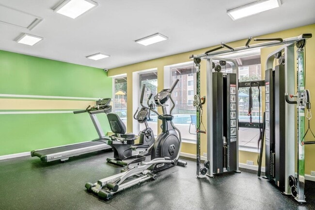
Apartment
Montgomery
R20
Maryland
B and X Area of moderate flood hazard, usually the area between the limits of the 100-year and 500-year floods.
6
2024
7.42 AC
2025
Aspen Hill
703213
Washington, DC
188,160 SF
Washington-Arlington-Alexandria, DC-VA-MD-WV
NEARBY LISTINGS FOR SALE OR LEASE
-
-
View all Silver Spring listings for sale on LoopNet.com
DEMOGRAPHICS near 14110 Grand Pre Rd
1 mile
3 mile
5 mile
2025 Total Population
27,815
140,317
321,138
2030 Population
28,652
144,014
330,370
Pop Growth 2025-2030
+ 3.01%
+ 2.63%
+ 2.87%
Average Age
40
42
42
2025 Total Households
9,689
47,924
117,243
HH Growth 2025-2030
+ 3.12%
+ 2.72%
+ 2.92%
Median Household Inc
$73,914
$105,900
$119,486
Avg Household Size
2.70
2.80
2.60
2025 Avg HH Vehicles
2.00
2.00
2.00
Median Home Value
$451,728
$513,717
$622,769
Median Year Built
1973
1969
1974
Nearby Places
Map Layers
Map Styles
 Street
 Aerial
Layers
 Traffic
 Biking
Places
Listings with unknown addresses are not visible on the map
- Restaurants
- Banks
- Shops
- Fitness
- Groceries
PUBLIC TRANSPORTATION
COMMUTER RAIL
Rockville (BRUNSWICK - WASHINGTON - Maryland Area Regional Commuter Trains (The MARC), Brunswick Line - Maryland Area Regional Commuter Trains (The MARC))
Drive
Walk
Distance
Rockville (BRUNSWICK - WASHINGTON - Maryland Area Regional Commuter Trains (The MARC), Brunswick Line - Maryland Area Regional Commuter Trains (The MARC))
11 min
5.0 mi
Garrett Park Marc Eb (BRUNSWICK - WASHINGTON - Maryland Transit Administration)
Drive
Walk
Distance
Garrett Park Marc Eb (BRUNSWICK - WASHINGTON - Maryland Transit Administration)
12 min
6.0 mi
AIRPORT
Ronald Reagan Washington Ntl
Drive
Walk
Distance
Ronald Reagan Washington Ntl
37 min
19.5 mi
Washington Dulles International
Drive
Walk
Distance
Washington Dulles International
51 min
30.3 mi
Baltimore/Washington International Thurgood Marshall
Drive
Walk
Distance
Baltimore/Washington International Thurgood Marshall
42 min
31.6 mi
Freight Ports
Port of Baltimore
Drive
Walk
Distance
Port of Baltimore
47 min
34.5 mi
Nearby Properties
Address
Land Use
TOTAL SIZE
Lot Size
Zoning
Address
Land Use
TOTAL SIZE
Lot Size
Zoning
1,332,482 SF
3.79 AC
CR2.0
Address
Land Use
TOTAL SIZE
Lot Size
Zoning
515,000 SF
5.23 AC
CR1.5
Address
Land Use
TOTAL SIZE
Lot Size
Zoning
431,630 SF
25.77 AC
R60
Address
Land Use
TOTAL SIZE
Lot Size
Zoning
223,520 SF
2.77 AC
CR2.0
Address
Land Use
TOTAL SIZE
Lot Size
Zoning
330,650 SF
2.89 AC
MXTD
Address
Land Use
TOTAL SIZE
Lot Size
Zoning
643,335 SF
29.18 AC
R20
Address
Land Use
TOTAL SIZE
Lot Size
Zoning
515,740 SF
19.97 AC
R20
Address
Land Use
TOTAL SIZE
Lot Size
Zoning
152,330 SF
CR
Address
Land Use
TOTAL SIZE
Lot Size
Zoning
258,000 SF
6.34 AC
PRC
Address
Land Use
TOTAL SIZE
Lot Size
Zoning
164,764 SF
15.42 AC
NR0.7
Address
Land Use
TOTAL SIZE
Lot Size
Zoning
316,973 SF
29.64 AC
R90
Address
Land Use
TOTAL SIZE
Lot Size
Zoning
131,521 SF
13.40 AC
PRC
Address
Land Use
TOTAL SIZE
Lot Size
Zoning
202,300 SF
4.01 AC
MXB
Address
Land Use
TOTAL SIZE
Lot Size
Zoning
294,082 SF
12.18 AC
R20
Address
Land Use
TOTAL SIZE
Lot Size
Zoning
427,500 SF
25.70 AC
R30
Address
Land Use
TOTAL SIZE
Lot Size
Zoning
195,864 SF
2.85 AC
PDTC
Address
Land Use
TOTAL SIZE
Lot Size
Zoning
425,295 SF
15.72 AC
CRT22
Address
Land Use
TOTAL SIZE
Lot Size
Zoning
215,937 SF
2.91 AC
CR2.0
Address
Land Use
TOTAL SIZE
Lot Size
Zoning
321,840 SF
13.95 AC
R20
Address
Land Use
TOTAL SIZE
Lot Size
Zoning
283,516 SF
9.18 AC
R90
Address
Land Use
TOTAL SIZE
Lot Size
Zoning
332,133 SF
28.24 AC
R90
Address
Land Use
TOTAL SIZE
Lot Size
Zoning
202,544 SF
14.56 AC
CRT1.
Address
Land Use
TOTAL SIZE
Lot Size
Zoning
161,369 SF
12.37 AC
RS
Address
Land Use
TOTAL SIZE
Lot Size
Zoning
258,694 SF
19.52 AC
R90
Address
Land Use
TOTAL SIZE
Lot Size
Zoning
262,984 SF
7.58 AC
R20
Address
Land Use
TOTAL SIZE
Lot Size
Zoning
387,943 SF
8.91 AC
R60
Address
Land Use
TOTAL SIZE
Lot Size
Zoning
122,322 SF
9.88 AC
R60
Address
Land Use
TOTAL SIZE
Lot Size
Zoning
74,243 SF
5.48 AC
NR0.7
Address
Land Use
TOTAL SIZE
Lot Size
Zoning
193,794 SF
11.77 AC
CRT1.
The World's #1 Commercial Real Estate Marketplace
Connect with us
© 2026 CoStar Group
The information above has been obtained from sources believed reliable. While we do not doubt its accuracy we have not verified it and make no guarantee, warranty or representation about it. It is your responsibility to independently confirm its accuracy and completeness. Any projections, opinions, assumptions, or estimates used are for example only and do not represent the current or future performance of the property. The value of this transaction to you depends on tax and other factors which should be evaluated by your tax, financial, and legal advisors. You and your advisors should conduct a careful, independent investigation of the property to determine to your satisfaction the suitability of the property for your needs.