Property Record
1413 E Hawthorne Rd, Spokane, WA 99218

Save to a Folder
{{folder.Name}}
{{folder.ListingIds.length}} Properties
{{folder.ListingIds.length}} Property
Create a New Folder
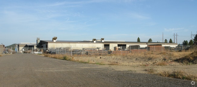
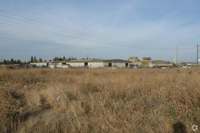
Property Detail
1413 E Hawthorne Rd
36166.9084
16 & 17-26-43: THAT PORTION OF THE NORTHEAST QUARTER OF SECTION 17, TOWNSHIP 26, RANGE 43 IN SPOKANE COUNTY WASHINGTON DESCRIBED AS FOLLOWS: BEGINNING AT THE NORTHEAST CORNER OF THE NORTHEAST QUARTER OF SAID SECTION; THENCE SOUTH ALONG THE EAST LINE
Industrialgeneral
SPOKANE
HI
Washington
B and X Area of moderate flood hazard, usually the area between the limits of the 100-year and 500-year floods.
41.68 AC
2026
NE North Metro
2026
Spokane
011203
Spokane-Spokane Valley, WA
247,669 SF
NEARBY LISTINGS FOR SALE OR LEASE
DEMOGRAPHICS near 1413 E Hawthorne Rd
1 mile
3 mile
5 mile
2025 Total Population
3,996
57,241
147,319
2030 Population
4,162
58,291
149,562
Pop Growth 2025-2030
+ 4.15%
+ 1.83%
+ 1.52%
Average Age
38
40
40
2025 Total Households
1,666
22,670
56,939
HH Growth 2025-2030
+ 4.14%
+ 1.84%
+ 1.51%
Median Household Inc
$72,624
$68,891
$74,417
Avg Household Size
2.40
2.40
2.50
2025 Avg HH Vehicles
2.00
2.00
2.00
Median Home Value
$420,043
$409,747
$383,899
Median Year Built
1989
1984
1974
Nearby Places
Map Layers
Map Styles
 Street
 Aerial
Layers
 Traffic
 Biking
Places
Listings with unknown addresses are not visible on the map
- Restaurants
- Banks
- Shops
- Fitness
- Groceries
PUBLIC TRANSPORTATION
COMMUTER RAIL
Spokane (Empire Builder - Amtrak)
Drive
Walk
Distance
Spokane (Empire Builder - Amtrak)
19 min
7.7 mi
AIRPORT
Spokane International
Drive
Walk
Distance
Spokane International
29 min
14.1 mi
Freight Ports
Port of Everett
Drive
Walk
Distance
Port of Everett
356 min
309.7 mi
Nearby Properties
Address
Land Use
TOTAL SIZE
Lot Size
Zoning
Address
Land Use
TOTAL SIZE
Lot Size
Zoning
909,350 SF
92.96 AC
LDR
Address
Land Use
TOTAL SIZE
Lot Size
Zoning
456,984 SF
26.06 AC
O
Address
Land Use
TOTAL SIZE
Lot Size
Zoning
278,777 SF
5.47 AC
HDR
Address
Land Use
TOTAL SIZE
Lot Size
Zoning
345,187 SF
14.84 AC
MU
Address
Land Use
TOTAL SIZE
Lot Size
Zoning
696,382 SF
37.43 AC
LI
Address
Land Use
TOTAL SIZE
Lot Size
Zoning
316,001 SF
31.10 AC
GC
Address
Land Use
TOTAL SIZE
Lot Size
Zoning
90,004 SF
9.19 AC
MU
Address
Land Use
TOTAL SIZE
Lot Size
Zoning
215,231 SF
11.30 AC
HDR
Address
Land Use
TOTAL SIZE
Lot Size
Zoning
148,224 SF
4.98 AC
GC
Address
Land Use
TOTAL SIZE
Lot Size
Zoning
118,875 SF
4.18 AC
LDR
Address
Land Use
TOTAL SIZE
Lot Size
Zoning
166,390 SF
19.33 AC
MU
Address
Land Use
TOTAL SIZE
Lot Size
Zoning
141,474 SF
6.60 AC
RMF
Address
Land Use
TOTAL SIZE
Lot Size
Zoning
116,772 SF
8.56 AC
MU
Address
Land Use
TOTAL SIZE
Lot Size
Zoning
76,559 SF
7.11 AC
LDR
Address
Land Use
TOTAL SIZE
Lot Size
Zoning
136,780 SF
8.75 AC
RMF
Address
Land Use
TOTAL SIZE
Lot Size
Zoning
153,780 SF
10.31 AC
RMF
Address
Land Use
TOTAL SIZE
Lot Size
Zoning
150,061 SF
5.01 AC
GC
Address
Land Use
TOTAL SIZE
Lot Size
Zoning
131,469 SF
7.24 AC
RMF
Address
Land Use
TOTAL SIZE
Lot Size
Zoning
67,094 SF
9.33 AC
RSF
Address
Land Use
TOTAL SIZE
Lot Size
Zoning
120,789 SF
6.26 AC
HDR
Address
Land Use
TOTAL SIZE
Lot Size
Zoning
125,588 SF
12.84 AC
RMF
Address
Land Use
TOTAL SIZE
Lot Size
Zoning
183,704 SF
12.67 AC
RMF
Address
Land Use
TOTAL SIZE
Lot Size
Zoning
180,440 SF
13.94 AC
RMF
Address
Land Use
TOTAL SIZE
Lot Size
Zoning
142,448 SF
14.85 AC
RMF
Address
Land Use
TOTAL SIZE
Lot Size
Zoning
35,343 SF
5.31 AC
GC
Address
Land Use
TOTAL SIZE
Lot Size
Zoning
230,295 SF
22.41 AC
GC
Address
Land Use
TOTAL SIZE
Lot Size
Zoning
317,648 SF
36.25 AC
LDR
Address
Land Use
TOTAL SIZE
Lot Size
Zoning
255,696 SF
38.47 AC
LDR
Address
Land Use
TOTAL SIZE
Lot Size
Zoning
64,553 SF
11.91 AC
LDR
The World's #1 Commercial Real Estate Marketplace
Connect with us
© 2026 CoStar Group
The information above has been obtained from sources believed reliable. While we do not doubt its accuracy we have not verified it and make no guarantee, warranty or representation about it. It is your responsibility to independently confirm its accuracy and completeness. Any projections, opinions, assumptions, or estimates used are for example only and do not represent the current or future performance of the property. The value of this transaction to you depends on tax and other factors which should be evaluated by your tax, financial, and legal advisors. You and your advisors should conduct a careful, independent investigation of the property to determine to your satisfaction the suitability of the property for your needs.