Property Record
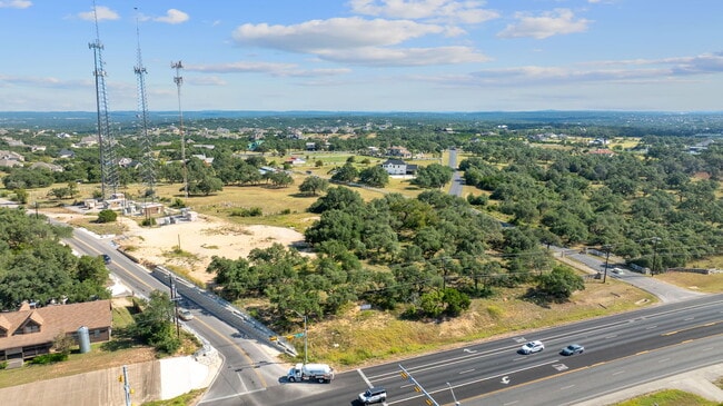
W Highway 290, Austin, TX 78737
This Property Is For Sale
NEARBY LISTINGS FOR SALE OR LEASE
Property Detail
W Highway 290
Austin-Round Rock-San Marcos, TX
E B Hargraves Survey
R15383
ABS 240 E B HARGRAVES SURVEY 7.155 AC GEO#90400761
Ruralagriculturalresidence
Hays
X
Texas
48453C0535J
7.16 AC
2024
Hays County
2025
Austin
010815
DEMOGRAPHICS near W Highway 290
1 mile
3 mile
5 mile
2024 Total Population
1,749
21,125
35,011
2029 Population
2,335
27,974
45,977
Pop Growth 2024-2029
+ 33.50%
+ 32.42%
+ 31.32%
Average Age
42
39
40
2024 Total Households
637
7,273
12,161
HH Growth 2024-2029
+ 34.54%
+ 33.45%
+ 32.30%
Median Household Inc
$124,137
$142,374
$140,876
Avg Household Size
2.70
2.90
2.90
2024 Avg HH Vehicles
2.00
2.00
2.00
Median Home Value
$645,186
$587,051
$624,139
Median Year Built
2006
2010
2009
Nearby Places
Map Layers
Map Styles
 Street
 Aerial
Transit
 Traffic
 Biking
Places
Listings with unknown addresses are not visible on the map
- Restaurants
- Banks
- Shops
- Fitness
- Groceries
PUBLIC TRANSPORTATION
AIRPORT
Austin-Bergstrom International
Drive
Walk
Distance
Austin-Bergstrom International
39 min
24.7 mi
Freight Ports
Calhoun Port
Drive
Walk
Distance
Calhoun Port
205 min
168.2 mi
Nearby Properties
Address
Land Use
TOTAL SIZE
Lot Size
Zoning
Address
Land Use
TOTAL SIZE
Lot Size
Zoning
399,662 SF
16.72 AC
Address
Land Use
TOTAL SIZE
Lot Size
Zoning
324,987 SF
8.29 AC
Address
Land Use
TOTAL SIZE
Lot Size
Zoning
191,928 SF
4.79 AC
Address
Land Use
TOTAL SIZE
Lot Size
Zoning
219,299 SF
4.89 AC
Address
Land Use
TOTAL SIZE
Lot Size
Zoning
275,753 SF
15.68 AC
Address
Land Use
TOTAL SIZE
Lot Size
Zoning
64,670 SF
13.53 AC
Address
Land Use
TOTAL SIZE
Lot Size
Zoning
231,472 SF
9.53 AC
Address
Land Use
TOTAL SIZE
Lot Size
Zoning
199,572 SF
9.63 AC
Address
Land Use
TOTAL SIZE
Lot Size
Zoning
103,045 SF
59.39 AC
Address
Land Use
TOTAL SIZE
Lot Size
Zoning
77,801 SF
14.49 AC
Address
Land Use
TOTAL SIZE
Lot Size
Zoning
121,400 SF
28.99 AC
Address
Land Use
TOTAL SIZE
Lot Size
Zoning
37,380 SF
4.35 AC
Address
Land Use
TOTAL SIZE
Lot Size
Zoning
Address
Land Use
TOTAL SIZE
Lot Size
Zoning
600 SF
12.61 AC
Address
Land Use
TOTAL SIZE
Lot Size
Zoning
33,145 SF
2.70 AC
Address
Land Use
TOTAL SIZE
Lot Size
Zoning
56.63 AC
Address
Land Use
TOTAL SIZE
Lot Size
Zoning
3 SF
14.51 AC
Address
Land Use
TOTAL SIZE
Lot Size
Zoning
82,488 SF
20.23 AC
Address
Land Use
TOTAL SIZE
Lot Size
Zoning
15,750 SF
1.94 AC
Address
Land Use
TOTAL SIZE
Lot Size
Zoning
Address
Land Use
TOTAL SIZE
Lot Size
Zoning
17,987 SF
12.07 AC
Address
Land Use
TOTAL SIZE
Lot Size
Zoning
Address
Land Use
TOTAL SIZE
Lot Size
Zoning
15,000 SF
8.73 AC
Address
Land Use
TOTAL SIZE
Lot Size
Zoning
4,844 SF
13.44 AC
Address
Land Use
TOTAL SIZE
Lot Size
Zoning
15,639 SF
2.10 AC
Address
Land Use
TOTAL SIZE
Lot Size
Zoning
2,280 SF
9.05 AC
Address
Land Use
TOTAL SIZE
Lot Size
Zoning
Address
Land Use
TOTAL SIZE
Lot Size
Zoning
20,860 SF
5.13 AC
Address
Land Use
TOTAL SIZE
Lot Size
Zoning
12,592 SF
3.74 AC
Address
Land Use
TOTAL SIZE
Lot Size
Zoning
8,221 SF
10.01 AC
The World's #1 Commercial Real Estate Marketplace
Connect with us
© 2026 CoStar Group
The information above has been obtained from sources believed reliable. While we do not doubt its accuracy we have not verified it and make no guarantee, warranty or representation about it. It is your responsibility to independently confirm its accuracy and completeness. Any projections, opinions, assumptions, or estimates used are for example only and do not represent the current or future performance of the property. The value of this transaction to you depends on tax and other factors which should be evaluated by your tax, financial, and legal advisors. You and your advisors should conduct a careful, independent investigation of the property to determine to your satisfaction the suitability of the property for your needs.