Property Record
1414 E 3850 S St S, St George, UT 84790
NEARBY LISTINGS FOR SALE OR LEASE
Property Detail
1414 E 3850 S St S
St. George, UT
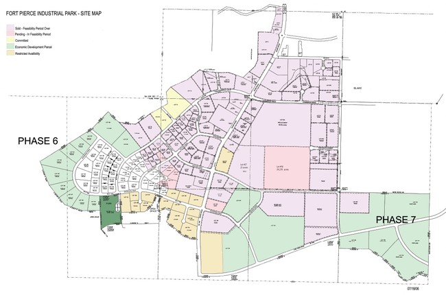
Fort Pierce Industrial Park
0500507
SUBDIVISION: FORT PIERCE INDUSTRIAL PARK (SG) LOT: 22 DESCRIBED AS: BEGINNING AT A POINT SOUTH 89*4542 WEST 704.10 FEET ALONG THE SOUTH BOUNDARY LINE FROM THE SOUTHEAST CORNER OF LOT 20 OF THE FORT PIERCE INDUSTRIAL PARK, SAID POINT BEING NORTH 0*161
Commercialnec
Washington
X
Utah
49053C1041G
22
2024
10.22 AC
2025
Cedar City & St George
271704
Other Market Areas
122,761 SF
DEMOGRAPHICS near 1414 E 3850 S St S
1 Mile
3 Mile
5 Mile
2024 Total Population
3,195
30,399
82,869
2029 Population
4,016
38,022
103,495
Pop Growth 2024-2029
+ 25.70%
+ 25.08%
+ 24.89%
Average Age
34
37
39
2024 Total Households
933
9,115
27,613
HH Growth 2024-2029
+ 26.15%
+ 25.54%
+ 25.44%
Median Household Inc
$78,561
$91,420
$67,051
Avg Household Size
3.40
3.30
2.90
2024 Avg HH Vehicles
2.00
2.00
2.00
Median Home Value
$464,916
$503,337
$454,253
Median Year Built
2010
2009
2004
Nearby Places
Map Layers
Map Styles
 Street
 Aerial
- Restaurants
- Banks
- Shops
- Fitness
- Groceries
PUBLIC TRANSPORTATION
AIRPORT
St George Regional
DRIVE
WALK
Distance
St George Regional
15 min
7.0 mi
Freight Ports
Port of Long Beach
DRIVE
WALK
Distance
Port of Long Beach
441 min
401.4 mi
Nearby Properties
Address
Land Use
TOTAL SIZE
Lot Size
Zoning
Address
Land Use
TOTAL SIZE
Lot Size
Zoning
823,767 SF
88.46 AC
Address
Land Use
TOTAL SIZE
Lot Size
Zoning
163,605 SF
13.51 AC
C3
Address
Land Use
TOTAL SIZE
Lot Size
Zoning
322,075 SF
26.62 AC
Address
Land Use
TOTAL SIZE
Lot Size
Zoning
1,063.96 AC
R110
Address
Land Use
TOTAL SIZE
Lot Size
Zoning
259,012 SF
22 AC
M-1
Address
Land Use
TOTAL SIZE
Lot Size
Zoning
173,917 SF
50 AC
M-1
Address
Land Use
TOTAL SIZE
Lot Size
Zoning
196,334 SF
22.87 AC
PDCOM
Address
Land Use
TOTAL SIZE
Lot Size
Zoning
152,090 SF
25 AC
M-1
Address
Land Use
TOTAL SIZE
Lot Size
Zoning
51,302 SF
56.23 AC
OST20
Address
Land Use
TOTAL SIZE
Lot Size
Zoning
87,750 SF
15.92 AC
Address
Land Use
TOTAL SIZE
Lot Size
Zoning
77,771 SF
6.02 AC
A1
Address
Land Use
TOTAL SIZE
Lot Size
Zoning
91,798 SF
5 AC
M-1
Address
Land Use
TOTAL SIZE
Lot Size
Zoning
169,923 SF
9.41 AC
Address
Land Use
TOTAL SIZE
Lot Size
Zoning
405 SF
407.69 AC
R110
Address
Land Use
TOTAL SIZE
Lot Size
Zoning
3,432 SF
57.26 AC
A20
Address
Land Use
TOTAL SIZE
Lot Size
Zoning
209,687 SF
7.54 AC
M-1
Address
Land Use
TOTAL SIZE
Lot Size
Zoning
56,572 SF
12 AC
Address
Land Use
TOTAL SIZE
Lot Size
Zoning
16,800 SF
250 AC
OS
Address
Land Use
TOTAL SIZE
Lot Size
Zoning
2,268 SF
49.03 AC
A20
Address
Land Use
TOTAL SIZE
Lot Size
Zoning
76,560 SF
2.32 AC
Address
Land Use
TOTAL SIZE
Lot Size
Zoning
63,519 SF
1.86 AC
Address
Land Use
TOTAL SIZE
Lot Size
Zoning
44,823 SF
6.05 AC
Address
Land Use
TOTAL SIZE
Lot Size
Zoning
97,357 SF
5.67 AC
M-1
Address
Land Use
TOTAL SIZE
Lot Size
Zoning
100,110 SF
8.48 AC
M-1
Address
Land Use
TOTAL SIZE
Lot Size
Zoning
57,607 SF
11.03 AC
M-1
Address
Land Use
TOTAL SIZE
Lot Size
Zoning
67,583 SF
2.99 AC
PDCOM
Address
Land Use
TOTAL SIZE
Lot Size
Zoning
22,954 SF
10.79 AC
The World's #1 Commercial Real Estate Marketplace
Connect with us
© 2026 CoStar Group
The information above has been obtained from sources believed reliable. While we do not doubt its accuracy we have not verified it and make no guarantee, warranty or representation about it. It is your responsibility to independently confirm its accuracy and completeness. Any projections, opinions, assumptions, or estimates used are for example only and do not represent the current or future performance of the property. The value of this transaction to you depends on tax and other factors which should be evaluated by your tax, financial, and legal advisors. You and your advisors should conduct a careful, independent investigation of the property to determine to your satisfaction the suitability of the property for your needs.