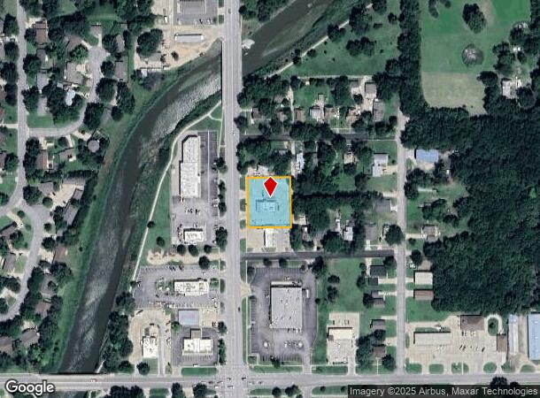
Property Record
1414 N Main St, Newton, KS 67114

NEARBY LISTINGS FOR SALE OR LEASE
Property Detail
1414 N Main St
Wichita, KS
Ragsdale's Add To Newton
093-08-0-40-11-008.00-0
RAGSDALE'S ADD TO NEWTON, S08, T23, R01E, S23 LT 5, ALL LTS 6-11, BLK 13
Restaurantdrivein
Harvey
X
Kansas
20079C0211E
5-11
2024
0.60 AC
2025
Newton/Hesston
030100
Wichita
2,282 SF
DEMOGRAPHICS near 1414 N Main St
1 Mile
3 Mile
5 Mile
2024 Total Population
7,278
20,113
21,478
2029 Population
7,258
20,019
21,356
Pop Growth 2024-2029
(0.27%)
(0.47%)
(0.57%)
Average Age
41
41
41
2024 Total Households
3,005
8,053
8,582
HH Growth 2024-2029
(0.37%)
(0.53%)
(0.63%)
Median Household Inc
$53,872
$60,500
$61,309
Avg Household Size
2.30
2.30
2.40
2024 Avg HH Vehicles
2.00
2.00
2.00
Median Home Value
$107,130
$125,532
$130,123
Median Year Built
1956
1963
1964
Nearby Places
Map Layers
Map Styles
 Street
 Aerial
- Restaurants
- Banks
- Shops
- Fitness
- Groceries
PUBLIC TRANSPORTATION
COMMUTER RAIL
Newton (Southwest Chief - Amtrak)
DRIVE
WALK
Distance
Newton (Southwest Chief - Amtrak)
1 min
15 min
0.8 mi
AIRPORT
Wichita Dwight D Eisenhower Ntl
DRIVE
WALK
Distance
Wichita Dwight D Eisenhower Ntl
42 min
33.1 mi
Freight Ports
Tulsa Port Of Catoosa
DRIVE
WALK
Distance
Tulsa Port Of Catoosa
234 min
219.1 mi
Nearby Properties
Address
Land Use
TOTAL SIZE
Lot Size
Zoning
Address
Land Use
TOTAL SIZE
Lot Size
Zoning
216,365 SF
56.60 AC
Address
Land Use
TOTAL SIZE
Lot Size
Zoning
3,400 SF
46.30 AC
Address
Land Use
TOTAL SIZE
Lot Size
Zoning
33,598 SF
4 AC
Address
Land Use
TOTAL SIZE
Lot Size
Zoning
145,392 SF
33 AC
R3
Address
Land Use
TOTAL SIZE
Lot Size
Zoning
81,340 SF
12.31 AC
Address
Land Use
TOTAL SIZE
Lot Size
Zoning
53,443 SF
11.52 AC
Address
Land Use
TOTAL SIZE
Lot Size
Zoning
61,740 SF
2.39 AC
Address
Land Use
TOTAL SIZE
Lot Size
Zoning
19,697 SF
0.15 AC
Address
Land Use
TOTAL SIZE
Lot Size
Zoning
51,225 SF
5.70 AC
R1
Address
Land Use
TOTAL SIZE
Lot Size
Zoning
49,910 SF
17.05 AC
R1
Address
Land Use
TOTAL SIZE
Lot Size
Zoning
52,180 SF
6.20 AC
R1
Address
Land Use
TOTAL SIZE
Lot Size
Zoning
49,644 SF
10.60 AC
R1
Address
Land Use
TOTAL SIZE
Lot Size
Zoning
36,685 SF
6.10 AC
Address
Land Use
TOTAL SIZE
Lot Size
Zoning
17,253 SF
2.30 AC
PO
Address
Land Use
TOTAL SIZE
Lot Size
Zoning
30,693 SF
29 AC
PO
Address
Land Use
TOTAL SIZE
Lot Size
Zoning
64,131 SF
1.60 AC
PO
Address
Land Use
TOTAL SIZE
Lot Size
Zoning
32,973 SF
1.40 AC
Address
Land Use
TOTAL SIZE
Lot Size
Zoning
27,268 SF
4.90 AC
Address
Land Use
TOTAL SIZE
Lot Size
Zoning
22,491 SF
1.36 AC
Address
Land Use
TOTAL SIZE
Lot Size
Zoning
8,670 SF
37.26 AC
Address
Land Use
TOTAL SIZE
Lot Size
Zoning
21,337 SF
1 AC
R1
Address
Land Use
TOTAL SIZE
Lot Size
Zoning
17,926 SF
0.14 AC
Address
Land Use
TOTAL SIZE
Lot Size
Zoning
16,735 SF
7.10 AC
R1
Address
Land Use
TOTAL SIZE
Lot Size
Zoning
29,115 SF
0.60 AC
Address
Land Use
TOTAL SIZE
Lot Size
Zoning
2,558 SF
2.82 AC
Address
Land Use
TOTAL SIZE
Lot Size
Zoning
42,160 SF
0.92 AC
PO
Address
Land Use
TOTAL SIZE
Lot Size
Zoning
93,229 SF
18.28 AC
Address
Land Use
TOTAL SIZE
Lot Size
Zoning
15,116 SF
2.50 AC
Address
Land Use
TOTAL SIZE
Lot Size
Zoning
18,431 SF
1.10 AC
Address
Land Use
TOTAL SIZE
Lot Size
Zoning
13,140 SF
1.50 AC
R3
The World's #1 Commercial Real Estate Marketplace
Connect with us
© 2025 CoStar Group
The information above has been obtained from sources believed reliable. While we do not doubt its accuracy we have not verified it and make no guarantee, warranty or representation about it. It is your responsibility to independently confirm its accuracy and completeness. Any projections, opinions, assumptions, or estimates used are for example only and do not represent the current or future performance of the property. The value of this transaction to you depends on tax and other factors which should be evaluated by your tax, financial, and legal advisors. You and your advisors should conduct a careful, independent investigation of the property to determine to your satisfaction the suitability of the property for your needs.