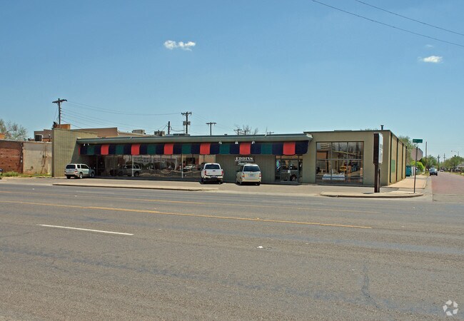
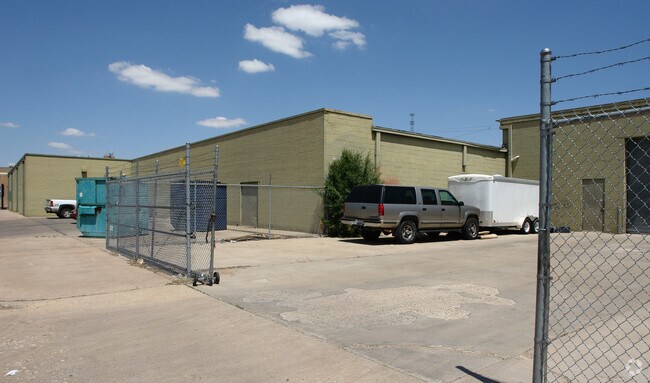
Property Record
1415 19Th St, Lubbock, TX 79401

Save to a Folder
{{folder.Name}}
{{folder.ListingIds.length}} Properties
{{folder.ListingIds.length}} Property
Create a New Folder
Property Detail
1415 19Th St
Lubbock, TX
MYRICK BLK 1 L 1 THRU 5
R104110
Lubbock
Commercialnec
Texas
B and X Area of moderate flood hazard, usually the area between the limits of the 100-year and 500-year floods.
5
2024
0.66 AC
2025
Southeast Inner Loop
001300
Lubbock
19,790 SF
NEARBY LISTINGS FOR SALE OR LEASE
DEMOGRAPHICS near 1415 19Th St
1 mile
3 mile
5 mile
2025 Total Population
10,400
76,768
160,163
2030 Population
10,993
79,894
166,159
Pop Growth 2025-2030
+ 5.70%
+ 4.07%
+ 3.74%
Average Age
35
34
35
2025 Total Households
4,060
27,869
60,817
HH Growth 2025-2030
+ 6.13%
+ 4.85%
+ 4.23%
Median Household Inc
$34,473
$39,210
$48,390
Avg Household Size
2.30
2.40
2.40
2025 Avg HH Vehicles
2.00
2.00
2.00
Median Home Value
$97,001
$110,071
$161,711
Median Year Built
1967
1966
1973
Nearby Places
Map Layers
Map Styles
 Street
 Aerial
Layers
 Traffic
 Biking
Places
Listings with unknown addresses are not visible on the map
- Restaurants
- Banks
- Shops
- Fitness
- Groceries
PUBLIC TRANSPORTATION
AIRPORT
Lubbock Preston Smith International
Drive
Walk
Distance
Lubbock Preston Smith International
23 min
12.0 mi
Nearby Properties
Address
Land Use
TOTAL SIZE
Lot Size
Zoning
Address
Land Use
TOTAL SIZE
Lot Size
Zoning
281,000 SF
6.19 AC
Address
Land Use
TOTAL SIZE
Lot Size
Zoning
21,110 SF
13.02 AC
Address
Land Use
TOTAL SIZE
Lot Size
Zoning
179,627 SF
2.66 AC
Address
Land Use
TOTAL SIZE
Lot Size
Zoning
122,016 SF
1.13 AC
Address
Land Use
TOTAL SIZE
Lot Size
Zoning
122,976 SF
14.50 AC
Address
Land Use
TOTAL SIZE
Lot Size
Zoning
396,570 SF
2.56 AC
Address
Land Use
TOTAL SIZE
Lot Size
Zoning
176,165 SF
36.61 AC
Address
Land Use
TOTAL SIZE
Lot Size
Zoning
64,800 SF
0.94 AC
Address
Land Use
TOTAL SIZE
Lot Size
Zoning
153,416 SF
3.14 AC
Address
Land Use
TOTAL SIZE
Lot Size
Zoning
92,624 SF
2.77 AC
Address
Land Use
TOTAL SIZE
Lot Size
Zoning
202,206 SF
18.86 AC
Address
Land Use
TOTAL SIZE
Lot Size
Zoning
143,905 SF
0.28 AC
Address
Land Use
TOTAL SIZE
Lot Size
Zoning
324.17 AC
Address
Land Use
TOTAL SIZE
Lot Size
Zoning
7.68 AC
Address
Land Use
TOTAL SIZE
Lot Size
Zoning
64,317 SF
4.50 AC
Address
Land Use
TOTAL SIZE
Lot Size
Zoning
625.50 AC
Address
Land Use
TOTAL SIZE
Lot Size
Zoning
77,404 SF
1.84 AC
Address
Land Use
TOTAL SIZE
Lot Size
Zoning
115,670 SF
2.28 AC
Address
Land Use
TOTAL SIZE
Lot Size
Zoning
36,684 SF
2.06 AC
Address
Land Use
TOTAL SIZE
Lot Size
Zoning
52,020 SF
0.86 AC
Address
Land Use
TOTAL SIZE
Lot Size
Zoning
40,258 SF
0.99 AC
Address
Land Use
TOTAL SIZE
Lot Size
Zoning
81,688 SF
2 AC
Address
Land Use
TOTAL SIZE
Lot Size
Zoning
213,611 SF
30.10 AC
Address
Land Use
TOTAL SIZE
Lot Size
Zoning
88,998 SF
7.56 AC
Address
Land Use
TOTAL SIZE
Lot Size
Zoning
253,852 SF
17.98 AC
Address
Land Use
TOTAL SIZE
Lot Size
Zoning
27,958 SF
Address
Land Use
TOTAL SIZE
Lot Size
Zoning
421,200 SF
43.22 AC
Address
Land Use
TOTAL SIZE
Lot Size
Zoning
33,840 SF
2.50 AC
Address
Land Use
TOTAL SIZE
Lot Size
Zoning
100,620 SF
2.64 AC
Address
Land Use
TOTAL SIZE
Lot Size
Zoning
75,296 SF
2.21 AC
The World's #1 Commercial Real Estate Marketplace
Connect with us
© 2026 CoStar Group
The information above has been obtained from sources believed reliable. While we do not doubt its accuracy we have not verified it and make no guarantee, warranty or representation about it. It is your responsibility to independently confirm its accuracy and completeness. Any projections, opinions, assumptions, or estimates used are for example only and do not represent the current or future performance of the property. The value of this transaction to you depends on tax and other factors which should be evaluated by your tax, financial, and legal advisors. You and your advisors should conduct a careful, independent investigation of the property to determine to your satisfaction the suitability of the property for your needs.