Property Record
1415 Highway 85 N, Fayetteville, GA 30214

NEARBY LISTINGS FOR SALE OR LEASE
Property Detail
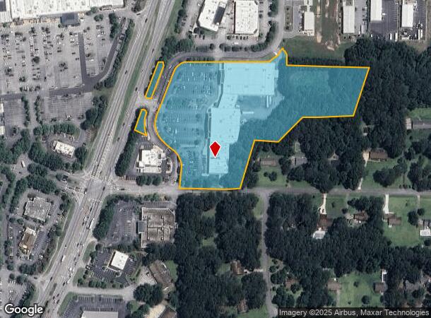
1415 Highway 85 N
05-38-00-024
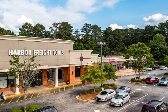
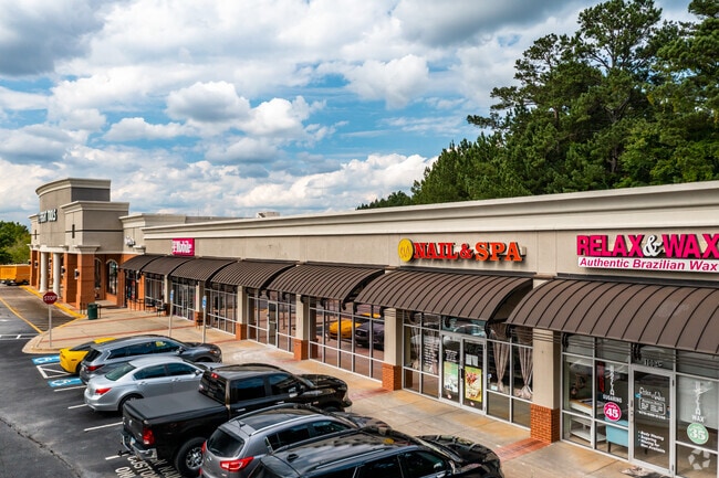
LINENS & THINGS/BARNES & NOBLE
Regionalshoppingcenterormallwithanchorstore
Fayette
X
Georgia
13063C0131F
185
0
8.58 AC
2024
Fayette/Peachtree
140102
Atlanta
71,768 SF
Atlanta-Sandy Springs-Roswell, GA
DEMOGRAPHICS near 1415 Highway 85 N
1 Mile
3 Mile
5 Mile
2024 Total Population
963
31,572
106,520
2029 Population
1,023
32,658
108,968
Pop Growth 2024-2029
+ 6.23%
+ 3.44%
+ 2.30%
Average Age
44
41
39
2024 Total Households
349
11,711
37,681
HH Growth 2024-2029
+ 6.30%
+ 3.61%
+ 2.39%
Median Household Inc
$69,090
$63,429
$67,498
Avg Household Size
2.60
2.60
2.80
2024 Avg HH Vehicles
3.00
2.00
2.00
Median Home Value
$263,461
$241,379
$237,841
Median Year Built
1984
1987
1990
Nearby Places
Map Layers
Map Styles
 Street
 Aerial
- Restaurants
- Banks
- Shops
- Fitness
- Groceries
PUBLIC TRANSPORTATION
AIRPORT
Hartsfield - Jackson Atlanta International
DRIVE
WALK
Distance
Hartsfield - Jackson Atlanta International
23 min
13.1 mi
Freight Ports
Georgia Ports - Savannah
DRIVE
WALK
Distance
Georgia Ports - Savannah
275 min
238.0 mi
SALE & LEASE HISTORY
LISTING DATE
SALE/LEASE

Sep 25, 2016
For Lease
May 29, 2018
For Sale
May 26, 2021
For Sale
Nearby Properties
Address
Land Use
TOTAL SIZE
Lot Size
Zoning
Address
Land Use
TOTAL SIZE
Lot Size
Zoning
565,679 SF
288.50 AC
PCD
Address
Land Use
TOTAL SIZE
Lot Size
Zoning
194.98 AC
PCD
Address
Land Use
TOTAL SIZE
Lot Size
Zoning
224,116 SF
41.20 AC
MUC
Address
Land Use
TOTAL SIZE
Lot Size
Zoning
197,026 SF
28 AC
Address
Land Use
TOTAL SIZE
Lot Size
Zoning
88,509 SF
31.54 AC
C C3
Address
Land Use
TOTAL SIZE
Lot Size
Zoning
151,194 SF
11.59 AC
C PUD
Address
Land Use
TOTAL SIZE
Lot Size
Zoning
230,474 SF
288.50 AC
PCD
Address
Land Use
TOTAL SIZE
Lot Size
Zoning
80,942 SF
44.16 AC
C CH
Address
Land Use
TOTAL SIZE
Lot Size
Zoning
256 SF
25 AC
PUD
Address
Land Use
TOTAL SIZE
Lot Size
Zoning
232,852 SF
35.39 AC
C C3
Address
Land Use
TOTAL SIZE
Lot Size
Zoning
158,310 SF
4.76 AC
C C1
Address
Land Use
TOTAL SIZE
Lot Size
Zoning
260,883 SF
21.30 AC
C C3
Address
Land Use
TOTAL SIZE
Lot Size
Zoning
160 SF
19.95 AC
RM
Address
Land Use
TOTAL SIZE
Lot Size
Zoning
111,198 SF
8.94 AC
C C1
Address
Land Use
TOTAL SIZE
Lot Size
Zoning
92,550 SF
10.70 AC
C C1
Address
Land Use
TOTAL SIZE
Lot Size
Zoning
120,793 SF
5.60 AC
C PUD
Address
Land Use
TOTAL SIZE
Lot Size
Zoning
112,650 SF
22.78 AC
C RMF15
Address
Land Use
TOTAL SIZE
Lot Size
Zoning
132,197 SF
18 AC
C RMF15
Address
Land Use
TOTAL SIZE
Lot Size
Zoning
220,887 SF
24.70 AC
Address
Land Use
TOTAL SIZE
Lot Size
Zoning
35,356 SF
2.01 AC
C C1
Address
Land Use
TOTAL SIZE
Lot Size
Zoning
210,122 SF
16.77 AC
C C3
Address
Land Use
TOTAL SIZE
Lot Size
Zoning
184,862 SF
21.90 AC
C C3
Address
Land Use
TOTAL SIZE
Lot Size
Zoning
127,836 SF
14.33 AC
C CH
Address
Land Use
TOTAL SIZE
Lot Size
Zoning
135,115 SF
32.15 AC
Address
Land Use
TOTAL SIZE
Lot Size
Zoning
199,132 SF
19.59 AC
C PUD
Address
Land Use
TOTAL SIZE
Lot Size
Zoning
136,320 SF
19.51 AC
C C3
Address
Land Use
TOTAL SIZE
Lot Size
Zoning
75,043 SF
3.20 AC
HC
Address
Land Use
TOTAL SIZE
Lot Size
Zoning
Address
Land Use
TOTAL SIZE
Lot Size
Zoning
65,951 SF
6.70 AC
C C3
Address
Land Use
TOTAL SIZE
Lot Size
Zoning
75,750 SF
10.43 AC
C C3
The World's #1 Commercial Real Estate Marketplace
Connect with us
© 2025 CoStar Group
The information above has been obtained from sources believed reliable. While we do not doubt its accuracy we have not verified it and make no guarantee, warranty or representation about it. It is your responsibility to independently confirm its accuracy and completeness. Any projections, opinions, assumptions, or estimates used are for example only and do not represent the current or future performance of the property. The value of this transaction to you depends on tax and other factors which should be evaluated by your tax, financial, and legal advisors. You and your advisors should conduct a careful, independent investigation of the property to determine to your satisfaction the suitability of the property for your needs.