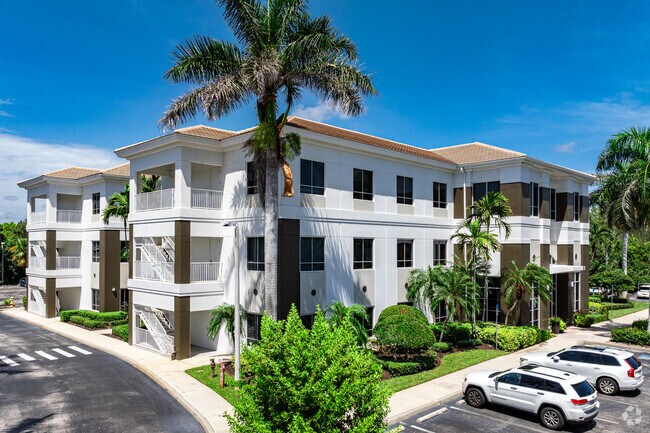
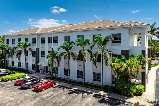
Property Record
1415 Panther Ln, Naples, FL 34109

NEARBY LISTINGS FOR SALE OR LEASE
Property Detail
1415 Panther Ln
00240280703
Acreage Header
Officebuilding
10 49 25 UNRECD BLDG B PINE RIDGE COMMONS PUD DESC AS COMM AT SLY 1/4 CNR SEC 10, N01DEG W 69.79FT, S89DEG W 9.57FT, NELY 454.08FT, N07DEG E 861.19 FT, SELY 39.25FT, S 37DEG E 35.34FT, S82DEG E 106.99FT, SELY 164.02FT, S70DEG E 83.82 FT TO POB, N19DE
AH
Collier
12021C0383J
Florida
2024
2.06 AC
2025
North Naples
010216
Southwest Florida
13,050 SF
Naples-Immokalee-Marco Island, FL
DEMOGRAPHICS near 1415 Panther Ln
1 Mile
3 Mile
5 Mile
2024 Total Population
5,992
53,833
108,864
2029 Population
6,845
61,870
124,265
Pop Growth 2024-2029
+ 14.24%
+ 14.93%
+ 14.15%
Average Age
49
56
53
2024 Total Households
2,741
26,398
50,810
HH Growth 2024-2029
+ 14.05%
+ 14.71%
+ 14.04%
Median Household Inc
$70,257
$99,304
$90,249
Avg Household Size
2.00
1.90
2.00
2024 Avg HH Vehicles
2.00
2.00
2.00
Median Home Value
$410,470
$760,457
$652,419
Median Year Built
1985
1991
1992
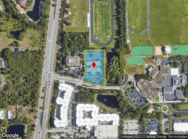
Nearby Places
Map Layers
Map Styles
 Street
 Aerial
- Restaurants
- Banks
- Shops
- Fitness
- Groceries
SALE & LEASE HISTORY
LISTING DATE
SALE/LEASE

Oct 25, 2016
For Lease
Mar 30, 2017
For Lease
Nearby Properties
Address
Land Use
TOTAL SIZE
Lot Size
Zoning
Address
Land Use
TOTAL SIZE
Lot Size
Zoning
688,632 SF
29.28 AC
A
Address
Land Use
TOTAL SIZE
Lot Size
Zoning
905,326 SF
69.45 AC
GC
Address
Land Use
TOTAL SIZE
Lot Size
Zoning
735,070 SF
41.34 AC
A
Address
Land Use
TOTAL SIZE
Lot Size
Zoning
411,909 SF
181.63 AC
RSF-3
Address
Land Use
TOTAL SIZE
Lot Size
Zoning
123,282 SF
6.50 AC
PUD
Address
Land Use
TOTAL SIZE
Lot Size
Zoning
250,674 SF
33.61 AC
NAPLES
Address
Land Use
TOTAL SIZE
Lot Size
Zoning
398,094 SF
17.31 AC
A
Address
Land Use
TOTAL SIZE
Lot Size
Zoning
216,788 SF
85.21 AC
PUD
Address
Land Use
TOTAL SIZE
Lot Size
Zoning
363,275 SF
21.02 AC
PUD
Address
Land Use
TOTAL SIZE
Lot Size
Zoning
218,013 SF
77.73 AC
A
Address
Land Use
TOTAL SIZE
Lot Size
Zoning
418,075 SF
38.19 AC
Address
Land Use
TOTAL SIZE
Lot Size
Zoning
292,967 SF
13.12 AC
PUD
Address
Land Use
TOTAL SIZE
Lot Size
Zoning
453,819 SF
4.53 AC
Address
Land Use
TOTAL SIZE
Lot Size
Zoning
256,507 SF
26.32 AC
PUD
Address
Land Use
TOTAL SIZE
Lot Size
Zoning
72,844 SF
15.94 AC
RSF-1
Address
Land Use
TOTAL SIZE
Lot Size
Zoning
277,290 SF
31.01 AC
PUD
Address
Land Use
TOTAL SIZE
Lot Size
Zoning
255,522 SF
21.83 AC
NAPLES
Address
Land Use
TOTAL SIZE
Lot Size
Zoning
82,382 SF
9.98 AC
PUD
Address
Land Use
TOTAL SIZE
Lot Size
Zoning
363,194 SF
2.51 AC
A
Address
Land Use
TOTAL SIZE
Lot Size
Zoning
134,551 SF
19.50 AC
PUD
Address
Land Use
TOTAL SIZE
Lot Size
Zoning
145,061 SF
18.82 AC
PUD
Address
Land Use
TOTAL SIZE
Lot Size
Zoning
164,004 SF
2.66 AC
Address
Land Use
TOTAL SIZE
Lot Size
Zoning
133,302 SF
3.82 AC
NAPLES
Address
Land Use
TOTAL SIZE
Lot Size
Zoning
100,375 SF
3.71 AC
Address
Land Use
TOTAL SIZE
Lot Size
Zoning
174,104 SF
13.36 AC
PUD
Address
Land Use
TOTAL SIZE
Lot Size
Zoning
99,700 SF
3.08 AC
Address
Land Use
TOTAL SIZE
Lot Size
Zoning
99,700 SF
3.05 AC
Address
Land Use
TOTAL SIZE
Lot Size
Zoning
223,844 SF
27.55 AC
PUD
Address
Land Use
TOTAL SIZE
Lot Size
Zoning
189,520 SF
9.98 AC
Address
Land Use
TOTAL SIZE
Lot Size
Zoning
153,644 SF
14.69 AC
PUD
The World's #1 Commercial Real Estate Marketplace
Connect with us
© 2025 CoStar Group
The information above has been obtained from sources believed reliable. While we do not doubt its accuracy we have not verified it and make no guarantee, warranty or representation about it. It is your responsibility to independently confirm its accuracy and completeness. Any projections, opinions, assumptions, or estimates used are for example only and do not represent the current or future performance of the property. The value of this transaction to you depends on tax and other factors which should be evaluated by your tax, financial, and legal advisors. You and your advisors should conduct a careful, independent investigation of the property to determine to your satisfaction the suitability of the property for your needs.