Property Record
1415 Raff Rd Sw, Canton, OH 44710
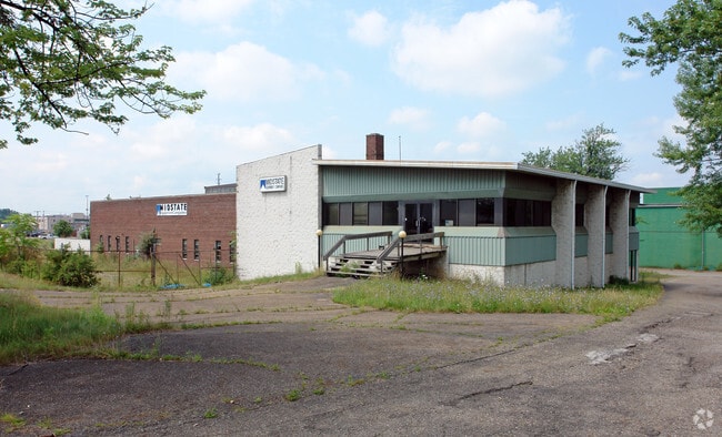


Property Detail
1415 Raff Rd Sw
01307274
18 NW 2.52A
Storebuilding
Stark
X
Ohio
39151C0216E
2.52 AC
0
Stark County
2025
Cleveland
713401
Canton-Massillon, OH
23,500 SF
NEARBY LISTINGS FOR SALE OR LEASE
DEMOGRAPHICS near 1415 Raff Rd Sw
1 mile
3 mile
5 mile
2024 Total Population
9,933
61,774
138,967
2029 Population
9,866
61,413
138,324
Pop Growth 2024-2029
(0.67%)
(0.58%)
(0.46%)
Average Age
40
40
41
2024 Total Households
4,252
26,617
60,211
HH Growth 2024-2029
(0.71%)
(0.61%)
(0.49%)
Median Household Inc
$46,975
$44,570
$47,849
Avg Household Size
2.20
2.20
2.20
2024 Avg HH Vehicles
2.00
2.00
2.00
Median Home Value
$74,005
$113,991
$129,971
Median Year Built
1950
1953
1957
Nearby Places
Map Layers
Map Styles
 Street
 Aerial
Transit
 Traffic
 Biking
Places
Listings with unknown addresses are not visible on the map
- Restaurants
- Banks
- Shops
- Fitness
- Groceries
PUBLIC TRANSPORTATION
AIRPORT
Akron-Canton Regional
Drive
Walk
Distance
Akron-Canton Regional
17 min
11.9 mi
SALE & LEASE HISTORY
LISTING DATE
SALE/LEASE

Jul 11, 2024
For Lease
Feb 27, 2018
For Lease
Nearby Properties
Address
Land Use
TOTAL SIZE
Lot Size
Zoning
Address
Land Use
TOTAL SIZE
Lot Size
Zoning
86,994 SF
35.20 AC
Address
Land Use
TOTAL SIZE
Lot Size
Zoning
551,338 SF
7.26 AC
Address
Land Use
TOTAL SIZE
Lot Size
Zoning
397,897 SF
3.76 AC
Address
Land Use
TOTAL SIZE
Lot Size
Zoning
521,112 SF
14.28 AC
Address
Land Use
TOTAL SIZE
Lot Size
Zoning
356,172 SF
4.06 AC
Address
Land Use
TOTAL SIZE
Lot Size
Zoning
194,249 SF
10.90 AC
Address
Land Use
TOTAL SIZE
Lot Size
Zoning
330,693 SF
14.29 AC
Address
Land Use
TOTAL SIZE
Lot Size
Zoning
433,773 SF
67.53 AC
Address
Land Use
TOTAL SIZE
Lot Size
Zoning
180,000 SF
Address
Land Use
TOTAL SIZE
Lot Size
Zoning
299,975 SF
18.92 AC
Address
Land Use
TOTAL SIZE
Lot Size
Zoning
194,249 SF
10.86 AC
Address
Land Use
TOTAL SIZE
Lot Size
Zoning
345,570 SF
29.76 AC
Address
Land Use
TOTAL SIZE
Lot Size
Zoning
168,731 SF
57.06 AC
Address
Land Use
TOTAL SIZE
Lot Size
Zoning
108,197 SF
8.19 AC
Address
Land Use
TOTAL SIZE
Lot Size
Zoning
118,619 SF
2.14 AC
Address
Land Use
TOTAL SIZE
Lot Size
Zoning
912,918 SF
266.76 AC
Address
Land Use
TOTAL SIZE
Lot Size
Zoning
117,601 SF
7.93 AC
Address
Land Use
TOTAL SIZE
Lot Size
Zoning
68,518 SF
40.92 AC
Address
Land Use
TOTAL SIZE
Lot Size
Zoning
107,248 SF
0.09 AC
Address
Land Use
TOTAL SIZE
Lot Size
Zoning
68,518 SF
9.27 AC
Address
Land Use
TOTAL SIZE
Lot Size
Zoning
423,783 SF
26.11 AC
Address
Land Use
TOTAL SIZE
Lot Size
Zoning
116,912 SF
18.85 AC
Address
Land Use
TOTAL SIZE
Lot Size
Zoning
316,099 SF
8.47 AC
Address
Land Use
TOTAL SIZE
Lot Size
Zoning
102,436 SF
4.95 AC
Address
Land Use
TOTAL SIZE
Lot Size
Zoning
158,390 SF
0.92 AC
Address
Land Use
TOTAL SIZE
Lot Size
Zoning
300,347 SF
14.78 AC
Address
Land Use
TOTAL SIZE
Lot Size
Zoning
61,884 SF
2.18 AC
Address
Land Use
TOTAL SIZE
Lot Size
Zoning
93,216 SF
4.93 AC
Address
Land Use
TOTAL SIZE
Lot Size
Zoning
0.35 AC
Address
Land Use
TOTAL SIZE
Lot Size
Zoning
89,344 SF
3.77 AC
The World's #1 Commercial Real Estate Marketplace
Connect with us
© 2026 CoStar Group
The information above has been obtained from sources believed reliable. While we do not doubt its accuracy we have not verified it and make no guarantee, warranty or representation about it. It is your responsibility to independently confirm its accuracy and completeness. Any projections, opinions, assumptions, or estimates used are for example only and do not represent the current or future performance of the property. The value of this transaction to you depends on tax and other factors which should be evaluated by your tax, financial, and legal advisors. You and your advisors should conduct a careful, independent investigation of the property to determine to your satisfaction the suitability of the property for your needs.