Property Record
14155 E Us Highway 24, Peyton, CO 80831

Property Detail
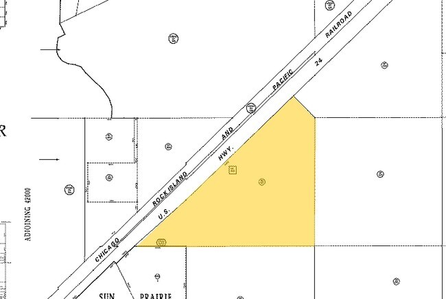
14155 E Us Highway 24
42330-00-021
PART OF SE4NW4 & PART OF SW4NW4 LY SELY OF HWY 24 & PART OF NE4NW4 LY SELY OF US HWY 24 & SWLY OF C/L OF R/W NO 1 DESC IN BK 2055-502
Commercialbuilding
EL PASO
CS
Colorado
AE The base floodplain where base flood elevations are provided. AE Zones are now used on new format FIRMs instead of A1-A30 Zones.
35.33 AC
2024
Southeast
2025
Colorado Springs
003914
Colorado Springs, CO
54,150 SF
NEARBY LISTINGS FOR SALE OR LEASE
DEMOGRAPHICS near 14155 E Us Highway 24
1 mile
3 mile
5 mile
2025 Total Population
657
21,396
30,896
2030 Population
679
21,973
31,719
Pop Growth 2025-2030
+ 3.35%
+ 2.70%
+ 2.66%
Average Age
36
36
37
2025 Total Households
207
6,523
9,823
HH Growth 2025-2030
+ 3.86%
+ 2.91%
+ 2.89%
Median Household Inc
$131,117
$140,091
$137,953
Avg Household Size
3.10
3.20
3.10
2025 Avg HH Vehicles
2.00
2.00
3.00
Median Home Value
$577,670
$607,284
$607,485
Median Year Built
2008
2008
2007
Nearby Places
Map Layers
Map Styles
 Street
 Aerial
Transit
 Traffic
 Biking
Places
Listings with unknown addresses are not visible on the map
- Restaurants
- Banks
- Shops
- Fitness
- Groceries
PUBLIC TRANSPORTATION
AIRPORT
City of Colorado Springs Municipal
Drive
Walk
Distance
City of Colorado Springs Municipal
26 min
13.8 mi
Nearby Properties
Address
Land Use
TOTAL SIZE
Lot Size
Zoning
Address
Land Use
TOTAL SIZE
Lot Size
Zoning
43,256 SF
4.49 AC
PUD
Address
Land Use
TOTAL SIZE
Lot Size
Zoning
43,256 SF
4.73 AC
Address
Land Use
TOTAL SIZE
Lot Size
Zoning
39,446 SF
10.71 AC
RR-5
Address
Land Use
TOTAL SIZE
Lot Size
Zoning
123,673 SF
9.98 AC
CR
Address
Land Use
TOTAL SIZE
Lot Size
Zoning
195,448 SF
19.86 AC
CR
Address
Land Use
TOTAL SIZE
Lot Size
Zoning
46,935 SF
13.62 AC
PUD
Address
Land Use
TOTAL SIZE
Lot Size
Zoning
16,915 SF
5.19 AC
PUD
Address
Land Use
TOTAL SIZE
Lot Size
Zoning
7,573 SF
757.70 AC
PUD R-4 R-
Address
Land Use
TOTAL SIZE
Lot Size
Zoning
16,455 SF
6.89 AC
A-35 RR-2.
Address
Land Use
TOTAL SIZE
Lot Size
Zoning
10,017 SF
1.50 AC
CR
Address
Land Use
TOTAL SIZE
Lot Size
Zoning
13,048 SF
1.63 AC
CR
Address
Land Use
TOTAL SIZE
Lot Size
Zoning
3,148 SF
0.58 AC
CR
Address
Land Use
TOTAL SIZE
Lot Size
Zoning
41,592 SF
8.59 AC
RR-5
Address
Land Use
TOTAL SIZE
Lot Size
Zoning
6,289 SF
2.04 AC
CC
Address
Land Use
TOTAL SIZE
Lot Size
Zoning
219.19 AC
PUD
Address
Land Use
TOTAL SIZE
Lot Size
Zoning
12,111 SF
2.54 AC
PUD
Address
Land Use
TOTAL SIZE
Lot Size
Zoning
29,113 SF
3.43 AC
CR
Address
Land Use
TOTAL SIZE
Lot Size
Zoning
26,235 SF
2.93 AC
CR
Address
Land Use
TOTAL SIZE
Lot Size
Zoning
22,680 SF
2.84 AC
CR
Address
Land Use
TOTAL SIZE
Lot Size
Zoning
326.51 AC
RR2
Address
Land Use
TOTAL SIZE
Lot Size
Zoning
55,980 SF
5.95 AC
CR
Address
Land Use
TOTAL SIZE
Lot Size
Zoning
160 AC
RR-5
Address
Land Use
TOTAL SIZE
Lot Size
Zoning
1.46 AC
CR
Address
Land Use
TOTAL SIZE
Lot Size
Zoning
29,494 SF
4.11 AC
CR
Address
Land Use
TOTAL SIZE
Lot Size
Zoning
9,566 SF
1.64 AC
CR
Address
Land Use
TOTAL SIZE
Lot Size
Zoning
16,139 SF
0.91 AC
PUD
Address
Land Use
TOTAL SIZE
Lot Size
Zoning
5,561 SF
280 AC
RR5
Address
Land Use
TOTAL SIZE
Lot Size
Zoning
4,123 SF
1.55 AC
CR
Address
Land Use
TOTAL SIZE
Lot Size
Zoning
1.46 AC
CS
The World's #1 Commercial Real Estate Marketplace
Connect with us
© 2026 CoStar Group
The information above has been obtained from sources believed reliable. While we do not doubt its accuracy we have not verified it and make no guarantee, warranty or representation about it. It is your responsibility to independently confirm its accuracy and completeness. Any projections, opinions, assumptions, or estimates used are for example only and do not represent the current or future performance of the property. The value of this transaction to you depends on tax and other factors which should be evaluated by your tax, financial, and legal advisors. You and your advisors should conduct a careful, independent investigation of the property to determine to your satisfaction the suitability of the property for your needs.