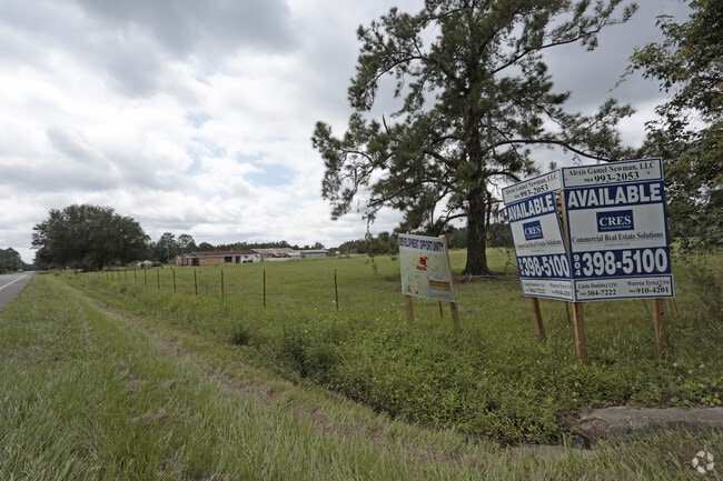
Property Record
14158 Lem Turner Rd, Jacksonville, FL 32218

NEARBY LISTINGS FOR SALE OR LEASE
Property Detail
14158 Lem Turner Rd
Jacksonville, FL
Section Land
019273-0000
20-1N-26E 1088.00 SEC 20-1N-26E PT SW1/4 OF SE1/4, SEC 29-1N-26E GOVT LOTS 1,2,5, PT NE1/4, SEC 30-1N-26E GOVT LOTS 1,2,3,4, PT W1/2, SEC 31-1N-26E W1/2 OF NE1/4, E1/2 OF NW1/4, PT SEC 37-1N-26E CHARLES BROWARD GRANT RECD O/R 12191-309
Pasture
Duval
A
Florida
12031C0176H
1,2,5
2025
1,080.77 AC
2026
Northwest Jacksonville
010501
Jacksonville (Florida)
3,273 SF
DEMOGRAPHICS near 14158 Lem Turner Rd
1 Mile
3 Mile
5 Mile
2024 Total Population
205
9,190
47,572
2029 Population
224
9,770
50,562
Pop Growth 2024-2029
+ 9.27%
+ 6.31%
+ 6.29%
Average Age
42
38
39
2024 Total Households
75
3,213
17,714
HH Growth 2024-2029
+ 9.33%
+ 6.50%
+ 6.47%
Median Household Inc
$92,045
$74,532
$56,852
Avg Household Size
2.60
2.80
2.60
2024 Avg HH Vehicles
2.00
2.00
2.00
Median Home Value
$325,000
$241,930
$196,442
Median Year Built
2010
2006
1995
Nearby Places
Map Layers
Map Styles
 Street
 Aerial
- Restaurants
- Banks
- Shops
- Fitness
- Groceries
PUBLIC TRANSPORTATION
COMMUTER RAIL
Jacksonville (Silver Meteor - Amtrak, Silver Star - Amtrak)
DRIVE
WALK
Distance
Jacksonville (Silver Meteor - Amtrak, Silver Star - Amtrak)
19 min
8.8 mi
AIRPORT
Jacksonville International
DRIVE
WALK
Distance
Jacksonville International
23 min
10.2 mi
Freight Ports
Jacksonville Port
DRIVE
WALK
Distance
Jacksonville Port
29 min
13.6 mi
Nearby Properties
Address
Land Use
TOTAL SIZE
Lot Size
Zoning
Address
Land Use
TOTAL SIZE
Lot Size
Zoning
395,655 SF
21.86 AC
PUD
Address
Land Use
TOTAL SIZE
Lot Size
Zoning
6,300 SF
744.81 AC
PUD
Address
Land Use
TOTAL SIZE
Lot Size
Zoning
39,251 SF
55.24 AC
PUD
Address
Land Use
TOTAL SIZE
Lot Size
Zoning
240,692 SF
30.32 AC
CCG-1
Address
Land Use
TOTAL SIZE
Lot Size
Zoning
79,407 SF
14.93 AC
PUD
Address
Land Use
TOTAL SIZE
Lot Size
Zoning
254.45 AC
PUD
Address
Land Use
TOTAL SIZE
Lot Size
Zoning
49,120 SF
89.32 AC
CCG-2
Address
Land Use
TOTAL SIZE
Lot Size
Zoning
1,950 SF
72.15 AC
IBP
Address
Land Use
TOTAL SIZE
Lot Size
Zoning
9,238 SF
48.79 AC
ROS
Address
Land Use
TOTAL SIZE
Lot Size
Zoning
132.15 AC
PBF-3
Address
Land Use
TOTAL SIZE
Lot Size
Zoning
17,698 SF
2.11 AC
CCG-1
Address
Land Use
TOTAL SIZE
Lot Size
Zoning
134,409 SF
17.67 AC
PUD
Address
Land Use
TOTAL SIZE
Lot Size
Zoning
66.30 AC
PUD
Address
Land Use
TOTAL SIZE
Lot Size
Zoning
13,214 SF
1.52 AC
PUD
Address
Land Use
TOTAL SIZE
Lot Size
Zoning
41.66 AC
PUD
Address
Land Use
TOTAL SIZE
Lot Size
Zoning
2,216 SF
275.40 AC
PUD
Address
Land Use
TOTAL SIZE
Lot Size
Zoning
16,030 SF
0.06 AC
CCG-1
Address
Land Use
TOTAL SIZE
Lot Size
Zoning
792 SF
9.18 AC
ROS
Address
Land Use
TOTAL SIZE
Lot Size
Zoning
16,110 SF
0.06 AC
CCG-1
Address
Land Use
TOTAL SIZE
Lot Size
Zoning
32,569 SF
35.01 AC
RR-ACRE
Address
Land Use
TOTAL SIZE
Lot Size
Zoning
14,880 SF
0.06 AC
CCG-1
Address
Land Use
TOTAL SIZE
Lot Size
Zoning
15,738 SF
9.70 AC
RR-ACRE
Address
Land Use
TOTAL SIZE
Lot Size
Zoning
257,160 SF
19.86 AC
PUD
Address
Land Use
TOTAL SIZE
Lot Size
Zoning
26,629 SF
2.15 AC
CCG-1
Address
Land Use
TOTAL SIZE
Lot Size
Zoning
28,799 SF
14.33 AC
PUD
Address
Land Use
TOTAL SIZE
Lot Size
Zoning
34,337 SF
23.09 AC
IL
Address
Land Use
TOTAL SIZE
Lot Size
Zoning
11,210 SF
49.12 AC
PBF-1
Address
Land Use
TOTAL SIZE
Lot Size
Zoning
261.83 AC
PBF-3
Address
Land Use
TOTAL SIZE
Lot Size
Zoning
720 SF
7.93 AC
ROS
Address
Land Use
TOTAL SIZE
Lot Size
Zoning
6,095 SF
0.96 AC
PUD
The World's #1 Commercial Real Estate Marketplace
Connect with us
© 2026 CoStar Group
The information above has been obtained from sources believed reliable. While we do not doubt its accuracy we have not verified it and make no guarantee, warranty or representation about it. It is your responsibility to independently confirm its accuracy and completeness. Any projections, opinions, assumptions, or estimates used are for example only and do not represent the current or future performance of the property. The value of this transaction to you depends on tax and other factors which should be evaluated by your tax, financial, and legal advisors. You and your advisors should conduct a careful, independent investigation of the property to determine to your satisfaction the suitability of the property for your needs.