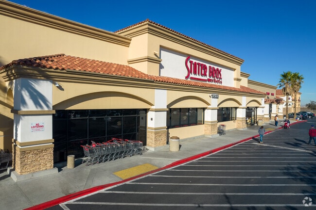
Property Record
14168 Us Highway 395, Adelanto, CA 92301


NEARBY LISTINGS FOR SALE OR LEASE
Property Detail
14168 Us Highway 395
3103-521-08
PARCEL MAP 16841 PARCEL 1 BOOK 205 PAGE 33 EX HWY
Supermarket
San Bernardino
X
California
06071C5795H
5.11 AC
2024
Mojave River Valley
2025
Inland Empire (California)
009124
Riverside-San Bernardino-Ontario, CA
42,278 SF
DEMOGRAPHICS near 14168 Us Highway 395
1 Mile
3 Mile
5 Mile
2024 Total Population
9,559
78,060
134,955
2029 Population
9,813
79,879
138,036
Pop Growth 2024-2029
+ 2.66%
+ 2.33%
+ 2.28%
Average Age
32
33
34
2024 Total Households
2,299
19,567
36,189
HH Growth 2024-2029
+ 2.65%
+ 2.36%
+ 2.31%
Median Household Inc
$69,885
$73,232
$70,361
Avg Household Size
4.00
3.80
3.60
2024 Avg HH Vehicles
3.00
2.00
2.00
Median Home Value
$288,022
$325,118
$314,617
Median Year Built
2002
2002
1998
Nearby Places
Map Layers
Map Styles
 Street
 Aerial
- Restaurants
- Banks
- Shops
- Fitness
- Groceries
PUBLIC TRANSPORTATION
COMMUTER RAIL
DRIVE
WALK
Distance
13 min
8.5 mi
AIRPORT
Ontario International
DRIVE
WALK
Distance
Ontario International
52 min
41.9 mi
Nearby Properties
Address
Land Use
TOTAL SIZE
Lot Size
Zoning
Address
Land Use
TOTAL SIZE
Lot Size
Zoning
194,280 SF
22.61 AC
Address
Land Use
TOTAL SIZE
Lot Size
Zoning
111,399 SF
5.96 AC
Address
Land Use
TOTAL SIZE
Lot Size
Zoning
94,372 SF
7.77 AC
Address
Land Use
TOTAL SIZE
Lot Size
Zoning
142,928 SF
9.13 AC
Address
Land Use
TOTAL SIZE
Lot Size
Zoning
151,906 SF
8.73 AC
RL
Address
Land Use
TOTAL SIZE
Lot Size
Zoning
12,238 SF
1.91 AC
Address
Land Use
TOTAL SIZE
Lot Size
Zoning
55,660 SF
3.70 AC
Address
Land Use
TOTAL SIZE
Lot Size
Zoning
14,736 SF
1.96 AC
Address
Land Use
TOTAL SIZE
Lot Size
Zoning
86,560 SF
4.56 AC
Address
Land Use
TOTAL SIZE
Lot Size
Zoning
9,000 SF
0.85 AC
Address
Land Use
TOTAL SIZE
Lot Size
Zoning
11,640 SF
0.65 AC
Address
Land Use
TOTAL SIZE
Lot Size
Zoning
5,176 SF
0.92 AC
Address
Land Use
TOTAL SIZE
Lot Size
Zoning
42,250 SF
4.56 AC
Address
Land Use
TOTAL SIZE
Lot Size
Zoning
Address
Land Use
TOTAL SIZE
Lot Size
Zoning
103,660 SF
4.64 AC
Address
Land Use
TOTAL SIZE
Lot Size
Zoning
6,971 SF
0.79 AC
Address
Land Use
TOTAL SIZE
Lot Size
Zoning
1.58 AC
Address
Land Use
TOTAL SIZE
Lot Size
Zoning
18.76 AC
Address
Land Use
TOTAL SIZE
Lot Size
Zoning
59,989 SF
2.97 AC
Address
Land Use
TOTAL SIZE
Lot Size
Zoning
13,190 SF
1.03 AC
Address
Land Use
TOTAL SIZE
Lot Size
Zoning
1.49 AC
Address
Land Use
TOTAL SIZE
Lot Size
Zoning
26,865 SF
2.50 AC
Address
Land Use
TOTAL SIZE
Lot Size
Zoning
16.67 AC
Address
Land Use
TOTAL SIZE
Lot Size
Zoning
19,764 SF
1.64 AC
Address
Land Use
TOTAL SIZE
Lot Size
Zoning
4,179 SF
1.03 AC
Address
Land Use
TOTAL SIZE
Lot Size
Zoning
1,470 SF
5 AC
Address
Land Use
TOTAL SIZE
Lot Size
Zoning
8,855 SF
1.77 AC
Address
Land Use
TOTAL SIZE
Lot Size
Zoning
4,953 SF
1.18 AC
Address
Land Use
TOTAL SIZE
Lot Size
Zoning
9,508 SF
0.78 AC
The World's #1 Commercial Real Estate Marketplace
Connect with us
© 2026 CoStar Group
The information above has been obtained from sources believed reliable. While we do not doubt its accuracy we have not verified it and make no guarantee, warranty or representation about it. It is your responsibility to independently confirm its accuracy and completeness. Any projections, opinions, assumptions, or estimates used are for example only and do not represent the current or future performance of the property. The value of this transaction to you depends on tax and other factors which should be evaluated by your tax, financial, and legal advisors. You and your advisors should conduct a careful, independent investigation of the property to determine to your satisfaction the suitability of the property for your needs.