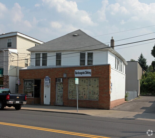
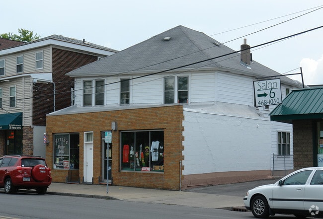
Property Record
1417 Milton Ave, Syracuse, NY 13209
NEARBY LISTINGS FOR SALE OR LEASE
Property Detail
1417 Milton Ave
313201-010-000-0008-004-000-0000
HUBBELL BLK 2 LT P4 1115067
Commercialofficeresidentialmixeduse
Onondaga
X
New York
36067C0212F
4.000
2025
0.11 AC
2024
W Outer Onondaga County
012900
Syracuse
3,683 SF
Syracuse, NY
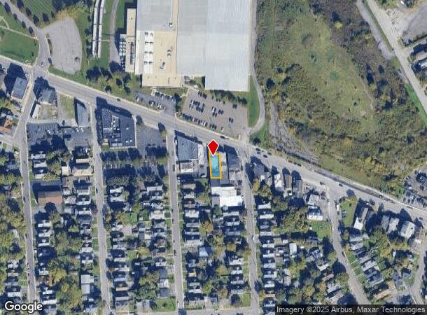
DEMOGRAPHICS near 1417 Milton Ave
1 Mile
3 Mile
5 Mile
2024 Total Population
8,277
79,429
216,000
2029 Population
8,001
77,637
211,091
Pop Growth 2024-2029
(3.33%)
(2.26%)
(2.27%)
Average Age
39
39
38
2024 Total Households
3,814
34,297
89,493
HH Growth 2024-2029
(3.51%)
(2.29%)
(2.37%)
Median Household Inc
$44,980
$51,197
$51,708
Avg Household Size
2.10
2.20
2.20
2024 Avg HH Vehicles
1.00
1.00
1.00
Median Home Value
$128,340
$141,946
$145,861
Median Year Built
1948
1951
1954
Nearby Places
Map Layers
Map Styles
 Street
 Aerial
- Restaurants
- Banks
- Shops
- Fitness
- Groceries
PUBLIC TRANSPORTATION
COMMUTER RAIL
Syracuse (Toronto - New York - VIA Rail)
DRIVE
WALK
Distance
Syracuse (Toronto - New York - VIA Rail)
6 min
3.0 mi
Nyf (Empire Service - Amtrak, Maple Leaf - Amtrak)
DRIVE
WALK
Distance
Nyf (Empire Service - Amtrak, Maple Leaf - Amtrak)
7 min
3.1 mi
AIRPORT
Syracuse Hancock International
DRIVE
WALK
Distance
Syracuse Hancock International
13 min
7.6 mi
Freight Ports
Albany, NY Port
DRIVE
WALK
Distance
Albany, NY Port
177 min
146.9 mi
Nearby Properties
Address
Land Use
TOTAL SIZE
Lot Size
Zoning
Address
Land Use
TOTAL SIZE
Lot Size
Zoning
847,042 SF
42.78 AC
23
Address
Land Use
TOTAL SIZE
Lot Size
Zoning
57,011 SF
22.53 AC
22
Address
Land Use
TOTAL SIZE
Lot Size
Zoning
508,658 SF
2.23 AC
25
Address
Land Use
TOTAL SIZE
Lot Size
Zoning
848,000 SF
30.29 AC
Address
Land Use
TOTAL SIZE
Lot Size
Zoning
52,800 SF
691.95 AC
06 - INDUS
Address
Land Use
TOTAL SIZE
Lot Size
Zoning
522,469 SF
1.87 AC
14
Address
Land Use
TOTAL SIZE
Lot Size
Zoning
6,598 SF
4.09 AC
14
Address
Land Use
TOTAL SIZE
Lot Size
Zoning
108,368 SF
3.36 AC
14
Address
Land Use
TOTAL SIZE
Lot Size
Zoning
653,177 SF
1.94 AC
13
Address
Land Use
TOTAL SIZE
Lot Size
Zoning
316,848 SF
10.72 AC
08 - GOVER
Address
Land Use
TOTAL SIZE
Lot Size
Zoning
13,800 SF
2.10 AC
16
Address
Land Use
TOTAL SIZE
Lot Size
Zoning
275,732 SF
2.91 AC
13
Address
Land Use
TOTAL SIZE
Lot Size
Zoning
296,703 SF
1.48 AC
25
Address
Land Use
TOTAL SIZE
Lot Size
Zoning
5,837 SF
1.26 AC
15
Address
Land Use
TOTAL SIZE
Lot Size
Zoning
31,947 SF
1.23 AC
Address
Land Use
TOTAL SIZE
Lot Size
Zoning
169,752 SF
12.81 AC
04 - FARM
Address
Land Use
TOTAL SIZE
Lot Size
Zoning
367,508 SF
0.48 AC
12
Address
Land Use
TOTAL SIZE
Lot Size
Zoning
22,692 SF
28.07 AC
03 - MULTI
Address
Land Use
TOTAL SIZE
Lot Size
Zoning
23,650 SF
146.50 AC
06 - INDUS
Address
Land Use
TOTAL SIZE
Lot Size
Zoning
329,212 SF
2.11 AC
12
Address
Land Use
TOTAL SIZE
Lot Size
Zoning
79,344 SF
1.65 AC
14
Address
Land Use
TOTAL SIZE
Lot Size
Zoning
410,021 SF
2.22 AC
05 - COMME
Address
Land Use
TOTAL SIZE
Lot Size
Zoning
297,376 SF
1.88 AC
13
Address
Land Use
TOTAL SIZE
Lot Size
Zoning
216,079 SF
17.57 AC
06 - INDUS
Address
Land Use
TOTAL SIZE
Lot Size
Zoning
285,000 SF
10.94 AC
23
Address
Land Use
TOTAL SIZE
Lot Size
Zoning
215,578 SF
0.30 AC
13
Address
Land Use
TOTAL SIZE
Lot Size
Zoning
270,834 SF
29.38 AC
05 - COMME
Address
Land Use
TOTAL SIZE
Lot Size
Zoning
58,012 SF
21.64 AC
02 - SINGL
Address
Land Use
TOTAL SIZE
Lot Size
Zoning
15,000 SF
59.65 AC
02 - SINGL
Address
Land Use
TOTAL SIZE
Lot Size
Zoning
35,848 SF
1.68 AC
05 - COMME
The World's #1 Commercial Real Estate Marketplace
Connect with us
© 2026 CoStar Group
The information above has been obtained from sources believed reliable. While we do not doubt its accuracy we have not verified it and make no guarantee, warranty or representation about it. It is your responsibility to independently confirm its accuracy and completeness. Any projections, opinions, assumptions, or estimates used are for example only and do not represent the current or future performance of the property. The value of this transaction to you depends on tax and other factors which should be evaluated by your tax, financial, and legal advisors. You and your advisors should conduct a careful, independent investigation of the property to determine to your satisfaction the suitability of the property for your needs.