Property Record
1418 E 72Nd St, Tacoma, WA 98404
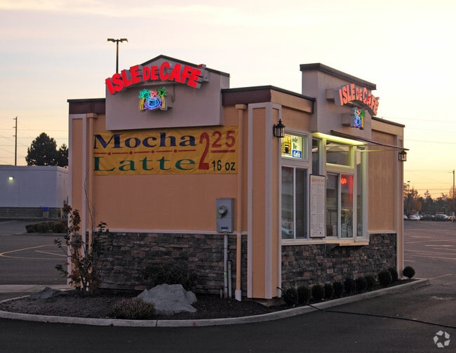


Property Detail
1418 E 72Nd St
032027-8024
SECTION 27 TOWNSHIP 20 RANGE 03 QUARTER 42 : L 4 SP 96-06-03-0332 TOG/W EASE OF REC OUT OF 4-105 SEG I0216 MD 8/22/96MD
Storebuilding
PIERCE
CCX
Washington
B and X Area of moderate flood hazard, usually the area between the limits of the 100-year and 500-year floods.
4
2024
8.48 AC
2025
Tacoma Suburban
071601
Seattle/Puget Sound
106,650 SF
Seattle-Tacoma-Bellevue, WA
NEARBY LISTINGS FOR SALE OR LEASE
DEMOGRAPHICS near 1418 E 72Nd St
1 mile
3 mile
5 mile
2025 Total Population
14,092
106,245
250,589
2030 Population
14,240
107,558
254,345
Pop Growth 2025-2030
+ 1.05%
+ 1.24%
+ 1.50%
Average Age
38
38
38
2025 Total Households
4,598
37,628
94,335
HH Growth 2025-2030
+ 1.13%
+ 1.27%
+ 1.64%
Median Household Inc
$85,664
$82,331
$80,695
Avg Household Size
2.90
2.70
2.50
2025 Avg HH Vehicles
2.00
2.00
2.00
Median Home Value
$433,742
$427,231
$444,060
Median Year Built
1977
1971
1976
Nearby Places
Map Layers
Map Styles
 Street
 Aerial
Layers
 Traffic
 Biking
Places
Listings with unknown addresses are not visible on the map
- Restaurants
- Banks
- Shops
- Fitness
- Groceries
PUBLIC TRANSPORTATION
COMMUTER RAIL
Tacoma Dome Station (Sounder South Line - Central Puget Sound Regional Transit Authority Rail (Link Light Rail/Sounder), Tacoma Link - Central Puget Sound Regional Transit Authority Rail (Link Light Rail/Sounder))
Drive
Walk
Distance
Tacoma Dome Station (Sounder South Line - Central Puget Sound Regional Transit Authority Rail (Link Light Rail/Sounder), Tacoma Link - Central Puget Sound Regional Transit Authority Rail (Link Light Rail/Sounder))
7 min
4.5 mi
South Tacoma Station (Seattle - Tacoma/Lakewood - Sound Transit)
Drive
Walk
Distance
South Tacoma Station (Seattle - Tacoma/Lakewood - Sound Transit)
10 min
4.9 mi
AIRPORT
Seattle-Tacoma International
Drive
Walk
Distance
Seattle-Tacoma International
36 min
23.2 mi
Freight Ports
Port of Tacoma
Drive
Walk
Distance
Port of Tacoma
8 min
4.8 mi
Nearby Properties
Address
Land Use
TOTAL SIZE
Lot Size
Zoning
Address
Land Use
TOTAL SIZE
Lot Size
Zoning
251,080 SF
18.22 AC
UCOR
Address
Land Use
TOTAL SIZE
Lot Size
Zoning
280,578 SF
6.52 AC
UCOR
Address
Land Use
TOTAL SIZE
Lot Size
Zoning
378,996 SF
34.43 AC
MHR
Address
Land Use
TOTAL SIZE
Lot Size
Zoning
133,979 SF
37.80 AC
R3
Address
Land Use
TOTAL SIZE
Lot Size
Zoning
268,627 SF
24.65 AC
RCX
Address
Land Use
TOTAL SIZE
Lot Size
Zoning
258,250 SF
10.83 AC
NCOR
Address
Land Use
TOTAL SIZE
Lot Size
Zoning
128,914 SF
16.03 AC
Address
Land Use
TOTAL SIZE
Lot Size
Zoning
133,372 SF
7.33 AC
R2
Address
Land Use
TOTAL SIZE
Lot Size
Zoning
121,400 SF
8.45 AC
R2
Address
Land Use
TOTAL SIZE
Lot Size
Zoning
158,177 SF
8.50 AC
NCOR
Address
Land Use
TOTAL SIZE
Lot Size
Zoning
297,048 SF
50.92 AC
NCOR
Address
Land Use
TOTAL SIZE
Lot Size
Zoning
101,008 SF
2.48 AC
CCX
Address
Land Use
TOTAL SIZE
Lot Size
Zoning
74,528 SF
5.34 AC
HMX
Address
Land Use
TOTAL SIZE
Lot Size
Zoning
146,728 SF
11.35 AC
C2
Address
Land Use
TOTAL SIZE
Lot Size
Zoning
181,427 SF
29.70 AC
ARL
Address
Land Use
TOTAL SIZE
Lot Size
Zoning
202,424 SF
3.50 AC
ECOR
Address
Land Use
TOTAL SIZE
Lot Size
Zoning
115,242 SF
6.60 AC
NCOR
Address
Land Use
TOTAL SIZE
Lot Size
Zoning
124,488 SF
8.79 AC
R2
Address
Land Use
TOTAL SIZE
Lot Size
Zoning
248,741 SF
21.34 AC
R2
Address
Land Use
TOTAL SIZE
Lot Size
Zoning
66,643 SF
3.02 AC
TAC
Address
Land Use
TOTAL SIZE
Lot Size
Zoning
112,844 SF
8.11 AC
R2
Address
Land Use
TOTAL SIZE
Lot Size
Zoning
66,285 SF
4.77 AC
R4L
Address
Land Use
TOTAL SIZE
Lot Size
Zoning
162,650 SF
7.05 AC
RSEP
Address
Land Use
TOTAL SIZE
Lot Size
Zoning
76,367 SF
0.46 AC
UCOR
Address
Land Use
TOTAL SIZE
Lot Size
Zoning
104,614 SF
7.49 AC
C2
Address
Land Use
TOTAL SIZE
Lot Size
Zoning
98,595 SF
3.86 AC
UCOR
Address
Land Use
TOTAL SIZE
Lot Size
Zoning
149,886 SF
11.95 AC
CCX
Address
Land Use
TOTAL SIZE
Lot Size
Zoning
110,811 SF
5.48 AC
R4L
Address
Land Use
TOTAL SIZE
Lot Size
Zoning
56,360 SF
8.88 AC
R2
Address
Land Use
TOTAL SIZE
Lot Size
Zoning
44,467 SF
3.19 AC
C2-STGPD
The World's #1 Commercial Real Estate Marketplace
Connect with us
© 2026 CoStar Group
The information above has been obtained from sources believed reliable. While we do not doubt its accuracy we have not verified it and make no guarantee, warranty or representation about it. It is your responsibility to independently confirm its accuracy and completeness. Any projections, opinions, assumptions, or estimates used are for example only and do not represent the current or future performance of the property. The value of this transaction to you depends on tax and other factors which should be evaluated by your tax, financial, and legal advisors. You and your advisors should conduct a careful, independent investigation of the property to determine to your satisfaction the suitability of the property for your needs.