Property Record
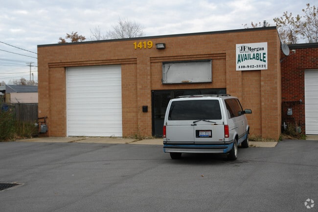
1419 E 328Th St, Eastlake, OH 44095


NEARBY LISTINGS FOR SALE OR LEASE
Property Detail
1419 E 328Th St
Cleveland-Elyria, OH
Clearview Subdivision
34-A-006-B-00-055
LOT 8 TRACT 16
Autorepair
Lake
X
Ohio
39085C0089G
8
0
0.13 AC
2025
Eastlake/S Willoughby
202100
Cleveland
3,096 SF
DEMOGRAPHICS near 1419 E 328Th St
1 Mile
3 Mile
5 Mile
2024 Total Population
13,176
60,539
119,652
2029 Population
13,116
60,370
119,228
Pop Growth 2024-2029
(0.46%)
(0.28%)
(0.35%)
Average Age
42
44
43
2024 Total Households
6,052
28,530
55,716
HH Growth 2024-2029
(0.43%)
(0.23%)
(0.35%)
Median Household Inc
$63,291
$64,483
$58,756
Avg Household Size
2.20
2.10
2.10
2024 Avg HH Vehicles
2.00
2.00
2.00
Median Home Value
$141,794
$152,219
$155,539
Median Year Built
1957
1960
1963
Nearby Places
Map Layers
Map Styles
 Street
 Aerial
- Restaurants
- Banks
- Shops
- Fitness
- Groceries
PUBLIC TRANSPORTATION
AIRPORT
Cleveland-Hopkins International
DRIVE
WALK
Distance
Cleveland-Hopkins International
46 min
30.4 mi
Nearby Properties
Address
Land Use
TOTAL SIZE
Lot Size
Zoning
Address
Land Use
TOTAL SIZE
Lot Size
Zoning
120.34 AC
Address
Land Use
TOTAL SIZE
Lot Size
Zoning
494,378 SF
11.54 AC
R-MFL
Address
Land Use
TOTAL SIZE
Lot Size
Zoning
1,283,872 SF
11.33 AC
U3
Address
Land Use
TOTAL SIZE
Lot Size
Zoning
208,119 SF
72.98 AC
1-R
Address
Land Use
TOTAL SIZE
Lot Size
Zoning
311,955 SF
31.16 AC
S-CMF
Address
Land Use
TOTAL SIZE
Lot Size
Zoning
327,593 SF
103.27 AC
Address
Land Use
TOTAL SIZE
Lot Size
Zoning
332,457 SF
15.93 AC
Address
Land Use
TOTAL SIZE
Lot Size
Zoning
79,620 SF
13.53 AC
Address
Land Use
TOTAL SIZE
Lot Size
Zoning
120,352 SF
15.05 AC
1FM60
Address
Land Use
TOTAL SIZE
Lot Size
Zoning
392,586 SF
6.50 AC
M
Address
Land Use
TOTAL SIZE
Lot Size
Zoning
263,441 SF
17.18 AC
I
Address
Land Use
TOTAL SIZE
Lot Size
Zoning
417,806 SF
28.90 AC
Address
Land Use
TOTAL SIZE
Lot Size
Zoning
75,843 SF
10.23 AC
B
Address
Land Use
TOTAL SIZE
Lot Size
Zoning
71,569 SF
5.74 AC
M
Address
Land Use
TOTAL SIZE
Lot Size
Zoning
214,881 SF
47.99 AC
S-5
Address
Land Use
TOTAL SIZE
Lot Size
Zoning
272,400 SF
1.07 AC
U2D
Address
Land Use
TOTAL SIZE
Lot Size
Zoning
53,637 SF
13.45 AC
G-BUS
Address
Land Use
TOTAL SIZE
Lot Size
Zoning
65,558 SF
8.80 AC
M
Address
Land Use
TOTAL SIZE
Lot Size
Zoning
113,801 SF
8.48 AC
I
Address
Land Use
TOTAL SIZE
Lot Size
Zoning
246,997 SF
10 AC
R-100
Address
Land Use
TOTAL SIZE
Lot Size
Zoning
136,722 SF
10.25 AC
GB
Address
Land Use
TOTAL SIZE
Lot Size
Zoning
164,666 SF
8 AC
R-100
Address
Land Use
TOTAL SIZE
Lot Size
Zoning
163,353 SF
12.43 AC
R-BUS
Address
Land Use
TOTAL SIZE
Lot Size
Zoning
174,098 SF
20.51 AC
U-1
Address
Land Use
TOTAL SIZE
Lot Size
Zoning
431,066 SF
6.15 AC
I
Address
Land Use
TOTAL SIZE
Lot Size
Zoning
122,130 SF
9.51 AC
Address
Land Use
TOTAL SIZE
Lot Size
Zoning
135,414 SF
4 AC
Address
Land Use
TOTAL SIZE
Lot Size
Zoning
151,690 SF
15.39 AC
Address
Land Use
TOTAL SIZE
Lot Size
Zoning
109,803 SF
9.77 AC
Address
Land Use
TOTAL SIZE
Lot Size
Zoning
120,676 SF
9.07 AC
R-MFL
The World's #1 Commercial Real Estate Marketplace
Connect with us
© 2026 CoStar Group
The information above has been obtained from sources believed reliable. While we do not doubt its accuracy we have not verified it and make no guarantee, warranty or representation about it. It is your responsibility to independently confirm its accuracy and completeness. Any projections, opinions, assumptions, or estimates used are for example only and do not represent the current or future performance of the property. The value of this transaction to you depends on tax and other factors which should be evaluated by your tax, financial, and legal advisors. You and your advisors should conduct a careful, independent investigation of the property to determine to your satisfaction the suitability of the property for your needs.