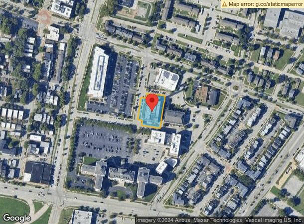
Property Record
1419 Carroll St, Saint Louis, MO 63104


NEARBY LISTINGS FOR SALE OR LEASE
Property Detail
1419 Carroll St
St. Louis, MO-IL
Peabody, Darst, Webbe
1250-00-0032-0
C.B. 1250 CARROLL ST 0.625 ACS PT CARROLL DILLON BNDRY ADJ LOT 3 & PT VAC DILLON ST
Restaurantbuilding
St. Louis City
X
Missouri
2903850102C
3
2024
0.63 AC
2025
St Louis City South
123200
St. Louis
16,608 SF
DEMOGRAPHICS near 1419 Carroll St
1 Mile
3 Mile
5 Mile
2024 Total Population
12,991
99,769
245,687
2029 Population
12,125
94,017
234,390
Pop Growth 2024-2029
(6.67%)
(5.77%)
(4.60%)
Average Age
37
37
39
2024 Total Households
6,855
47,738
116,903
HH Growth 2024-2029
(6.32%)
(5.81%)
(4.76%)
Median Household Inc
$63,510
$52,076
$49,036
Avg Household Size
1.90
1.90
2.00
2024 Avg HH Vehicles
1.00
1.00
1.00
Median Home Value
$267,374
$228,213
$165,926
Median Year Built
1947
1947
1947
Nearby Places
Map Layers
Map Styles
 Street
 Aerial
- Restaurants
- Banks
- Shops
- Fitness
- Groceries
PUBLIC TRANSPORTATION
TRANSIT/SUBWAY
Union Station (Lambert Airport Shiloh-Scott - St. Louis MetroLink (MetroLink), Shrewsbury-Lansdowne I-44 Emerson Park - St. Louis MetroLink (MetroLink))
DRIVE
WALK
Distance
Union Station (Lambert Airport Shiloh-Scott - St. Louis MetroLink (MetroLink), Shrewsbury-Lansdowne I-44 Emerson Park - St. Louis MetroLink (MetroLink))
2 min
19 min
0.9 mi
Civic Center (Lambert Airport Shiloh-Scott - St. Louis MetroLink (MetroLink), Shrewsbury-Lansdowne I-44 Emerson Park - St. Louis MetroLink (MetroLink))
DRIVE
WALK
Distance
Civic Center (Lambert Airport Shiloh-Scott - St. Louis MetroLink (MetroLink), Shrewsbury-Lansdowne I-44 Emerson Park - St. Louis MetroLink (MetroLink))
3 min
19 min
1.0 mi
COMMUTER RAIL
Civic Center (Lambert Airport Shiloh-Scott - St. Louis MetroLink (MetroLink), Shrewsbury-Lansdowne I-44 Emerson Park - St. Louis MetroLink (MetroLink))
DRIVE
WALK
Distance
Civic Center (Lambert Airport Shiloh-Scott - St. Louis MetroLink (MetroLink), Shrewsbury-Lansdowne I-44 Emerson Park - St. Louis MetroLink (MetroLink))
3 min
18 min
0.9 mi
Union Station (Lambert Airport Shiloh-Scott - St. Louis MetroLink (MetroLink), Shrewsbury-Lansdowne I-44 Emerson Park - St. Louis MetroLink (MetroLink))
DRIVE
WALK
Distance
Union Station (Lambert Airport Shiloh-Scott - St. Louis MetroLink (MetroLink), Shrewsbury-Lansdowne I-44 Emerson Park - St. Louis MetroLink (MetroLink))
3 min
19 min
0.9 mi
AIRPORT
St Louis Lambert International
DRIVE
WALK
Distance
St Louis Lambert International
26 min
14.9 mi
Scott AFB/Midamerica St Louis
DRIVE
WALK
Distance
Scott AFB/Midamerica St Louis
42 min
26.8 mi
SALE & LEASE HISTORY
LISTING DATE
SALE/LEASE

Oct 19, 2023
For Sale
May 03, 2022
For Lease
Mar 10, 2021
For Lease
Jul 26, 2024
For Sale
Nearby Properties
Address
Land Use
TOTAL SIZE
Lot Size
Zoning
Address
Land Use
TOTAL SIZE
Lot Size
Zoning
467,000 SF
11.19 AC
I
Address
Land Use
TOTAL SIZE
Lot Size
Zoning
1,037,632 SF
3.34 AC
I
Address
Land Use
TOTAL SIZE
Lot Size
Zoning
661,472 SF
7.29 AC
L
Address
Land Use
TOTAL SIZE
Lot Size
Zoning
1.72 AC
I
Address
Land Use
TOTAL SIZE
Lot Size
Zoning
1.71 AC
I
Address
Land Use
TOTAL SIZE
Lot Size
Zoning
355,000 SF
0.75 AC
I
Address
Land Use
TOTAL SIZE
Lot Size
Zoning
229.57 AC
B
Address
Land Use
TOTAL SIZE
Lot Size
Zoning
472,328 SF
19.85 AC
I
Address
Land Use
TOTAL SIZE
Lot Size
Zoning
10.97 AC
I
Address
Land Use
TOTAL SIZE
Lot Size
Zoning
1,165,128 SF
1.70 AC
L
Address
Land Use
TOTAL SIZE
Lot Size
Zoning
624,049 SF
20.78 AC
K
Address
Land Use
TOTAL SIZE
Lot Size
Zoning
1,189,932 SF
1.45 AC
I
Address
Land Use
TOTAL SIZE
Lot Size
Zoning
7.38 AC
I
Address
Land Use
TOTAL SIZE
Lot Size
Zoning
1,089,750 SF
8.43 AC
I
Address
Land Use
TOTAL SIZE
Lot Size
Zoning
593,701 SF
2.08 AC
I
Address
Land Use
TOTAL SIZE
Lot Size
Zoning
246,345 SF
4.17 AC
J
Address
Land Use
TOTAL SIZE
Lot Size
Zoning
1.98 AC
H
Address
Land Use
TOTAL SIZE
Lot Size
Zoning
Address
Land Use
TOTAL SIZE
Lot Size
Zoning
423,303 SF
9.97 AC
H
Address
Land Use
TOTAL SIZE
Lot Size
Zoning
702,704 SF
2.10 AC
I
Address
Land Use
TOTAL SIZE
Lot Size
Zoning
360,580 SF
26.13 AC
KJ
Address
Land Use
TOTAL SIZE
Lot Size
Zoning
570,135 SF
0.52 AC
I
Address
Land Use
TOTAL SIZE
Lot Size
Zoning
359,040 SF
1.33 AC
L
Address
Land Use
TOTAL SIZE
Lot Size
Zoning
439,346 SF
1.45 AC
I
Address
Land Use
TOTAL SIZE
Lot Size
Zoning
303,680 SF
2.09 AC
I
Address
Land Use
TOTAL SIZE
Lot Size
Zoning
190,000 SF
2.71 AC
I
Address
Land Use
TOTAL SIZE
Lot Size
Zoning
189,841 SF
4.18 AC
K
Address
Land Use
TOTAL SIZE
Lot Size
Zoning
192,892 SF
4.44 AC
I
Address
Land Use
TOTAL SIZE
Lot Size
Zoning
8.54 AC
H
Address
Land Use
TOTAL SIZE
Lot Size
Zoning
15.11 AC
I
The World's #1 Commercial Real Estate Marketplace
Connect with us
© 2026 CoStar Group
The information above has been obtained from sources believed reliable. While we do not doubt its accuracy we have not verified it and make no guarantee, warranty or representation about it. It is your responsibility to independently confirm its accuracy and completeness. Any projections, opinions, assumptions, or estimates used are for example only and do not represent the current or future performance of the property. The value of this transaction to you depends on tax and other factors which should be evaluated by your tax, financial, and legal advisors. You and your advisors should conduct a careful, independent investigation of the property to determine to your satisfaction the suitability of the property for your needs.