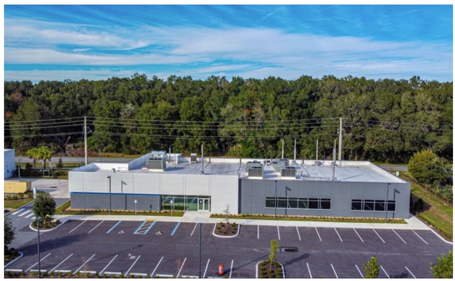
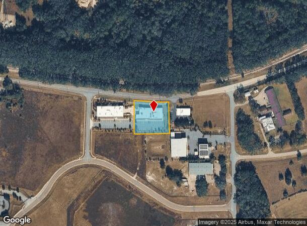
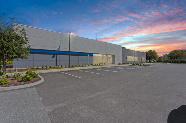
Property Record
14193 Nw 129Th Way, Alachua, FL 32615
NEARBY LISTINGS FOR SALE OR LEASE
Property Detail
14193 Nw 129Th Way
03230-002-004
COM NW COR OF PARCEL DESC IN OR 3214/1296 PARCEL 3230-2-1 POB S 01 DEG 36 MIN 16 SEC E 213.67 FT S 88 DEG 23 MIN 44 SEC W 163.27 FT S 88 DEG 22 MIN 30 SEC W 76.85 FT N 00 DEG 11 MIN 01 SEC W 227.36 FT SELY ALG CURVE 235.32 FT POB OR 4949/1674
Lightindustrial
Alachua
X
Florida
12001C0140D
1.19 AC
2025
Gainesville
2025
Other Market Areas
001817
Gainesville, FL
11,392 SF
DEMOGRAPHICS near 14193 Nw 129Th Way
1 Mile
3 Mile
5 Mile
2024 Total Population
2,470
9,340
14,413
2029 Population
2,565
9,844
15,274
Pop Growth 2024-2029
+ 3.85%
+ 5.40%
+ 5.97%
Average Age
42
42
42
2024 Total Households
989
3,742
5,774
HH Growth 2024-2029
+ 4.15%
+ 5.64%
+ 6.25%
Median Household Inc
$68,011
$75,787
$77,014
Avg Household Size
2.50
2.50
2.50
2024 Avg HH Vehicles
2.00
2.00
2.00
Median Home Value
$248,717
$264,276
$259,243
Median Year Built
1989
1993
1994
Nearby Places
Map Layers
Map Styles
 Street
 Aerial
- Restaurants
- Banks
- Shops
- Fitness
- Groceries
PUBLIC TRANSPORTATION
AIRPORT
Gainesville Regional
DRIVE
WALK
Distance
Gainesville Regional
28 min
16.1 mi
Nearby Properties
Address
Land Use
TOTAL SIZE
Lot Size
Zoning
Address
Land Use
TOTAL SIZE
Lot Size
Zoning
204,258 SF
23.24 AC
ILW
Address
Land Use
TOTAL SIZE
Lot Size
Zoning
526,018 SF
208.06 AC
IG
Address
Land Use
TOTAL SIZE
Lot Size
Zoning
1,296,224 SF
67.06 AC
A
Address
Land Use
TOTAL SIZE
Lot Size
Zoning
318,416 SF
22.90 AC
RMF-15
Address
Land Use
TOTAL SIZE
Lot Size
Zoning
147,781 SF
17.01 AC
PUD
Address
Land Use
TOTAL SIZE
Lot Size
Zoning
99,873 SF
34 AC
A
Address
Land Use
TOTAL SIZE
Lot Size
Zoning
200,050 SF
18.60 AC
RSF-3
Address
Land Use
TOTAL SIZE
Lot Size
Zoning
76,504 SF
20 AC
RSF-3
Address
Land Use
TOTAL SIZE
Lot Size
Zoning
28,727 SF
6.04 AC
PUD
Address
Land Use
TOTAL SIZE
Lot Size
Zoning
56,468 SF
4.25 AC
Address
Land Use
TOTAL SIZE
Lot Size
Zoning
43,646 SF
4.90 AC
ILW
Address
Land Use
TOTAL SIZE
Lot Size
Zoning
64,076 SF
2.73 AC
CI
Address
Land Use
TOTAL SIZE
Lot Size
Zoning
40,804 SF
3.94 AC
ILW
Address
Land Use
TOTAL SIZE
Lot Size
Zoning
83,635 SF
182.70 AC
PUD
Address
Land Use
TOTAL SIZE
Lot Size
Zoning
95,185 SF
7.72 AC
CI
Address
Land Use
TOTAL SIZE
Lot Size
Zoning
42,695 SF
10.66 AC
CI
Address
Land Use
TOTAL SIZE
Lot Size
Zoning
41,464 SF
3.96 AC
PUD
Address
Land Use
TOTAL SIZE
Lot Size
Zoning
54,768 SF
11.63 AC
ILW
Address
Land Use
TOTAL SIZE
Lot Size
Zoning
125,982 SF
23.50 AC
CI
Address
Land Use
TOTAL SIZE
Lot Size
Zoning
23,683 SF
6.02 AC
ILW
Address
Land Use
TOTAL SIZE
Lot Size
Zoning
44,384 SF
7.50 AC
CP
Address
Land Use
TOTAL SIZE
Lot Size
Zoning
21,446 SF
4.05 AC
ILW
Address
Land Use
TOTAL SIZE
Lot Size
Zoning
37,274 SF
6.14 AC
PUD
Address
Land Use
TOTAL SIZE
Lot Size
Zoning
31,248 SF
3.27 AC
PUD
Address
Land Use
TOTAL SIZE
Lot Size
Zoning
132,880 SF
20 AC
IG
Address
Land Use
TOTAL SIZE
Lot Size
Zoning
38,024 SF
3.17 AC
CI
Address
Land Use
TOTAL SIZE
Lot Size
Zoning
24,154 SF
3.46 AC
PUD
Address
Land Use
TOTAL SIZE
Lot Size
Zoning
64,052 SF
35.96 AC
ILW
Address
Land Use
TOTAL SIZE
Lot Size
Zoning
9,113 SF
36.19 AC
A
Address
Land Use
TOTAL SIZE
Lot Size
Zoning
35,745 SF
9.73 AC
GF
The World's #1 Commercial Real Estate Marketplace
Connect with us
© 2026 CoStar Group
The information above has been obtained from sources believed reliable. While we do not doubt its accuracy we have not verified it and make no guarantee, warranty or representation about it. It is your responsibility to independently confirm its accuracy and completeness. Any projections, opinions, assumptions, or estimates used are for example only and do not represent the current or future performance of the property. The value of this transaction to you depends on tax and other factors which should be evaluated by your tax, financial, and legal advisors. You and your advisors should conduct a careful, independent investigation of the property to determine to your satisfaction the suitability of the property for your needs.