Property Record
142 Main St, Groton, MA 01450
Save to a Folder
{{folder.Name}}
{{folder.ListingIds.length}} Properties
{{folder.ListingIds.length}} Property
Create a New Folder
Property Detail
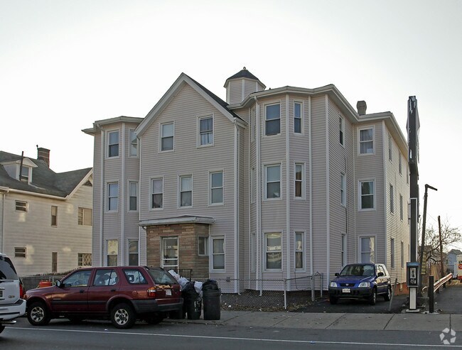
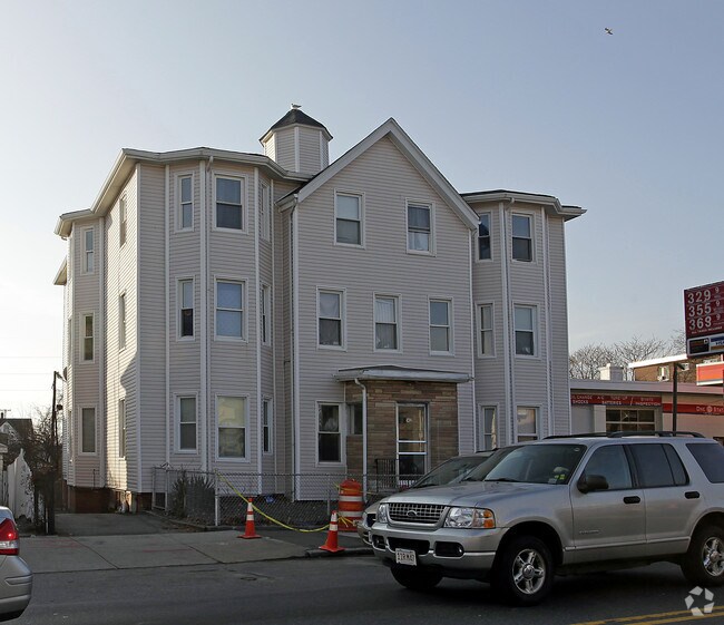
142 Main St
Officecondo
Middlesex
RA
Massachusetts
B and X Area of moderate flood hazard, usually the area between the limits of the 100-year and 500-year floods.
3.0
2025
West Everett
2025
Boston
330202
Boston-Cambridge-Newton, MA-NH
3,507 SF
GROT-000113-000007-000001
NEARBY LISTINGS FOR SALE OR LEASE
-
-
View all Groton listings for sale on LoopNet.com
DEMOGRAPHICS near 142 Main St
1 mile
3 mile
5 mile
2025 Total Population
38,483
371,651
835,294
2030 Population
38,944
378,758
859,225
Pop Growth 2025-2030
+ 1.20%
+ 1.91%
+ 2.86%
Average Age
37
38
38
2025 Total Households
14,372
150,704
344,947
HH Growth 2025-2030
+ 1.63%
+ 2.24%
+ 3.32%
Median Household Inc
$88,197
$104,458
$110,433
Avg Household Size
2.60
2.40
2.20
2025 Avg HH Vehicles
1.00
1.00
1.00
Median Home Value
$694,224
$747,401
$814,057
Median Year Built
1948
1949
1949
Nearby Places
Map Layers
Map Styles
 Street
 Aerial
Layers
 Traffic
 Biking
Places
Listings with unknown addresses are not visible on the map
- Restaurants
- Banks
- Shops
- Fitness
- Groceries
PUBLIC TRANSPORTATION
COMMUTER RAIL
Ayer (Fitchburg/South Acton Line - Massachusetts Bay Transportation Authority Commuter Rail (Purple Line))
Drive
Walk
Distance
Ayer (Fitchburg/South Acton Line - Massachusetts Bay Transportation Authority Commuter Rail (Purple Line))
9 min
5.0 mi
Shirley (Fitchburg/South Acton Line - Massachusetts Bay Transportation Authority Commuter Rail (Purple Line))
Drive
Walk
Distance
Shirley (Fitchburg/South Acton Line - Massachusetts Bay Transportation Authority Commuter Rail (Purple Line))
14 min
7.6 mi
AIRPORT
Manchester Boston Regional
Drive
Walk
Distance
Manchester Boston Regional
49 min
28.4 mi
General Edward Lawrence Logan International
Drive
Walk
Distance
General Edward Lawrence Logan International
64 min
39.9 mi
Worcester Regional
Drive
Walk
Distance
Worcester Regional
58 min
40.3 mi
Freight Ports
Port of Boston
Drive
Walk
Distance
Port of Boston
64 min
38.3 mi
Nearby Properties
Address
Land Use
TOTAL SIZE
Lot Size
Zoning
Address
Land Use
TOTAL SIZE
Lot Size
Zoning
329,818 SF
55 AC
A1
Address
Land Use
TOTAL SIZE
Lot Size
Zoning
35.63 AC
O
Address
Land Use
TOTAL SIZE
Lot Size
Zoning
28 AC
RA
Address
Land Use
TOTAL SIZE
Lot Size
Zoning
15.98 AC
O
Address
Land Use
TOTAL SIZE
Lot Size
Zoning
105,559 SF
35.45 AC
A1
Address
Land Use
TOTAL SIZE
Lot Size
Zoning
8.44 AC
B1
Address
Land Use
TOTAL SIZE
Lot Size
Zoning
14.90 AC
RA
Address
Land Use
TOTAL SIZE
Lot Size
Zoning
6.50 AC
RA
Address
Land Use
TOTAL SIZE
Lot Size
Zoning
58,738 SF
183.84 AC
RA
Address
Land Use
TOTAL SIZE
Lot Size
Zoning
130 AC
RA
Address
Land Use
TOTAL SIZE
Lot Size
Zoning
16.66 AC
RA
Address
Land Use
TOTAL SIZE
Lot Size
Zoning
36,400 SF
4.26 AC
A2
Address
Land Use
TOTAL SIZE
Lot Size
Zoning
13,786 SF
2.79 AC
RA
Address
Land Use
TOTAL SIZE
Lot Size
Zoning
74,320 SF
10.75 AC
LI
Address
Land Use
TOTAL SIZE
Lot Size
Zoning
68,200 SF
6.43 AC
B1
Address
Land Use
TOTAL SIZE
Lot Size
Zoning
47,654 SF
3.42 AC
A1
Address
Land Use
TOTAL SIZE
Lot Size
Zoning
121.50 AC
A1
Address
Land Use
TOTAL SIZE
Lot Size
Zoning
518.99 AC
RA
Address
Land Use
TOTAL SIZE
Lot Size
Zoning
75,480 SF
7.98 AC
LI
Address
Land Use
TOTAL SIZE
Lot Size
Zoning
13,117 SF
4.04 AC
RA
Address
Land Use
TOTAL SIZE
Lot Size
Zoning
9 AC
B1
Address
Land Use
TOTAL SIZE
Lot Size
Zoning
6.44 AC
B1
Address
Land Use
TOTAL SIZE
Lot Size
Zoning
49,791 SF
3.14 AC
RA
Address
Land Use
TOTAL SIZE
Lot Size
Zoning
18,302 SF
2.83 AC
A2
Address
Land Use
TOTAL SIZE
Lot Size
Zoning
10,795 SF
5.02 AC
RA
Address
Land Use
TOTAL SIZE
Lot Size
Zoning
11,516 SF
0.50 AC
RA
Address
Land Use
TOTAL SIZE
Lot Size
Zoning
16,410 SF
3.62 AC
RA
Address
Land Use
TOTAL SIZE
Lot Size
Zoning
14,645 SF
2.84 AC
RA
Address
Land Use
TOTAL SIZE
Lot Size
Zoning
12,822 SF
1 AC
RA
Address
Land Use
TOTAL SIZE
Lot Size
Zoning
8,324 SF
2.98 AC
B1
The World's #1 Commercial Real Estate Marketplace
Connect with us
© 2026 CoStar Group
The information above has been obtained from sources believed reliable. While we do not doubt its accuracy we have not verified it and make no guarantee, warranty or representation about it. It is your responsibility to independently confirm its accuracy and completeness. Any projections, opinions, assumptions, or estimates used are for example only and do not represent the current or future performance of the property. The value of this transaction to you depends on tax and other factors which should be evaluated by your tax, financial, and legal advisors. You and your advisors should conduct a careful, independent investigation of the property to determine to your satisfaction the suitability of the property for your needs.