Property Record
142 W Maple St, Mount Wolf, PA 17347

Property Detail
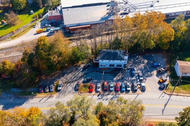
142 W Maple St
Autorepair
York
ID
Pennsylvania
AE The base floodplain where base flood elevations are provided. AE Zones are now used on new format FIRMs instead of A1-A30 Zones.
0.53 AC
2025
York County
2025
Philadelphia
000900
York-Hanover, PA
2,464 SF
77-000-02-0289.00-00000
NEARBY LISTINGS FOR SALE OR LEASE
DEMOGRAPHICS near 142 W Maple St
1 mile
3 mile
5 mile
2025 Total Population
6,144
15,215
42,435
2030 Population
6,269
15,671
43,845
Pop Growth 2025-2030
+ 2.03%
+ 3.00%
+ 3.32%
Average Age
40
41
41
2025 Total Households
2,409
5,841
16,055
HH Growth 2025-2030
+ 2.16%
+ 3.10%
+ 3.38%
Median Household Inc
$79,512
$84,673
$89,393
Avg Household Size
2.50
2.60
2.60
2025 Avg HH Vehicles
2.00
2.00
2.00
Median Home Value
$222,094
$224,029
$246,134
Median Year Built
1973
1981
1986
Nearby Places
Map Layers
Map Styles
 Street
 Aerial
Transit
 Traffic
 Biking
Places
Listings with unknown addresses are not visible on the map
- Restaurants
- Banks
- Shops
- Fitness
- Groceries
PUBLIC TRANSPORTATION
AIRPORT
Harrisburg International
Drive
Walk
Distance
Harrisburg International
39 min
25.5 mi
Freight Ports
Port Newark Container Terminal
Drive
Walk
Distance
Port Newark Container Terminal
115 min
72.4 mi
SALE & LEASE HISTORY
LISTING DATE
SALE/LEASE

Dec 14, 2021
For Sale
Aug 18, 2021
For Sale
Nearby Properties
Address
Land Use
TOTAL SIZE
Lot Size
Zoning
Address
Land Use
TOTAL SIZE
Lot Size
Zoning
93.42 AC
Address
Land Use
TOTAL SIZE
Lot Size
Zoning
2,285 SF
121.20 AC
RS
Address
Land Use
TOTAL SIZE
Lot Size
Zoning
1,456 SF
97.78 AC
AG
Address
Land Use
TOTAL SIZE
Lot Size
Zoning
1,344 SF
274.50 AC
ID
Address
Land Use
TOTAL SIZE
Lot Size
Zoning
299,254 SF
Address
Land Use
TOTAL SIZE
Lot Size
Zoning
89.58 AC
ID
Address
Land Use
TOTAL SIZE
Lot Size
Zoning
603,000 SF
56.64 AC
AG
Address
Land Use
TOTAL SIZE
Lot Size
Zoning
1,120 SF
67.19 AC
ID
Address
Land Use
TOTAL SIZE
Lot Size
Zoning
216,544 SF
Address
Land Use
TOTAL SIZE
Lot Size
Zoning
708,000 SF
55.49 AC
I
Address
Land Use
TOTAL SIZE
Lot Size
Zoning
624,000 SF
50.30 AC
AG
Address
Land Use
TOTAL SIZE
Lot Size
Zoning
378,090 SF
38.70 AC
I
Address
Land Use
TOTAL SIZE
Lot Size
Zoning
496,062 SF
45.60 AC
I
Address
Land Use
TOTAL SIZE
Lot Size
Zoning
282 AC
I
Address
Land Use
TOTAL SIZE
Lot Size
Zoning
390,000 SF
32.13 AC
RS
Address
Land Use
TOTAL SIZE
Lot Size
Zoning
1,716 SF
11.30 AC
RS
Address
Land Use
TOTAL SIZE
Lot Size
Zoning
390,619 SF
46.36 AC
I
Address
Land Use
TOTAL SIZE
Lot Size
Zoning
23.72 AC
AG
Address
Land Use
TOTAL SIZE
Lot Size
Zoning
193,025 SF
32.22 AC
I
Address
Land Use
TOTAL SIZE
Lot Size
Zoning
265,645 SF
18.19 AC
I
Address
Land Use
TOTAL SIZE
Lot Size
Zoning
12.12 AC
Address
Land Use
TOTAL SIZE
Lot Size
Zoning
14.22 AC
Address
Land Use
TOTAL SIZE
Lot Size
Zoning
11.22 AC
Address
Land Use
TOTAL SIZE
Lot Size
Zoning
15.88 AC
AG
Address
Land Use
TOTAL SIZE
Lot Size
Zoning
15.55 AC
I
Address
Land Use
TOTAL SIZE
Lot Size
Zoning
174,733 SF
Address
Land Use
TOTAL SIZE
Lot Size
Zoning
219,126 SF
Address
Land Use
TOTAL SIZE
Lot Size
Zoning
248,040 SF
21.39 AC
I
Address
Land Use
TOTAL SIZE
Lot Size
Zoning
12.76 AC
Address
Land Use
TOTAL SIZE
Lot Size
Zoning
406,400 SF
11.97 AC
I
The World's #1 Commercial Real Estate Marketplace
Connect with us
© 2026 CoStar Group
The information above has been obtained from sources believed reliable. While we do not doubt its accuracy we have not verified it and make no guarantee, warranty or representation about it. It is your responsibility to independently confirm its accuracy and completeness. Any projections, opinions, assumptions, or estimates used are for example only and do not represent the current or future performance of the property. The value of this transaction to you depends on tax and other factors which should be evaluated by your tax, financial, and legal advisors. You and your advisors should conduct a careful, independent investigation of the property to determine to your satisfaction the suitability of the property for your needs.