Property Record
1420 E Renfro St, Burleson, TX 76028
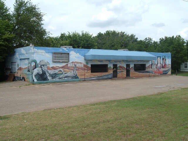

Property Detail
1420 E Renfro St
126-0934-00737
ABST 934 TR 3A TURPIN & ESTES 126.5525.00408
Commercialnec
Johnson
AE The base floodplain where base flood elevations are provided. AE Zones are now used on new format FIRMs instead of A1-A30 Zones.
Texas
2024
0.57 AC
2025
Southwest Outlying
130406
Dallas/Ft Worth
6,000 SF
Dallas-Fort Worth-Arlington, TX
NEARBY LISTINGS FOR SALE OR LEASE
DEMOGRAPHICS near 1420 E Renfro St
1 mile
3 mile
5 mile
2025 Total Population
4,418
31,125
98,436
2030 Population
4,979
34,772
108,282
Pop Growth 2025-2030
+ 12.70%
+ 11.72%
+ 10.00%
Average Age
40
40
38
2025 Total Households
1,486
11,303
34,271
HH Growth 2025-2030
+ 12.31%
+ 11.49%
+ 9.98%
Median Household Inc
$120,165
$98,993
$97,812
Avg Household Size
2.90
2.70
2.80
2025 Avg HH Vehicles
2.00
2.00
2.00
Median Home Value
$381,966
$366,514
$337,229
Median Year Built
1998
1993
2000
Nearby Places
Map Layers
Map Styles
 Street
 Aerial
Layers
 Traffic
 Biking
Places
Listings with unknown addresses are not visible on the map
- Restaurants
- Banks
- Shops
- Fitness
- Groceries
PUBLIC TRANSPORTATION
AIRPORT
Dallas-Fort Worth International
Drive
Walk
Distance
Dallas-Fort Worth International
49 min
38.9 mi
Freight Ports
Port of Shreveport
Drive
Walk
Distance
Port of Shreveport
254 min
235.7 mi
SALE & LEASE HISTORY
LISTING DATE
SALE/LEASE

Feb 01, 2018
For Sale
Nearby Properties
Address
Land Use
TOTAL SIZE
Lot Size
Zoning
Address
Land Use
TOTAL SIZE
Lot Size
Zoning
647,641 SF
13.56 AC
Address
Land Use
TOTAL SIZE
Lot Size
Zoning
354,702 SF
80.43 AC
Address
Land Use
TOTAL SIZE
Lot Size
Zoning
861,840 SF
58.61 AC
Address
Land Use
TOTAL SIZE
Lot Size
Zoning
316,872 SF
17.46 AC
Address
Land Use
TOTAL SIZE
Lot Size
Zoning
278,301 SF
14.71 AC
Address
Land Use
TOTAL SIZE
Lot Size
Zoning
242,003 SF
14 AC
Address
Land Use
TOTAL SIZE
Lot Size
Zoning
180,391 SF
19.14 AC
Address
Land Use
TOTAL SIZE
Lot Size
Zoning
13.33 AC
Address
Land Use
TOTAL SIZE
Lot Size
Zoning
140,167 SF
34.86 AC
Address
Land Use
TOTAL SIZE
Lot Size
Zoning
94,918 SF
13.54 AC
Address
Land Use
TOTAL SIZE
Lot Size
Zoning
117,990 SF
7.28 AC
Address
Land Use
TOTAL SIZE
Lot Size
Zoning
227,486 SF
10.06 AC
Address
Land Use
TOTAL SIZE
Lot Size
Zoning
74,941 SF
36.66 AC
Address
Land Use
TOTAL SIZE
Lot Size
Zoning
35.61 AC
Address
Land Use
TOTAL SIZE
Lot Size
Zoning
4,432 SF
40.20 AC
Address
Land Use
TOTAL SIZE
Lot Size
Zoning
115,448 SF
19.01 AC
Address
Land Use
TOTAL SIZE
Lot Size
Zoning
11.95 AC
Address
Land Use
TOTAL SIZE
Lot Size
Zoning
442.50 AC
Address
Land Use
TOTAL SIZE
Lot Size
Zoning
79,732 SF
12.28 AC
Address
Land Use
TOTAL SIZE
Lot Size
Zoning
178,582 SF
8.03 AC
Address
Land Use
TOTAL SIZE
Lot Size
Zoning
114,308 SF
9.73 AC
Address
Land Use
TOTAL SIZE
Lot Size
Zoning
19.33 AC
Address
Land Use
TOTAL SIZE
Lot Size
Zoning
123,388 SF
26.82 AC
Address
Land Use
TOTAL SIZE
Lot Size
Zoning
81,630 SF
11.03 AC
Address
Land Use
TOTAL SIZE
Lot Size
Zoning
58,506 SF
9.56 AC
Address
Land Use
TOTAL SIZE
Lot Size
Zoning
4.47 AC
Address
Land Use
TOTAL SIZE
Lot Size
Zoning
165,550 SF
12.25 AC
Address
Land Use
TOTAL SIZE
Lot Size
Zoning
24.33 AC
Address
Land Use
TOTAL SIZE
Lot Size
Zoning
81,500 SF
7.92 AC
Address
Land Use
TOTAL SIZE
Lot Size
Zoning
151,300 SF
5 AC
The World's #1 Commercial Real Estate Marketplace
Connect with us
© 2026 CoStar Group
The information above has been obtained from sources believed reliable. While we do not doubt its accuracy we have not verified it and make no guarantee, warranty or representation about it. It is your responsibility to independently confirm its accuracy and completeness. Any projections, opinions, assumptions, or estimates used are for example only and do not represent the current or future performance of the property. The value of this transaction to you depends on tax and other factors which should be evaluated by your tax, financial, and legal advisors. You and your advisors should conduct a careful, independent investigation of the property to determine to your satisfaction the suitability of the property for your needs.