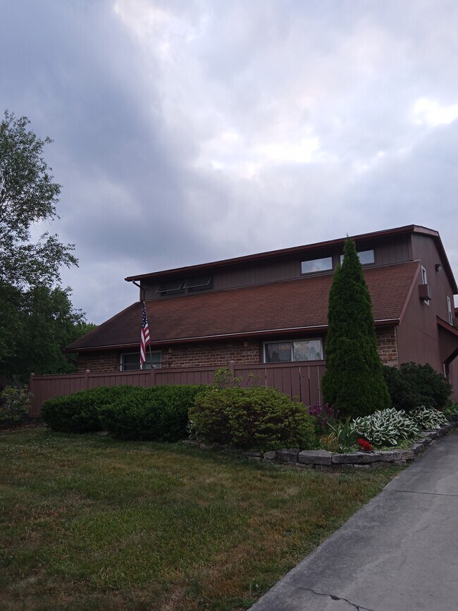
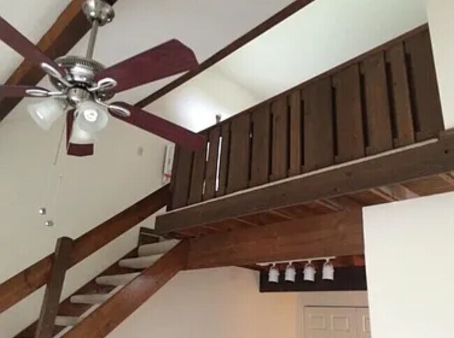
Property Record
1420 Maplecrest Dr, Youngstown, OH 44515
NEARBY LISTINGS FOR SALE OR LEASE
-
-
View all Youngstown listings for sale on LoopNet.com
Property Detail
1420 Maplecrest Dr
Youngstown/Warren/Boardman
City/Youngstown
Youngstown-Warren, OH
LOT 17 100 X 229 IRR REPL LOT #3 CENT PK WEST
48-076-0-056.02-0
Mahoning
Apartment
Ohio
2024
17
2024
0.46 AC
812601
North Outer Austintown/Boardman
3,794 SF
DEMOGRAPHICS near 1420 Maplecrest Dr
1 Mile
3 Mile
5 Mile
2024 Total Population
8,123
43,731
93,028
2029 Population
7,909
42,610
91,319
Pop Growth 2024-2029
(2.63%)
(2.56%)
(1.84%)
Average Age
45
43
43
2024 Total Households
3,987
19,797
40,744
HH Growth 2024-2029
(2.76%)
(2.70%)
(1.97%)
Median Household Inc
$45,573
$52,210
$51,296
Avg Household Size
2.00
2.20
2.20
2024 Avg HH Vehicles
2.00
2.00
2.00
Median Home Value
$136,016
$130,325
$133,766
Median Year Built
1967
1964
1963
Nearby Places
Map Layers
Map Styles
 Street
 Aerial
- Restaurants
- Banks
- Shops
- Fitness
- Groceries
SALE & LEASE HISTORY
LISTING DATE
SALE/LEASE

Jun 16, 2023
For Sale
Nearby Properties
Address
Land Use
TOTAL SIZE
Lot Size
Zoning
Address
Land Use
TOTAL SIZE
Lot Size
Zoning
178,531 SF
189.16 AC
Address
Land Use
TOTAL SIZE
Lot Size
Zoning
188,134 SF
12.60 AC
R1
Address
Land Use
TOTAL SIZE
Lot Size
Zoning
127,210 SF
12.43 AC
R1
Address
Land Use
TOTAL SIZE
Lot Size
Zoning
227,713 SF
15.07 AC
Address
Land Use
TOTAL SIZE
Lot Size
Zoning
122,806 SF
9.46 AC
R1
Address
Land Use
TOTAL SIZE
Lot Size
Zoning
324,442 SF
54 AC
R1
Address
Land Use
TOTAL SIZE
Lot Size
Zoning
101,687 SF
9.93 AC
Address
Land Use
TOTAL SIZE
Lot Size
Zoning
78,660 SF
22.36 AC
R3
Address
Land Use
TOTAL SIZE
Lot Size
Zoning
54,767 SF
16 AC
B2
Address
Land Use
TOTAL SIZE
Lot Size
Zoning
470,857 SF
18.81 AC
I2
Address
Land Use
TOTAL SIZE
Lot Size
Zoning
103,976 SF
16.14 AC
PUD
Address
Land Use
TOTAL SIZE
Lot Size
Zoning
123,472 SF
28.58 AC
R3
Address
Land Use
TOTAL SIZE
Lot Size
Zoning
70,544 SF
7.62 AC
B2
Address
Land Use
TOTAL SIZE
Lot Size
Zoning
63,713 SF
7.38 AC
Address
Land Use
TOTAL SIZE
Lot Size
Zoning
110,387 SF
20 AC
R3
Address
Land Use
TOTAL SIZE
Lot Size
Zoning
89,623 SF
20.45 AC
ASER
Address
Land Use
TOTAL SIZE
Lot Size
Zoning
106,276 SF
10.86 AC
Address
Land Use
TOTAL SIZE
Lot Size
Zoning
382,202 SF
18.29 AC
I2
Address
Land Use
TOTAL SIZE
Lot Size
Zoning
81,954 SF
15 AC
R3
Address
Land Use
TOTAL SIZE
Lot Size
Zoning
49,659 SF
19.52 AC
R3
Address
Land Use
TOTAL SIZE
Lot Size
Zoning
23,603 SF
8.87 AC
B2
Address
Land Use
TOTAL SIZE
Lot Size
Zoning
114,617 SF
18.07 AC
B2
Address
Land Use
TOTAL SIZE
Lot Size
Zoning
70,713 SF
7.73 AC
B2
Address
Land Use
TOTAL SIZE
Lot Size
Zoning
58,663 SF
24.53 AC
ASER
Address
Land Use
TOTAL SIZE
Lot Size
Zoning
60,742 SF
10 AC
R1
Address
Land Use
TOTAL SIZE
Lot Size
Zoning
315,482 SF
33.17 AC
I2
Address
Land Use
TOTAL SIZE
Lot Size
Zoning
43,927 SF
13.92 AC
R3
Address
Land Use
TOTAL SIZE
Lot Size
Zoning
58,085 SF
3.31 AC
I2
Address
Land Use
TOTAL SIZE
Lot Size
Zoning
57,318 SF
3.01 AC
B2
Address
Land Use
TOTAL SIZE
Lot Size
Zoning
13,667 SF
7.29 AC
B1
The World's #1 Commercial Real Estate Marketplace
Connect with us
© 2026 CoStar Group
The information above has been obtained from sources believed reliable. While we do not doubt its accuracy we have not verified it and make no guarantee, warranty or representation about it. It is your responsibility to independently confirm its accuracy and completeness. Any projections, opinions, assumptions, or estimates used are for example only and do not represent the current or future performance of the property. The value of this transaction to you depends on tax and other factors which should be evaluated by your tax, financial, and legal advisors. You and your advisors should conduct a careful, independent investigation of the property to determine to your satisfaction the suitability of the property for your needs.