Property Record
1420 Martin Rd, Mogadore, OH 44260

Save to a Folder
{{folder.Name}}
{{folder.ListingIds.length}} Properties
{{folder.ListingIds.length}} Property
Create a New Folder
Property Detail
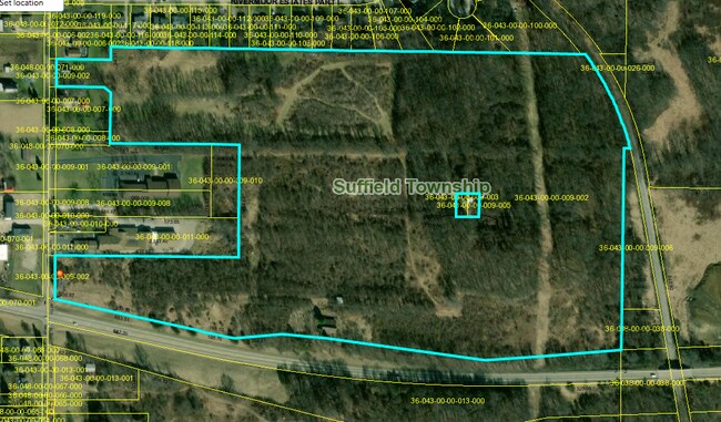
1420 Martin Rd
Akron, OH
LOT 43 M & 38
36-043-00-00-009-002
PORTAGE
Commercialnec
Ohio
B and X Area of moderate flood hazard, usually the area between the limits of the 100-year and 500-year floods.
43
2025
59.87 AC
2025
Portage County
602101
Cleveland
1,970 SF
NEARBY LISTINGS FOR SALE OR LEASE
DEMOGRAPHICS near 1420 Martin Rd
1 mile
3 mile
5 mile
2025 Total Population
1,135
20,795
69,562
2030 Population
1,144
20,847
69,401
Pop Growth 2025-2030
+ 0.79%
+ 0.25%
(0.23%)
Average Age
46
44
43
2025 Total Households
476
8,834
29,160
HH Growth 2025-2030
+ 0.84%
+ 0.28%
(0.24%)
Median Household Inc
$66,036
$66,052
$69,680
Avg Household Size
2.30
2.30
2.30
2025 Avg HH Vehicles
2.00
2.00
2.00
Median Home Value
$202,381
$172,368
$182,703
Median Year Built
1966
1965
1966
Nearby Places
Map Layers
Map Styles
 Street
 Aerial
Layers
 Traffic
 Biking
Places
Listings with unknown addresses are not visible on the map
- Restaurants
- Banks
- Shops
- Fitness
- Groceries
PUBLIC TRANSPORTATION
AIRPORT
Akron-Canton Regional
Drive
Walk
Distance
Akron-Canton Regional
22 min
11.8 mi
Freight Ports
Port of Toledo
Drive
Walk
Distance
Port of Toledo
173 min
145.9 mi
SALE & LEASE HISTORY
LISTING DATE
SALE/LEASE

Nov 07, 2018
For Lease
Mar 30, 2021
For Sale
Mar 06, 2018
For Lease
Nearby Properties
Address
Land Use
TOTAL SIZE
Lot Size
Zoning
Address
Land Use
TOTAL SIZE
Lot Size
Zoning
162,774 SF
16.58 AC
Address
Land Use
TOTAL SIZE
Lot Size
Zoning
115,586 SF
4.93 AC
Address
Land Use
TOTAL SIZE
Lot Size
Zoning
882,093 SF
50.96 AC
Address
Land Use
TOTAL SIZE
Lot Size
Zoning
329,075 SF
14.11 AC
Address
Land Use
TOTAL SIZE
Lot Size
Zoning
124,939 SF
13.89 AC
Address
Land Use
TOTAL SIZE
Lot Size
Zoning
328,600 SF
19.36 AC
Address
Land Use
TOTAL SIZE
Lot Size
Zoning
53,454 SF
3.78 AC
Address
Land Use
TOTAL SIZE
Lot Size
Zoning
97,454 SF
3.14 AC
Address
Land Use
TOTAL SIZE
Lot Size
Zoning
248,589 SF
25.31 AC
Address
Land Use
TOTAL SIZE
Lot Size
Zoning
76,000 SF
4 AC
Address
Land Use
TOTAL SIZE
Lot Size
Zoning
291,490 SF
14 AC
Address
Land Use
TOTAL SIZE
Lot Size
Zoning
Address
Land Use
TOTAL SIZE
Lot Size
Zoning
88,400 SF
5.58 AC
Address
Land Use
TOTAL SIZE
Lot Size
Zoning
120,480 SF
5.45 AC
Address
Land Use
TOTAL SIZE
Lot Size
Zoning
40.64 AC
Address
Land Use
TOTAL SIZE
Lot Size
Zoning
131,820 SF
4.77 AC
Address
Land Use
TOTAL SIZE
Lot Size
Zoning
273,024 SF
14 AC
Address
Land Use
TOTAL SIZE
Lot Size
Zoning
353,162 SF
9.67 AC
Address
Land Use
TOTAL SIZE
Lot Size
Zoning
60,721 SF
7.46 AC
Address
Land Use
TOTAL SIZE
Lot Size
Zoning
410,743 SF
59.26 AC
Address
Land Use
TOTAL SIZE
Lot Size
Zoning
144,900 SF
7.24 AC
Address
Land Use
TOTAL SIZE
Lot Size
Zoning
36,184 SF
5.03 AC
Address
Land Use
TOTAL SIZE
Lot Size
Zoning
86,016 SF
5.05 AC
Address
Land Use
TOTAL SIZE
Lot Size
Zoning
55,520 SF
5.81 AC
Address
Land Use
TOTAL SIZE
Lot Size
Zoning
45,942 SF
14.29 AC
Address
Land Use
TOTAL SIZE
Lot Size
Zoning
63,105 SF
4.66 AC
Address
Land Use
TOTAL SIZE
Lot Size
Zoning
7,425 SF
14.13 AC
Address
Land Use
TOTAL SIZE
Lot Size
Zoning
16,838 SF
0.75 AC
Address
Land Use
TOTAL SIZE
Lot Size
Zoning
61,860 SF
3.70 AC
Address
Land Use
TOTAL SIZE
Lot Size
Zoning
13,904 SF
8.18 AC
The World's #1 Commercial Real Estate Marketplace
Connect with us
© 2026 CoStar Group
The information above has been obtained from sources believed reliable. While we do not doubt its accuracy we have not verified it and make no guarantee, warranty or representation about it. It is your responsibility to independently confirm its accuracy and completeness. Any projections, opinions, assumptions, or estimates used are for example only and do not represent the current or future performance of the property. The value of this transaction to you depends on tax and other factors which should be evaluated by your tax, financial, and legal advisors. You and your advisors should conduct a careful, independent investigation of the property to determine to your satisfaction the suitability of the property for your needs.