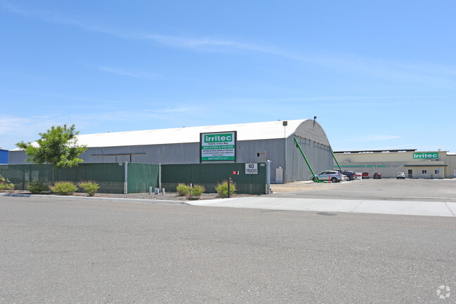
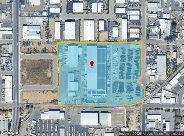
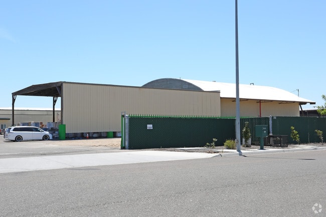
Property Record
1420 N Irritec Way, Fresno, CA 93703
NEARBY LISTINGS FOR SALE OR LEASE
Property Detail
1420 N Irritec Way
453-160-13
12.76 AC PAR K OF P/M 2014-05 BK 72 PGS 74-75
Warehouse
Fresno
X
California
06019C1590H
12.76 AC
2025
Northeast Fresno
2025
Fresno
002800
Fresno, CA
141,577 SF
DEMOGRAPHICS near 1420 N Irritec Way
1 Mile
3 Mile
5 Mile
2024 Total Population
20,477
171,183
400,101
2029 Population
20,807
174,470
408,625
Pop Growth 2024-2029
+ 1.61%
+ 1.92%
+ 2.13%
Average Age
33
34
35
2024 Total Households
5,639
51,780
127,038
HH Growth 2024-2029
+ 1.60%
+ 1.97%
+ 2.15%
Median Household Inc
$38,114
$41,779
$51,465
Avg Household Size
3.40
3.20
3.00
2024 Avg HH Vehicles
2.00
2.00
2.00
Median Home Value
$221,552
$229,616
$278,281
Median Year Built
1965
1965
1970
Nearby Places
Map Layers
Map Styles
 Street
 Aerial
- Restaurants
- Banks
- Shops
- Fitness
- Groceries
PUBLIC TRANSPORTATION
COMMUTER RAIL
DRIVE
WALK
Distance
7 min
4.1 mi
AIRPORT
Fresno Yosemite International
DRIVE
WALK
Distance
Fresno Yosemite International
6 min
2.3 mi
Nearby Properties
Address
Land Use
TOTAL SIZE
Lot Size
Zoning
Address
Land Use
TOTAL SIZE
Lot Size
Zoning
1,081,456 SF
113.56 AC
M1
Address
Land Use
TOTAL SIZE
Lot Size
Zoning
794,471 SF
73.71 AC
Address
Land Use
TOTAL SIZE
Lot Size
Zoning
0.01 AC
P
Address
Land Use
TOTAL SIZE
Lot Size
Zoning
534,993 SF
5.23 AC
CP
Address
Land Use
TOTAL SIZE
Lot Size
Zoning
74,499 SF
17.48 AC
M3
Address
Land Use
TOTAL SIZE
Lot Size
Zoning
147,101 SF
6.31 AC
SPLIT
Address
Land Use
TOTAL SIZE
Lot Size
Zoning
184,130 SF
1.87 AC
PI
Address
Land Use
TOTAL SIZE
Lot Size
Zoning
2,008 SF
20.14 AC
M1
Address
Land Use
TOTAL SIZE
Lot Size
Zoning
385,529 SF
29.36 AC
R2
Address
Land Use
TOTAL SIZE
Lot Size
Zoning
372,862 SF
42.43 AC
R1
Address
Land Use
TOTAL SIZE
Lot Size
Zoning
471,760 SF
1.98 AC
CP
Address
Land Use
TOTAL SIZE
Lot Size
Zoning
116,349 SF
16.56 AC
CP
Address
Land Use
TOTAL SIZE
Lot Size
Zoning
60,227 SF
4.72 AC
M1
Address
Land Use
TOTAL SIZE
Lot Size
Zoning
194,109 SF
19.42 AC
C3
Address
Land Use
TOTAL SIZE
Lot Size
Zoning
175,310 SF
19.22 AC
CMX
Address
Land Use
TOTAL SIZE
Lot Size
Zoning
94,584 SF
10.93 AC
M1
Address
Land Use
TOTAL SIZE
Lot Size
Zoning
157,702 SF
4.61 AC
R2A
Address
Land Use
TOTAL SIZE
Lot Size
Zoning
79,518 SF
2.03 AC
R4
Address
Land Use
TOTAL SIZE
Lot Size
Zoning
480,570 SF
2.98 AC
P
Address
Land Use
TOTAL SIZE
Lot Size
Zoning
90,500 SF
1.29 AC
CM
Address
Land Use
TOTAL SIZE
Lot Size
Zoning
669,447 SF
0.01 AC
C3
Address
Land Use
TOTAL SIZE
Lot Size
Zoning
249,126 SF
17.33 AC
SPLIT
Address
Land Use
TOTAL SIZE
Lot Size
Zoning
250,412 SF
16.09 AC
RM3
Address
Land Use
TOTAL SIZE
Lot Size
Zoning
319,790 SF
41.15 AC
R1
Address
Land Use
TOTAL SIZE
Lot Size
Zoning
190,006 SF
19.35 AC
RM1
Address
Land Use
TOTAL SIZE
Lot Size
Zoning
151,980 SF
4.94 AC
CM
Address
Land Use
TOTAL SIZE
Lot Size
Zoning
212,113 SF
13.21 AC
R3
Address
Land Use
TOTAL SIZE
Lot Size
Zoning
203,687 SF
10.63 AC
R3
Address
Land Use
TOTAL SIZE
Lot Size
Zoning
138,502 SF
3.46 AC
C2
Address
Land Use
TOTAL SIZE
Lot Size
Zoning
121,250 SF
9.51 AC
R3
The World's #1 Commercial Real Estate Marketplace
Connect with us
© 2026 CoStar Group
The information above has been obtained from sources believed reliable. While we do not doubt its accuracy we have not verified it and make no guarantee, warranty or representation about it. It is your responsibility to independently confirm its accuracy and completeness. Any projections, opinions, assumptions, or estimates used are for example only and do not represent the current or future performance of the property. The value of this transaction to you depends on tax and other factors which should be evaluated by your tax, financial, and legal advisors. You and your advisors should conduct a careful, independent investigation of the property to determine to your satisfaction the suitability of the property for your needs.